Category:Afrikaans-language SVG maps
Jump to navigation
Jump to search
Subcategories
This category has only the following subcategory.
Media in category "Afrikaans-language SVG maps"
The following 19 files are in this category, out of 19 total.
-
Antarctic-seas-af.svg 1,120 × 900; 48 KB
-
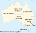
Australiese state af2.svg 1,361 × 1,231; 133 KB
-
Greater Johannesburg OpenStreetMap small Afrikaans.svg 496 × 325; 1.96 MB
-
Historiese dele Libië-af.svg 969 × 929; 124 KB
-
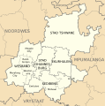
Kaart van Gauteng munisipaliteite (2011).svg 754 × 760; 223 KB
-
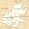
Kaart van Gauteng munisipaliteite (2016).svg 754 × 760; 295 KB
-
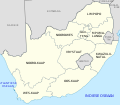
Kaart van Suid-Afrika met Afrikaanse byskrifte.svg 757 × 660; 352 KB
-
Kaart van Wes-Kaap munisipaliteite (2011).svg 849 × 676; 540 KB
-
Kaart van Wes-Kaap munisipaliteite (2016).svg 849 × 676; 676 KB
-
Kaarte van Siprus.svg 702 × 411; 148 KB
-
Map of African phonology-Afrikaans.svg 1,525 × 1,440; 721 KB
-
Map of fertile crescent-af.svg 1,987 × 2,441; 467 KB
-
Pangaea continents af.svg 815 × 960; 59 KB
-
Plates tect2 af.svg 4,167 × 2,844; 252 KB
-
Scotland topographic map-af.svg 2,400 × 3,450; 5.56 MB
-
Shosholoza Meyl roete 2012.svg 1,070 × 934; 322 KB
-
Verdrag van Troyes.svg 425 × 519; 136 KB


