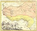
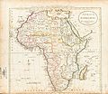
Category:Aethiopian Sea
Jump to navigation
Jump to search
dated term for the South Atlantic collectively or particularly for the portion of the South Atlantic south of the Guinea Coast and west of southern Africa | |||||
| Upload media | |||||
| Instance of | |||||
|---|---|---|---|---|---|
| Part of | |||||
| Said to be the same as | South Atlantic Ocean | ||||
 | |||||
Subcategories
This category has the following 4 subcategories, out of 4 total.
Media in category "Aethiopian Sea"
The following 19 files are in this category, out of 19 total.
-
1710 De La Feuille Map of Africa - Geographicus - Africa-lafeuille-1710.jpg 2,528 × 1,745; 801 KB
-
Carte de Afrique - DPLA - 64312b9c029b8e0923ef437223de91f2.jpg 1,000 × 998; 318 KB
-
Afrique - DPLA - 30f87a4501730f95862768d989104577.jpg 1,000 × 820; 266 KB
-
Map - Special Collections University of Amsterdam - OTM- HB-KZL 31-01-28.tif 7,888 × 6,447; 145.49 MB
-
Africa 1795, Mathew Carey (4016621-recto).jpg 4,930 × 4,272; 4.62 MB
-
Africa 1797, Franz Ludwig Güssefeld (4017888-recto) cropped.jpg 1,534 × 1,376; 1.23 MB
-
Africae nova tabula (8431021226).jpg 800 × 691; 141 KB
-
AMH-7760-KB Map of the west coast of Africa.jpg 2,400 × 1,623; 892 KB
-
Ethiopian Sea-Africa 1795, Mathew Carey (4016621-recto).jpg 1,335 × 1,022; 507 KB
-
Rennel map 1799.png 1,318 × 1,060; 335 KB
-
Resized-inu-afrmap-4004357-recto-master.png 3,695 × 3,111; 19.99 MB
-
Typus orbis terrarum - Arnoldus F. ab Langren, auth. et scalp. - btv1b8490572r.jpg 7,426 × 5,028; 7.64 MB


