Category:Aerial photographs of the Solomon Islands
Jump to navigation
Jump to search
Countries of Oceania: Australia · Fiji · Federated States of Micronesia · Kiribati · Marshall Islands · Nauru · New Zealand · Palau · Papua New Guinea · Samoa · Solomon Islands · Tonga · Tuvalu · Vanuatu
Other areas: American Samoa · Clipperton Island · Cook Islands · French Polynesia · Guam · Hawaii · New Caledonia · Northern Mariana Islands · Wallis and Futuna – Partly: British overseas territories · Indonesia · French Southern and Antarctic Lands · United States Minor Outlying Islands
Other areas: American Samoa · Clipperton Island · Cook Islands · French Polynesia · Guam · Hawaii · New Caledonia · Northern Mariana Islands · Wallis and Futuna – Partly: British overseas territories · Indonesia · French Southern and Antarctic Lands · United States Minor Outlying Islands
Media in category "Aerial photographs of the Solomon Islands"
The following 43 files are in this category, out of 43 total.
-
 A-top-view-from-a-plane-of-New-Georgia-Islands-142353330580.jpg 995 × 719; 259 KB
-
 Aerial photo of Rove Police HQ and corrections centre.jpg 4,000 × 1,500; 2.93 MB
-
 Aerial view of Henderson Field on Guadalcanal, 7 August 1942.jpg 640 × 424; 71 KB
-
 Aerial view of Henderson Field, Guadalcanal, in late August 1942.jpg 5,694 × 4,544; 9.65 MB
-
 Aerial view of Honiara, 2013.jpg 5,184 × 3,456; 1.06 MB
-
 Batuna north.jpg 640 × 359; 93 KB
-
 Batuna west.jpg 640 × 374; 127 KB
-
 C shaped Island near Kasopo Is New Georgia.jpg 640 × 480; 49 KB
-
 Eastern Yandina aerial view.jpg 640 × 480; 66 KB
-
 Fanagho Solomon Islands aerial view.jpg 640 × 480; 41 KB
-
 GuadHFPagodaView.jpg 520 × 263; 36 KB
-
 Henderson Airfield - 1944.jpg 640 × 418; 110 KB
-
 Henderson Airfield runway.jpg 916 × 1,510; 309 KB
-
 Honiara aerial crop.jpg 374 × 571; 63 KB
-
 Honiara aerial.jpg 1,024 × 768; 221 KB
-
 Ikele Is Nazareth New Georgia.jpg 640 × 480; 52 KB
-
 Island-generated cumulonimbus (32500912632).jpg 5,184 × 3,456; 3.88 MB
-
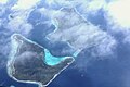
 Islands make clouds (32274639930).jpg 5,184 × 3,456; 4.18 MB
-
 Kukum Highway Ranadi Honiara.jpg 640 × 480; 93 KB
-
 Lologhan Island south aerial photo.jpg 640 × 480; 50 KB
-
 Lologhan Island southwest aerial photo.jpg 640 × 480; 42 KB
-
 Loun Island village aerial view.jpg 640 × 480; 50 KB
-
 Lunga River and Kukum Highway crossing.jpg 640 × 480; 94 KB
-
 Mbareho Bareho village.jpg 640 × 480; 55 KB
-
 Mborokua Island from northeast.jpg 640 × 480; 28 KB
-
 Mbuinitusu Reef.jpg 640 × 480; 44 KB
-
 Mbuinitusu.jpg 480 × 640; 56 KB
-
 Mbulo Is Nggatokae Is.jpg 640 × 480; 31 KB
-
 Minjanga Sanihulumu Vangunu Islands.jpg 640 × 480; 39 KB
-
 Nggatokae Minjanga Vangunu Islands.jpg 640 × 480; 33 KB
-
 Pavuvu central north inlets Nono Is.jpg 480 × 640; 65 KB
-
 Pavuvu Maquitti Bay.jpg 640 × 480; 53 KB
-
 Pavuvu Marulaon Is channel.jpg 640 × 480; 55 KB
-
 Solomon Isles.jpg 400 × 260; 60 KB
-
 Sunlight Channel Tillotson Cove.jpg 640 × 480; 58 KB
-
 Telin and Loun Islands aerial view.jpg 640 × 480; 48 KB
-
 TulagiAerial.jpg 640 × 377; 67 KB
-
 TulagiAerial2.jpg 698 × 584; 246 KB
-
 Uepi, Western Province, Solomon Islands, 2012.jpg 5,184 × 3,456; 4.4 MB
-
 Vangunu Island.jpg 640 × 480; 41 KB
-
 Vangunu NNW peninsula.jpg 640 × 480; 49 KB
-
 Yandina aerial view from northeast.jpg 640 × 480; 54 KB
-
 Yandina from east aerial view.jpg 640 × 480; 59 KB


.jpg)
.jpg)


