Category:Aerial photographs of the London Borough of Bexley
Jump to navigation
Jump to search
Media in category "Aerial photographs of the London Borough of Bexley"
The following 16 files are in this category, out of 16 total.
-
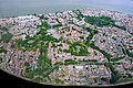
 2015 London-Thamesmead, aerial view 1.jpg 2,400 × 1,800; 1.52 MB
-
 2015 London-Thamesmead, aerial view 2.jpg 2,400 × 1,628; 1.43 MB
-
 2015 London-Thamesmead, aerial view 3.jpg 2,400 × 1,594; 1.49 MB
-
 2017 Thamesmead aerial view 01.jpg 3,563 × 2,754; 2.69 MB
-
 2017 Thamesmead aerial view 01a.jpg 2,632 × 1,772; 1.26 MB
-
 Foots Cray from the air - geograph.org.uk - 6250240.jpg 1,024 × 768; 421 KB
-
 London, Thamesmead & Abbey Wood, aerial view 01.jpg 3,110 × 2,125; 1.82 MB
-
 London, Thamesmead, aerial view 01.jpg 3,261 × 2,132; 1.79 MB
-
 London, Thamesmead, aerial view 02.jpg 3,261 × 2,123; 1.5 MB
-
 London, Thamesmead, aerial view 03.jpg 3,262 × 2,118; 1.72 MB
-
 Sidcup from the air - geograph.org.uk - 6250248.jpg 1,024 × 673; 415 KB
-
 Sidcup from the air - geograph.org.uk - 6250265.jpg 1,024 × 667; 376 KB
-
 Sidcup from the air - geograph.org.uk - 6250266.jpg 1,024 × 768; 427 KB
-
 Sidcup town centre from the air - geograph.org.uk - 6250244.jpg 1,024 × 620; 386 KB
-
 Sidcup town centre from the air - geograph.org.uk - 6250246.jpg 1,024 × 768; 478 KB
-
 Welling from the air - geograph.org.uk - 2795186.jpg 640 × 623; 250 KB


