Category:Aerial photographs of river deltas
Jump to navigation
Jump to search
Subcategories
This category has the following 2 subcategories, out of 2 total.
C
O
- Aerial photographs of Okavango Delta (140 F)
Media in category "Aerial photographs of river deltas"
The following 115 files are in this category, out of 115 total.
-
 2012-03-04 - Pyroclastic flows poured into the sea - panoramio.jpg 3,911 × 2,386; 3.39 MB
-
 A maze of waterways on the Mississippi Coast near Bay St. Louis (5594527164).jpg 2,984 × 2,275; 5.37 MB
-
 Aerial view of the Lower Paraná Delta, 2009-03-25.jpg 3,643 × 2,739; 10.57 MB
-

-
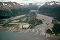 Alaska pipeline route near Valdez River.jpg 2,898 × 1,944; 1.09 MB
-
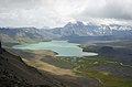 Ania surprise lake 20060809205205.JPG 2,000 × 1,312; 1.28 MB
-
 Atchafalaya River delta.jpg 1,500 × 1,001; 537 KB
-
 Bocas del Atrato.JPG 3,032 × 2,008; 788 KB
-
 Brooks River 5 02242015 Patrol Flight (16645231652).jpg 4,896 × 3,264; 4.02 MB
-
 Buna delta (WPWTR16).JPG 4,912 × 3,264; 3.22 MB
-
 Copper River Delta - panoramio.jpg 2,552 × 1,912; 1.72 MB
-
 Dalmatia Neretva river delta IMG 9868.JPG 5,184 × 3,456; 10.94 MB
-
 Dalmatia Neretva river delta IMG 9877.JPG 3,456 × 3,683; 2.25 MB
-
 Dalmatia Neretva river delta IMG 9879.JPG 3,456 × 2,929; 6.14 MB
-
 Delta in Rapadalen.jpg 2,592 × 1,944; 2.06 MB
-
 Desembocadura del Guadalquivir - Vista aérea.jpg 1,789 × 1,119; 241 KB
-
 From aeroplane.jpg 1,920 × 2,560; 1 MB
-
 Islands, Sacramento River Delta, California.jpg 1,600 × 1,200; 348 KB
-
 JMLeb 1989 Mad Fiherena 23.jpg 1,969 × 1,488; 1.79 MB
-
 Kuskokwim Delta Wetlands - Aerial View.jpg 1,050 × 707; 93 KB
-
 Laitaure ASTER 2002-08-09.jpg 1,200 × 726; 427 KB
-
 Laitaure Tjaktjajaure ASTER 2010-06-28.jpg 1,768 × 1,586; 469 KB
-
 Landbrot 01.jpg 2,592 × 1,944; 808 KB
-
 Line5066 - Flickr - NOAA Photo Library.jpg 3,008 × 2,000; 964 KB
-
 Line5116 - Flickr - NOAA Photo Library.jpg 3,008 × 2,000; 664 KB
-
 Maggia Delta 2014 Air.jpg 3,532 × 2,649; 2.39 MB
-
 Mamberamo River NASA.jpg 1,024 × 702; 124 KB
-
 Mangoky delta.jpg 640 × 624; 146 KB
-
 Mississippi Delta 1976.jpg 1,500 × 1,500; 235 KB
-
 Mississippi delta from space.jpg 1,797 × 1,910; 794 KB
-
 NASA Worldwind, USGS imagery map, Acker Island, California.png 899 × 901; 756 KB
-
 NASA Worldwind, USGS imagery map, Atherton Island, California.png 500 × 200; 146 KB
-
 NASA Worldwind, USGS imagery map, Atlas Tract, California.png 1,600 × 1,600; 2.04 MB
-
 NASA Worldwind, USGS imagery map, Bradmoor Island, California.png 1,500 × 1,500; 3.21 MB
-
 NASA Worldwind, USGS imagery map, Brannan Island, California.png 1,300 × 1,300; 2.2 MB
-
 NASA Worldwind, USGS imagery map, Chain Island, California.png 600 × 600; 420 KB
-
 NASA Worldwind, USGS imagery map, Deadman Island, California.png 300 × 300; 112 KB
-
 NASA Worldwind, USGS imagery map, Empire Tract, California.png 1,213 × 1,923; 2.88 MB
-
 NASA Worldwind, USGS imagery map, Eucalyptus Island, California.png 475 × 300; 170 KB
-
 NASA Worldwind, USGS imagery map, French Island, California.png 600 × 600; 356 KB
-
 NASA Worldwind, USGS imagery map, Goat Island, California.png 200 × 200; 60 KB
-
 NASA Worldwind, USGS imagery map, Grizzly Island, California.png 2,600 × 1,800; 6.17 MB
-
 NASA Worldwind, USGS imagery map, Hammer Island, California.png 450 × 300; 153 KB
-
 NASA Worldwind, USGS imagery map, Hammond Island, California.png 3,400 × 1,700; 7.53 MB
-
 NASA Worldwind, USGS imagery map, Hastings Tract, California.png 2,672 × 1,668; 5.37 MB
-
 NASA Worldwind, USGS imagery map, Headreach Island, California.png 500 × 400; 239 KB
-
 NASA Worldwind, USGS imagery map, Hog Island (San Joaquin County), California.png 1,375 × 1,375; 1.69 MB
-
 NASA Worldwind, USGS imagery map, Holland Tract, California.png 1,673 × 1,907; 4.31 MB
-
 NASA Worldwind, USGS imagery map, Ida Island, California.png 900 × 500; 619 KB
-
 NASA Worldwind, USGS imagery map, Joice Island, California.png 1,500 × 1,500; 2.51 MB
-
 NASA Worldwind, USGS imagery map, Kimball Island, California.png 1,600 × 1,200; 1.86 MB
-
 NASA Worldwind, USGS imagery map, Kings Island, California.png 225 × 225; 93 KB
-
 NASA Worldwind, USGS imagery map, Liberty Island, California.png 550 × 1,800; 1.25 MB
-
 NASA Worldwind, USGS imagery map, Little Hastings Tract, California.png 1,000 × 1,000; 1.24 MB
-
 NASA Worldwind, USGS imagery map, Little Holland Tract, California.png 2,001 × 2,000; 3.82 MB
-
 NASA Worldwind, USGS imagery map, Little Venice Island, California.png 1,000 × 1,000; 916 KB
-
 NASA Worldwind, USGS imagery map, Long Island, California.png 650 × 350; 310 KB
-
 NASA Worldwind, USGS imagery map, Mallard Island, California.png 300 × 150; 71 KB
-

-
 NASA Worldwind, USGS imagery map, Montezuma Island, California.png 600 × 600; 428 KB
-
 NASA Worldwind, USGS imagery map, Moore Tract, California.png 2,090 × 2,090; 4.93 MB
-
 NASA Worldwind, USGS imagery map, Orwood Tract, California.png 1,729 × 1,729; 3.34 MB
-
 NASA Worldwind, USGS imagery map, Palm Tract, California.png 1,729 × 1,729; 3.38 MB
-
 NASA Worldwind, USGS imagery map, Randall Island, California.png 1,800 × 1,800; 4.36 MB
-
 NASA Worldwind, USGS imagery map, Rhode Island, California.png 550 × 550; 342 KB
-
 NASA Worldwind, USGS imagery map, Rindge Tract, California.png 2,359 × 1,778; 5.09 MB
-
 NASA Worldwind, USGS imagery map, Rio Blanco Tract, California.png 2,507 × 1,787; 4.43 MB
-
 NASA Worldwind, USGS imagery map, Rough and Ready Island, California.png 2,262 × 1,748; 5.51 MB
-
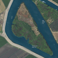
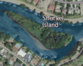 NASA Worldwind, USGS imagery map, Shenkel Island, California.png 250 × 200; 96 KB
-
 NASA Worldwind, USGS imagery map, Shima Tract, California.png 1,759 × 1,758; 3.2 MB
-
 NASA Worldwind, USGS imagery map, Shin Kee Tract, California.png 1,991 × 1,630; 3.78 MB
-
 NASA Worldwind, USGS imagery map, Spinner Island, California.png 800 × 800; 816 KB
-
 NASA Worldwind, USGS imagery map, Spud Island, California.png 1,180 × 1,179; 1.19 MB
-
 NASA Worldwind, USGS imagery map, Stewart Tract, California.png 2,000 × 1,222; 2.66 MB
-
 NASA Worldwind, USGS imagery map, Terminous Tract, California.png 1,800 × 1,800; 3.18 MB
-
 NASA Worldwind, USGS imagery map, Terminous, California.png 1,800 × 1,800; 3.19 MB
-
 NASA Worldwind, USGS imagery map, Tinsley Island, California.png 650 × 650; 506 KB
-
 NASA Worldwind, USGS imagery map, Tule Island, California.png 611 × 611; 447 KB
-
 NASA Worldwind, USGS imagery map, Vulcan Island, California.png 600 × 300; 267 KB
-
 NASA Worldwind, USGS imagery map, Ward Island, California.png 647 × 645; 431 KB
-
 NASA Worldwind, USGS imagery map, Webb Tract, California.png 1,956 × 1,671; 4.07 MB
-
 NASA Worldwind, USGS imagery map, Widdows Island, California.png 542 × 542; 292 KB
-
 NASA Worldwind, USGS imagery map, Wright-Elmwood Tract, California.png 1,790 × 1,936; 3.55 MB
-
 Nigerdelta NASA.jpg 624 × 639; 121 KB
-
 Nuradelta.jpg 886 × 1,512; 200 KB
-
 Omo river delta.jpg 624 × 639; 123 KB
-
 Oyern1.jpg 398 × 265; 71 KB
-
 PSM V54 D480 Temporary wet weather delta.jpg 1,675 × 1,297; 479 KB
-
 PSM V54 D487 The mississippi delta.png 1,710 × 1,232; 282 KB
-
 Pårte Piellorieppe Rapasalet ASTER 2008-09-02.jpg 1,157 × 1,129; 336 KB
-
 QeshmIsland NASA.jpg 3,850 × 2,950; 6.31 MB
-
 Rapaselet (1994-09-03).jpg 609 × 543; 75 KB
-
 RhineUtrecht.jpg 783 × 803; 170 KB
-
 Rhone delta.jpg 1,280 × 1,024; 365 KB
-
 Rio Plata delta Air view 1.JPG 3,200 × 2,400; 1.78 MB
-
 River Deltas, Lake Ayakum, Tibet.JPG 4,288 × 2,850; 2.74 MB
-
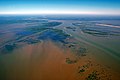
 Sacramento Delta at flood stage, 2009.jpg 3,504 × 2,336; 5.95 MB
-
 Salween delta.jpg 640 × 640; 198 KB
-
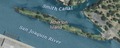
 San Joaquin Delta Aerial 2.jpg 3,600 × 2,400; 3.85 MB
-
 San Joaquin Delta Aerial.jpg 3,600 × 2,400; 3.58 MB
-
 Sarektjåkkå (1994-09-03).jpg 839 × 625; 119 KB
-
 Saskatchewan River delta (NASA).jpg 540 × 720; 150 KB
-
 Skokomish River Delta 07772.JPG 2,560 × 1,920; 1.34 MB
-
 Skokomish River Delta 07773.JPG 2,560 × 1,920; 1.24 MB
-
 Small stream with delta in Tenakee Inlet.jpg 400 × 264; 18 KB
-
 Stora Lulevatten ASTER 2002-09-08.jpg 513 × 599; 31 KB
-
 STS61C-42-72 (north).jpg 639 × 639; 58 KB
-
 STS61C-42-72.jpg 639 × 639; 122 KB
-
 Susitna River 8386.JPG 4,272 × 2,848; 3.75 MB
-
 Tjakjajaure - Laitaure (1994-09-03).jpg 906 × 776; 110 KB
-
 Tjaktjajaure - Laitaure (2004-05-08).jpg 1,756 × 1,636; 961 KB
-
 Ural Delta outline map.jpg 283 × 260; 50 KB
-
 Wax Lake Delta.jpg 292 × 256; 84 KB
-
 Yukon Delta, Alaska.jpg 4,000 × 4,000; 6.31 MB
-
 Äpar ASTER 2008-09-02.jpg 1,177 × 991; 295 KB

.jpg)


.jpg)
.JPG)


,_California.png)


.jpg)


.jpg)
.jpg)


.jpg)


.jpg)
.jpg)


