Category:Aerial photographs of airports in Nevada
Jump to navigation
Jump to search
States of the United States: Alabama · Alaska · Arizona · Arkansas · California · Colorado · Connecticut · Delaware · Florida · Georgia · Hawaii · Idaho · Illinois · Indiana · Iowa · Kansas · Kentucky · Louisiana · Maine · Maryland · Massachusetts · Michigan · Minnesota · Mississippi · Missouri · Montana · Nebraska · Nevada · New Hampshire · New Jersey · New Mexico · New York · North Carolina · North Dakota · Ohio · Oklahoma · Oregon · Pennsylvania · Rhode Island · South Carolina · South Dakota · Tennessee · Texas · Utah · Vermont · Virginia · Washington · West Virginia · Wisconsin · Wyoming
Puerto Rico
Puerto Rico
English: Aerial photographs of airports in the state of Nevada, United States
Subcategories
This category has only the following subcategory.
Media in category "Aerial photographs of airports in Nevada"
The following 12 files are in this category, out of 12 total.
-
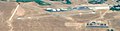 Boulder City Municipal Airport.jpg 665 × 174; 39 KB
-
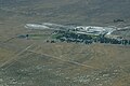 Kluft-photo-Empire-Airport-Jun-2006-Img 6036.jpg 3,072 × 2,048; 3.43 MB
-
 Las Vegas Army Airfield - 1942 - USAAF.jpg 790 × 564; 143 KB
-
 Nellis AFB - USGS - 09 June 1994.jpg 1,258 × 1,264; 583 KB
-
 Nellis AFB 2008.JPG 3,648 × 2,736; 1.86 MB
-
 Nellis AFB NV - 9 Jun 1994.jpg 564 × 606; 120 KB
-
 Nellis Air Force Base, Las Vegas, Nevada (14017031619).jpg 4,000 × 3,000; 6.75 MB
-
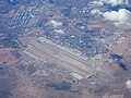
 Northlasvegasairport-kvgt.jpg 1,043 × 698; 159 KB
-
 Reno Stead Airport-2006-USGS.jpg 492 × 536; 103 KB
-
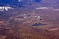 Reno Stead Field (3392833169).jpg 2,596 × 1,740; 911 KB
-
 Stead Air Force Base-NV-11 September 1999-USGS.jpg 765 × 991; 257 KB
-
 Tonopah-5sep99.jpg 476 × 434; 38 KB


.jpg)


.jpg)

