Category:Aerial photographs of Yamagata prefecture
Jump to navigation
Jump to search
| Prefectures of Japan | |||
|---|---|---|---|
| Hokkaido | Aomori · Iwate · Miyagi · Akita · Yamagata · Fukushima · Ibaraki · Tochigi · Gunma · Saitama · Chiba · Tokyo · Kanagawa · Niigata · Toyama · Ishikawa · Fukui · Yamanashi · Nagano · Gifu · Shizuoka · Aichi · Mie · Shiga · Kyoto · Osaka · Hyogo · Nara · Wakayama · Tottori · Shimane · Okayama · Hiroshima · Yamaguchi | Tokushima · Kagawa · Ehime · Kōchi | Fukuoka · Saga · Nagasaki · Kumamoto · Ōita · Miyazaki · Kagoshima | Okinawa | 
| ||
Media in category "Aerial photographs of Yamagata prefecture"
The following 72 files are in this category, out of 72 total.
-
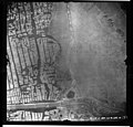
Aerial photo of Okama, the crater lake of Mt. Zaō in 1976.jpg 3,423 × 3,428; 15.62 MB
-
Aerial photograph of Kaminoyama Hospital.jpg 900 × 750; 498 KB
-
Aerial photographs of Gassanko parking area.jpg 2,400 × 1,800; 2.76 MB
-
CTO20131X-C6-18 Motosawa Dam.jpg 466 × 349; 50 KB
-
CTO7617-C13-5 Ginzan Onsen and Ginzangawa Dam.jpg 1,209 × 907; 353 KB
-
GSI CTO20151X-C9-9 20151001.jpg 4,810 × 3,140; 1.41 MB
-
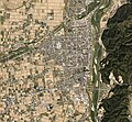
Higashine city center area Aerial photograph.1976.jpg 5,890 × 8,234; 38.76 MB
-
Japan, Yamagata - Sakata, Aka river 1947.jpg 3,937 × 3,780; 1.06 MB
-
Japan, Yamagata - Sakata, Aka river 1949 1.jpg 3,937 × 3,779; 1.02 MB
-
Japan, Yamagata - Sakata, Aka river 1949 2.jpg 3,937 × 3,779; 1,007 KB
-
Japan, Yamagata - Sakata, Aka river 1949 3.jpg 3,272 × 3,422; 2.28 MB
-
Japan, Yamagata - Sakata, Aka river 1952.jpg 3,937 × 3,780; 1.52 MB
-
Japan, Yamagata - Sakata, Aka river 1981 1.jpg 4,094 × 3,780; 1.31 MB
-
Japan, Yamagata - Sakata, Aka river 1981 2.jpg 1,997 × 2,143; 1.17 MB
-
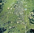
Kaminoyama city center area Aerial photograph.1976.jpg 4,401 × 3,169; 12.46 MB
-
Kaminoyama Racecourse Aerial photograph.1976.jpg 3,136 × 2,271; 5.46 MB
-
Kenko-no-mori, Yamagata.jpg 1,240 × 1,940; 1.45 MB
-
Lake Ootori-Ike Aerial Photograph.jpg 1,544 × 1,161; 599 KB
-
Lake Tokura water reservoir Aerial photograph.1976.jpg 2,045 × 1,477; 2.93 MB
-
Mogamigawa Country Club, Sakata Yamagata Aerial photograph.2009.jpg 5,354 × 4,016; 6.17 MB
-
Murayama city center area Aerial photograph.1976.jpg 4,845 × 4,589; 17.71 MB
-
Murayama city center area Aerial photograph.2018.jpg 7,420 × 6,102; 29.07 MB
-
Nagai city center area Aerial photograph.1976.jpg 5,405 × 6,802; 29.7 MB
-
Nagai city center area Aerial photograph.2013.jpg 8,917 × 8,278; 53.88 MB
-
Nanyo city center area Aerial photograph.1976.jpg 4,466 × 4,610; 19.23 MB
-
Nanyo city center area Aerial photograph.2016.jpg 10,988 × 8,773; 66.16 MB
-
New Blossom Garden Club, Kahoku Yamagata Aerial photograph.2013.jpg 3,730 × 2,797; 3.02 MB
-
Nishi park, Yamagata.jpg 1,136 × 1,484; 982 KB
-
Obanazawa city center area Aerial photograph.1976.jpg 6,674 × 5,604; 29.02 MB
-
Obanazawa city center area Aerial photograph.2019.jpg 7,922 × 5,571; 34.32 MB
-
Oishida Golf Club, Oishida Yamagata Aerial photograph.2019.jpg 4,712 × 3,534; 5.46 MB
-
Oshaku-jima Island Yamagata prefecture Aerial photograph.1976.jpg 2,994 × 2,170; 4.46 MB
-
Oyama Kami-ike and Shimo-ike water reservoirs Aerial photograph.1976.jpg 3,433 × 4,243; 14.16 MB
-
Ryutoanshima Island, Tsuruoka Yamagata Aerial photograph.2016.jpg 946 × 710; 64 KB
-
Sagae city center area Aerial photograph.1976.jpg 5,393 × 7,246; 28.01 MB
-
Sagae city center area Aerial photograph.2010.jpg 3,178 × 3,531; 9.74 MB
-
Sakata Big Fire aerial photograph, with explanation, in 1976-09-26.jpg 2,200 × 2,200; 2.53 MB
-
Sakata Big Fire aerial photograph, without explanation, in 1976-09-26.jpg 2,200 × 2,200; 2.57 MB
-
Sakata city center area Aerial photograph.1976.jpg 10,530 × 5,805; 45 MB
-
Sakata city Daisan junior high school Aerial view (2013).png 490 × 480; 495 KB
-
Sakuranbo Country Club, Murayama Yamagata Aerial photograph.2019.jpg 4,874 × 3,655; 6.41 MB
-
Shinjo city center area Aerial photograph.1976.jpg 5,548 × 5,266; 19.98 MB
-
Shinjo city center area Aerial photograph.2013.jpg 7,846 × 11,509; 70.21 MB
-
Shinjo city Nissin elementary school Aerial view (2013-09).png 580 × 520; 600 KB
-
Shonai Airport Aerial photograph.2016.jpg 7,661 × 2,862; 7.76 MB
-
Shonai Golf Club, Shonai Yamagata Aerial photograph.2016.jpg 3,487 × 3,844; 4.43 MB
-
Sosho Park, Nan-yo.jpg 694 × 874; 510 KB
-
Tamamushi-numa water reservoir Aerial photograph.1976.jpg 2,662 × 1,927; 4.56 MB
-
Tendo city center area Aerial photograph.1976.jpg 5,689 × 7,748; 34.29 MB
-
Tendo Country Club, Tendo Yamagata Aerial photograph.2007.jpg 3,085 × 2,314; 2.66 MB
-
Tobi-shima Island, Sakata Yamagata Aerial photograph.2017.jpg 8,828 × 6,620; 17.42 MB
-
Tobi-sima Island Yamagata prefecture Aerial photograph.1976.jpg 3,447 × 2,492; 5.61 MB
-
Townsman Golf Course in Kahoku Yamagata Aerial photograph.2013.jpg 3,000 × 3,642; 3.08 MB
-
Tsurugaoka Castle air.jpg 2,040 × 1,521; 1.77 MB
-
Tsuruoka city center area Aerial photograph.1976.jpg 9,584 × 5,854; 49.84 MB
-
Tsuruoka city center area Aerial photograph.2016.jpg 11,082 × 9,730; 80.16 MB
-
Umagami-Tameike water reservoir Aerial photograph.1976.jpg 2,805 × 2,032; 4.92 MB
-
USA-R1307-57.jpg 327 × 271; 20 KB
-
Yakuwa Dam survey 1977.jpg 558 × 419; 64 KB
-
Yamagata Airport Aerial Photograph.jpg 2,268 × 3,146; 2.49 MB
-
Yamagata Castle air.jpg 2,391 × 2,657; 2.49 MB
-
Yamagata Golf Club, Yamanobe Yamagata Aerial photograph.2010.jpg 2,810 × 2,108; 2.56 MB
-
Yamagataminami Country Club, Kawanishi Yamagata Aerial photograph.2013.jpg 3,759 × 2,820; 4.41 MB
-
Yonezawa Castle air.jpg 1,239 × 1,311; 990 KB
-
Yonezawa city center area Aerial photograph.1976.jpg 7,813 × 6,177; 42.04 MB
-
Yonezawa city center area Aerial photograph.2013.jpg 10,602 × 9,973; 74.58 MB
-
Yunohama Country Club, Tsuruoka Yamagata Aerial photograph.2016.jpg 3,560 × 2,670; 3.38 MB
-
Yunohama.jpg 500 × 315; 39 KB
-
Yuso-no-oka, Yamagata.jpg 2,004 × 1,364; 1.57 MB
-
Zao Country Club, Yamagata Yamagata Aerial photograph.2017.jpg 3,974 × 2,979; 4.7 MB
-
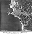
米軍による1948年(昭和23年)撮影の写真 鼠ヶ関.jpg 3,616 × 3,864; 3.6 MB


