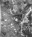
Category:Aerial photographs of Venlo
Jump to navigation
Jump to search
Wikimedia category | |||||
| Upload media | |||||
| Instance of | |||||
|---|---|---|---|---|---|
| Category combines topics | |||||
| Venlo | |||||
municipality in southern Netherlands | |||||
| Instance of |
| ||||
| Location | Limburg, Netherlands | ||||
| Located in or next to body of water | |||||
| Capital | |||||
| Head of government | |||||
| Population |
| ||||
| Area |
| ||||
| Elevation above sea level |
| ||||
| Replaces | |||||
| Different from | |||||
| official website | |||||
 | |||||
Media in category "Aerial photographs of Venlo"
The following 44 files are in this category, out of 44 total.
-
NIMH - 2011 - 5281 - Aerial photograph of Venlo, The Netherlands.jpg 4,000 × 2,865; 1.8 MB
-
1920 Luchtfoto, panorama van de omgeving van de fabriek Pope in Venlo.jpg 1,086 × 755; 170 KB
-
NIMH - 2011 - 9900-012 - Aerial photograph of Venlo, The Netherlands.jpg 4,000 × 2,779; 2.6 MB
-
NIMH - 2155 043344 - Aerial photograph of Venlo, The Netherlands.jpg 5,095 × 3,606; 5.27 MB
-
1923 Luchtfoto van het nog niet helemaal volgebouwde Villapark Wilhelminapark, Venlo.jpg 2,643 × 1,816; 1.01 MB
-
NIMH - 2011 - 0550 - Aerial photograph of Venlo, The Netherlands - 1920 - 1940.jpg 3,500 × 2,555; 2.23 MB
-
1929 Het Mutsaersoord, oorspronkelijk gebouwd als herstellingsoord.jpg 5,100 × 3,510; 3.07 MB
-
Klooster Trans-Cedron Venlo omstreeks 1933.jpg 1,113 × 729; 325 KB
-
NIMH - 2011 - 0551 - Aerial photograph of Venlo, The Netherlands - 1920 - 1940.jpg 3,500 × 2,536; 2.52 MB
-
NIMH - 2011 - 0544 - Aerial photograph of Venlo, The Netherlands - 1920 - 1940.jpg 3,500 × 2,547; 2.19 MB
-
NIMH - 2011 - 0548 - Aerial photograph of Venlo, The Netherlands - 1920 - 1940.jpg 3,500 × 2,560; 1.65 MB
-
NIMH - 2011 - 0549 - Aerial photograph of Venlo, The Netherlands - 1920 - 1940.jpg 3,500 × 2,531; 1.74 MB
-
FliegerhorstVenlo 3 september 1944.jpg 725 × 471; 53 KB
-
1944 Luchtfoto van Venlo-Zuid vanaf Kaldenkerkerweg tot de wijk Hagerhof.jpg 2,107 × 2,462; 1.02 MB
-
1945 02 03 Luchtfoto van Venlo en Blerick.jpg 1,021 × 1,200; 687 KB
-
1950 Luchtfoto van Venlo rond de Hertog Reinoudsingel.jpg 981 × 606; 118 KB
-
2000s Luchtfoto binnenstad Venlo 01.jpg 2,913 × 2,322; 1.89 MB
-
2000s Luchtfoto binnenstad Venlo 02.jpg 2,913 × 2,322; 2.37 MB
-
NIMH - 2011 - 0545 - Aerial photograph of Venlo, The Netherlands - 1920 - 1940.jpg 3,500 × 2,479; 2.2 MB
-
NIMH - 2011 - 0546 - Aerial photograph of Venlo, The Netherlands - 1920 - 1940.jpg 3,500 × 2,529; 2.97 MB
-
NIMH - 2011 - 0547 - Aerial photograph of Venlo, The Netherlands - 1920 - 1940.jpg 3,500 × 2,532; 2.52 MB
-
NIMH - 2011 - 0806 - Aerial photograph of Arcen, The Netherlands - 1920 - 1940.jpg 3,500 × 2,548; 2.55 MB
-
NIMH - 2011 - 2004 - Aerial photograph of Venlo, The Netherlands.jpg 3,500 × 2,554; 2.43 MB
-
NIMH - 2011 - 2005 - Aerial photograph of Venlo, The Netherlands.jpg 3,500 × 2,539; 2.22 MB
-
NIMH - 2011 - 3730 - Aerial photograph of Venlo, The Netherlands.jpg 3,500 × 2,522; 1.95 MB
-
NIMH - 2011 - 3731 - Aerial photograph of Venlo, The Netherlands.jpg 3,500 × 2,478; 2.11 MB
-
NIMH - 2011 - 5275 - Aerial photograph of Venlo, The Netherlands.jpg 4,000 × 1,504; 1.58 MB
-
NIMH - 2011 - 5276 - Aerial photograph of Venlo, The Netherlands.jpg 4,000 × 2,915; 3.09 MB
-
NIMH - 2011 - 5280 - Aerial photographs of Venlo, The Netherlands - 1920 - 1940.jpg 4,000 × 2,945; 1.93 MB
-
NIMH - 2155 011446 - Aerial photograph of Venlo, The Netherlands.jpg 3,520 × 2,488; 1.46 MB
-
NIMH - 2155 011447 - Aerial photograph of Venlo, The Netherlands.jpg 3,520 × 2,466; 1.54 MB


