Category:Aerial photographs of Stuttgart
Jump to navigation
Jump to search
Urban districts (cities): Baden-Baden · Freiburg · Heidelberg · Heilbronn · Karlsruhe · Mannheim · Pforzheim · Stuttgart · Ulm
Deutsch: Luftbilder aus Stuttgart in Baden-Württemberg.
Subcategories
This category has only the following subcategory.
!
Media in category "Aerial photographs of Stuttgart"
The following 9 files are in this category, out of 9 total.
-
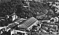
 Kiefer Klimatechnik Werksgelaende 1973.jpg 5,604 × 4,000; 12.14 MB
-
 Kliniken schmieder stuttgart luftbild.svg 354 × 236; 139 KB
-
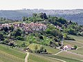 Landappbw 207149 1817 Rotenberg Stuttgart-Rotenberg.jpg 1,279 × 959; 246 KB
-
 Luftbild Daimlerstadion Schleyerhalle Porsche-Arena.jpg 575 × 384; 264 KB
-
 Olgahospital aerial.jpg 800 × 533; 473 KB
-
 Patch Barracks (Kurmärker Kaserne) Vaihingen 1957.jpg 1,600 × 1,250; 371 KB
-
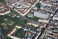
 Photo - Stuttgart - Luftbild - Garnisonskirche.jpg 1,600 × 1,025; 366 KB
-
 Stuttgart Aerial view.jpg 2,580 × 1,932; 599 KB
-


_Vaihingen_1957.jpg)


