Category:Aerial photographs of Moreton Island
Jump to navigation
Jump to search
Media in category "Aerial photographs of Moreton Island"
The following 12 files are in this category, out of 12 total.
-

-
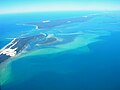
 Aerial view of the southern part of Moreton Island.jpg 3,264 × 1,832; 381 KB
-
 Moreton Island 01.jpg 2,592 × 1,944; 1.14 MB
-
 Moreton Island 02.jpg 2,592 × 1,944; 965 KB
-
 Moreton Island 03.jpg 2,592 × 1,944; 1,011 KB
-
 Moreton Island 04.jpg 2,592 × 1,944; 992 KB
-
 Moreton.png 329 × 699; 523 KB
-
 North End of Moreton Island.jpg 3,264 × 2,448; 2.42 MB
-
 North Stradbroke Island 01.jpg 2,592 × 1,944; 1,020 KB
-
 StateLibQld 1 194299 Moreton Bay, ca. 1933.jpg 1,000 × 755; 82 KB
-
 Stradbroke Island.jpg 2,592 × 1,944; 951 KB
-
 Turbulent Sand, South End of Moreton Island.jpg 3,264 × 2,448; 2.45 MB


