Category:Aerial photographs of Berkshire
Jump to navigation
Jump to search
Ceremonial counties of England: Bedfordshire · Berkshire · Buckinghamshire · Cambridgeshire · Cheshire · Cornwall · Cumbria · Derbyshire · Devon · Dorset · Durham · East Riding of Yorkshire · East Sussex · Essex · Gloucestershire · Greater London · Greater Manchester · Hampshire · Herefordshire · Hertfordshire · Isle of Wight · Kent · Lancashire · Leicestershire · Lincolnshire · Merseyside · Norfolk · North Yorkshire · Northamptonshire · Northumberland · Nottinghamshire · Oxfordshire · Shropshire · Somerset · South Yorkshire · Staffordshire · Suffolk · Surrey · Tyne and Wear · Warwickshire · West Midlands · West Sussex · West Yorkshire · Wiltshire · Worcestershire
City-counties: Bristol · City of London
Former historic counties: Middlesex · Sussex · Yorkshire
Other former counties:
City-counties: Bristol · City of London
Former historic counties: Middlesex · Sussex · Yorkshire
Other former counties:

Subcategories
This category has the following 2 subcategories, out of 2 total.
R
W
Media in category "Aerial photographs of Berkshire"
The following 26 files are in this category, out of 26 total.
-
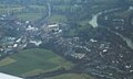
 Windsor - geograph.org.uk - 1098215.jpg 640 × 480; 139 KB
-
 Aerial view of Eton, 2009-02-01.jpg 2,807 × 1,690; 2.94 MB
-
 Aerial view of London from LHR departure (02).jpg 4,320 × 2,880; 4.69 MB
-
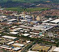 Aerial View of Slough Trading Estate.JPG 1,152 × 1,014; 253 KB
-
 Aerial view of the Thames, centered near Cookham.jpg 6,000 × 4,000; 10.56 MB
-
 Aerial view of Windsor and Eton, 2009-02-01.jpg 3,888 × 2,592; 6.04 MB
-
 Ascot Racecourse from the air 015.jpg 3,648 × 2,736; 3.56 MB
-
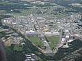 Atomic Weapons Establishment at Aldermaston.jpg 2,272 × 1,704; 1 MB
-
 AWE Aldermaston from the air - geograph.org.uk - 2339374.jpg 640 × 480; 153 KB
-
 AWE Aldermaston from the air - geograph.org.uk - 2339376.jpg 480 × 640; 148 KB
-
 Englefield and Bradfield from the air - geograph.org.uk - 2339383.jpg 480 × 640; 114 KB
-
 Eton Dorney from the air-geograph-3989752.jpg 640 × 480; 167 KB
-
 Eton from the air - geograph.org.uk - 3989691.jpg 640 × 480; 223 KB
-
 Hambleden Lock - geograph.org.uk - 1036996.jpg 640 × 428; 70 KB
-
 Membury-8aug44.png 600 × 713; 457 KB
-
 RAF Greenham Common runway.jpg 709 × 471; 90 KB
-
 RAF Greenham Common.jpg 1,536 × 2,048; 663 KB
-
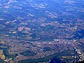 Reading from the air - geograph.org.uk - 2613135.jpg 640 × 480; 180 KB
-
 Seven Barrows from the air, 1933.jpg 300 × 199; 11 KB
-
 VirginiaWater AerialView.jpg 640 × 480; 108 KB
-
 Welford-may44.jpg 600 × 432; 71 KB
-
 Windsor & Eton Riverside railway station.jpg 1,224 × 1,705; 366 KB
-

-
 Windsor Great Park from the air - geograph.org.uk - 4217184.jpg 640 × 413; 92 KB
-
 Windsor Great Park, 2001 - geograph.org.uk - 5568901.jpg 576 × 853; 77 KB
-


.jpg)


