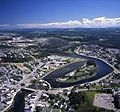
Category:Aerial photographs of Bas-Saint-Laurent
Jump to navigation
Jump to search
Subcategories
This category has the following 4 subcategories, out of 4 total.
Media in category "Aerial photographs of Bas-Saint-Laurent"
The following 27 files are in this category, out of 27 total.
-
Aerial photograph of Lac aux Bois Verts, Quebec.jpg 3,659 × 2,746; 2.59 MB
-
Amqui.jpg 800 × 600; 284 KB
-
Approche à Mont-Joli (CYYY) (5948334821) (2).jpg 2,592 × 1,456; 499 KB
-
Approche à Mont-Joli (CYYY) (5948335471) (2).jpg 2,592 × 1,456; 536 KB
-
Approche à Mont-Joli (CYYY) (5948336115) (2).jpg 2,592 × 1,456; 451 KB
-
Approche à Mont-Joli (CYYY) (5948336727) (2).jpg 2,592 × 1,456; 456 KB
-
Vue Aerienne Bas Saint-Laurent.jpg 1,000 × 631; 232 KB
-
Biencourt3.JPG 1,558 × 1,058; 204 KB
-
Canton Biencourt - secteur riviere Patapedia.jpg 1,366 × 1,068; 446 KB
-
Fort-Ingall.JPG 634 × 853; 116 KB
-
La riviere Mitis et ses chutes a Price.jpg 1,000 × 790; 251 KB
-
Lac-des-Aigles.JPG 1,200 × 1,600; 242 KB
-
Matane 2009.jpg 200 × 186; 10 KB
-
Notre-Dame-du-Lac - Lac Temiscouata - Vue aerienne.jpg 1,422 × 945; 524 KB
-
Notre-Dame-du-Lac-1.JPG 1,200 × 1,600; 320 KB
-
Notre-Dame-du-Lac.JPG 1,200 × 1,600; 181 KB
-
Packington.JPG 1,154 × 1,528; 392 KB
-
Rivière-du-Loup-chutes.JPG 510 × 740; 99 KB
-
Saint-fabien.jpg 2,919 × 600; 254 KB
-
Saint-Pierre-de-Lamy.JPG 1,433 × 1,054; 174 KB
-
Sayabec.jpg 800 × 533; 98 KB
-
Squatec3.JPG 1,145 × 862; 121 KB
-
St-Eusèbe.JPG 1,600 × 1,200; 293 KB
-
St-Honoré-de-Témiscouata.JPG 1,537 × 845; 133 KB
-
St-Marc.JPG 1,028 × 1,429; 1.22 MB
-
St-Paul-pano.JPG 1,600 × 699; 549 KB
-
Vue aérienne de St-Paul-de-la-Croix.JPG 1,600 × 1,200; 492 KB


