Category:Achtergracht 2, Amsterdam
Jump to navigation
Jump to search
| Object location | | View all coordinates using: OpenStreetMap |
|---|
 | |||||
| Upload media | |||||
| Instance of | |||||
|---|---|---|---|---|---|
| Location | Amsterdam, North Holland, Netherlands | ||||
| Street address |
| ||||
| Located on street | |||||
| Heritage designation |
| ||||
 | |||||
|
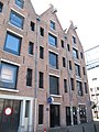
This is a category about rijksmonument number 143
|
| Address |
|
Media in category "Achtergracht 2, Amsterdam"
The following 2 files are in this category, out of 2 total.
-
 RM143 Achtergracht 2.jpg 2,448 × 3,264; 2.41 MB
-
 RM144 Achtergracht 4 (foto 2).jpg 2,448 × 3,264; 2.23 MB
.jpg)