Category:Abergavenny
Jump to navigation
Jump to search
English: Abergavenny.
Cymraeg: Y Fenni.
town and community in Monmouthshire, Wales, UK | |||||
| Upload media | |||||
| Instance of | |||||
|---|---|---|---|---|---|
| Location | Monmouthshire, Wales | ||||
| Located in or next to body of water | |||||
| Population |
| ||||
| Area |
| ||||
| official website | |||||
 | |||||
Subcategories
This category has the following 18 subcategories, out of 18 total.
Media in category "Abergavenny"
The following 78 files are in this category, out of 78 total.
-
33-35 Hereford Road, Abergavenny - geograph.org.uk - 7005622.jpg 4,032 × 3,024; 3.97 MB
-
45-49 Hereford Road, Abergavenny - geograph.org.uk - 7005624.jpg 4,032 × 3,024; 4.2 MB
-
51 Hereford Road, Abergavenny - geograph.org.uk - 7005625.jpg 4,032 × 3,024; 2.63 MB
-
77 Hereford Road, Abergavenny - geograph.org.uk - 7005629.jpg 4,032 × 3,024; 3.19 MB
-
Abergavenny - Baptist Church - geograph.org.uk - 6620578.jpg 3,864 × 4,286; 5.81 MB
-
Abergavenny - Clock Tower - geograph.org.uk - 6620558.jpg 3,352 × 4,810; 7.03 MB
-
Abergavenny - Frogmore Street - geograph.org.uk - 6620082.jpg 5,152 × 3,864; 5.9 MB
-
Abergavenny - Kings Arms Hotel - geograph.org.uk - 6620585.jpg 5,152 × 3,864; 6.15 MB
-
Abergavenny - Market Hall - geograph.org.uk - 6620550.jpg 3,864 × 5,152; 6.88 MB
-
Abergavenny - Old Bank - geograph.org.uk - 6620564.jpg 4,868 × 3,450; 5.35 MB
-
Abergavenny - River Usk - geograph.org.uk - 6620054.jpg 5,152 × 3,864; 6.38 MB
-
Abergavenny - Shopping Centre - geograph.org.uk - 6620571.jpg 5,152 × 3,864; 7.21 MB
-
Abergavenny - St Mary's - Effigies - geograph.org.uk - 6620526.jpg 5,152 × 3,864; 6.2 MB
-
Abergavenny - St Mary's - Effigies - geograph.org.uk - 6620534.jpg 5,152 × 3,864; 6.52 MB
-
Abergavenny - St Mary's - geograph.org.uk - 6620073.jpg 5,152 × 3,864; 7.66 MB
-
Abergavenny - St Mary's - Jesse - geograph.org.uk - 6620523.jpg 5,152 × 3,864; 5.64 MB
-
Abergavenny - St Mary's - Monument - geograph.org.uk - 6620540.jpg 5,152 × 3,864; 6.82 MB
-
Abergavenny - St Mary's - Tomb - geograph.org.uk - 6620528.jpg 5,152 × 3,864; 6.65 MB
-
Abergavenny - St Mary's Font - geograph.org.uk - 6620518.jpg 4,267 × 3,303; 4.77 MB
-
Abergavenny - St Mary's Priory Church - geograph.org.uk - 6620091.jpg 5,152 × 3,524; 6.51 MB
-
Abergavenny Bus Station - geograph.org.uk - 6796773.jpg 1,600 × 972; 374 KB
-
Abergavenny Castle - geograph.org.uk - 6620067.jpg 5,152 × 3,864; 5.67 MB
-
Abergavenny Livestock Market 1987 - geograph.org.uk - 6739866.jpg 5,184 × 3,456; 2.7 MB
-
Abergavenny, Looking towards Monk Street - geograph.org.uk - 6871435.jpg 7,092 × 4,729; 6.72 MB
-
Abergavenny, Small playground - geograph.org.uk - 6871437.jpg 5,790 × 3,861; 7.01 MB
-
Cairn among the heather - geograph.org.uk - 6960959.jpg 1,024 × 683; 926 KB
-
Cairn among the heather - geograph.org.uk - 6960964.jpg 1,024 × 683; 845 KB
-
Cloudless blue sky on Easter Sunday 2021, Abergavenny - geograph.org.uk - 6796764.jpg 1,600 × 1,200; 525 KB
-
Dan-y Bryn, Hereford Road, Abergavenny - geograph.org.uk - 7005632.jpg 4,032 × 3,024; 5.56 MB
-
Edge of the boundary wall - geograph.org.uk - 7005577.jpg 3,648 × 2,432; 4.53 MB
-
Entrance to Sugar Loaf Vineyard - geograph.org.uk - 7005599.jpg 4,032 × 3,024; 5.78 MB
-
Ford over Afon Cibi - geograph.org.uk - 7005593.jpg 4,032 × 3,024; 6.96 MB
-
Gate to Sunnyvale Farm - geograph.org.uk - 7005588.jpg 3,648 × 2,432; 5.76 MB
-
Gatehouse to Llywn Du Court - geograph.org.uk - 7005596.jpg 4,032 × 3,024; 5.39 MB
-
Harold Road, Abergavenny - geograph.org.uk - 7005609.jpg 4,032 × 3,024; 6.64 MB
-
Hereford Court - geograph.org.uk - 7005619.jpg 4,032 × 3,024; 4 MB
-
House on Avenue Road, Abergavenny - geograph.org.uk - 7005611.jpg 4,032 × 3,024; 4.5 MB
-
In bracken with a view of the Sugarloaf - geograph.org.uk - 6973095.jpg 1,024 × 768; 225 KB
-
Maple in full autumn colour - geograph.org.uk - 7005605.jpg 4,032 × 3,024; 5.37 MB
-
Merthyr Street, looking north - geograph.org.uk - 6972347.jpg 1,024 × 768; 159 KB
-
Milestone, A40, Cantref - geograph.org.uk - 6865354.jpg 768 × 1,024; 440 KB
-
Moorland below Sugar Loaf - geograph.org.uk - 7005574.jpg 4,032 × 3,024; 5.29 MB
-
Old weighbridge detail, Abergavenny - geograph.org.uk - 5984174.jpg 2,733 × 1,850; 1.51 MB
-
Path through bracken - geograph.org.uk - 6960568.jpg 1,024 × 683; 807 KB
-
Path through bracken - geograph.org.uk - 6960569.jpg 1,024 × 683; 956 KB
-
Path through bracken - geograph.org.uk - 6960571.jpg 1,024 × 683; 948 KB
-
Path through bracken - geograph.org.uk - 6960572.jpg 1,024 × 683; 946 KB
-
Paths through bracken - geograph.org.uk - 6960567.jpg 1,024 × 683; 735 KB
-
Pen y Fal - Sugar Loaf - geograph.org.uk - 4207542.jpg 640 × 480; 96 KB
-
Pen y Fal - Sugar Loaf - geograph.org.uk - 4207548.jpg 640 × 480; 75 KB
-
Raised bank on the Sugar Loaf - geograph.org.uk - 2954772.jpg 640 × 480; 65 KB
-
Sessile oak woodland - geograph.org.uk - 7005580.jpg 3,648 × 2,432; 7.43 MB
-
Stone wall on Deri - geograph.org.uk - 7005576.jpg 3,648 × 2,432; 4.18 MB
-
Sugar Loaf summit - geograph.org.uk - 6960575.jpg 1,024 × 683; 611 KB
-
Sugar Loaf Vineyard - geograph.org.uk - 7005603.jpg 4,032 × 3,024; 4.34 MB
-
Sunnyvale Farm - geograph.org.uk - 7005589.jpg 3,648 × 2,432; 5.04 MB
-
Two jets in a blue sky - geograph.org.uk - 4282081.jpg 531 × 800; 108 KB
-
Ty'r Morwydd (St Michael's Convent) - geograph.org.uk - 7005614.jpg 4,032 × 3,024; 5.24 MB
-
Waterwheels at Mill House - geograph.org.uk - 307859.jpg 640 × 428; 180 KB
-
Willow structures in the castle grounds - geograph.org.uk - 6972343.jpg 1,024 × 768; 307 KB
-
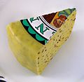
Y Fenni Cheese I.jpg 1,679 × 1,292; 1.5 MB
-
Y Fenni Cheese II.jpg 1,508 × 1,466; 1.47 MB
-
Y Fenni Cheese III.jpg 1,431 × 1,471; 1.44 MB


