Category:Aberedw
Jump to navigation
Jump to search

village and community in Powys   | |||||
| Upload media | |||||
| Instance of | |||||
|---|---|---|---|---|---|
| Location | Powys, Wales | ||||
| Population |
| ||||
| Area |
| ||||
 | |||||
Subcategories
This category has the following 7 subcategories, out of 7 total.
E
- River Edw (33 F)
L
- Llandeilo Hill (11 F)
- Llewellyn's Cave, Aberedw (10 F)
R
- Rhulen (8 F)
S
W
- Waun Hirwaun (2 F)
Media in category "Aberedw"
The following 200 files are in this category, out of 677 total.
(previous page) (next page)-
 -The Nyth fishing lodge, Aberedw (1293474).jpg 1,000 × 712; 83 KB
-
 -The Nyth, Aberedw (1294842).jpg 1,000 × 710; 117 KB
-
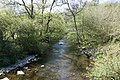
 A fording Place - geograph.org.uk - 4558821.jpg 1,024 × 683; 266 KB
-
 A long way - geograph.org.uk - 3128497.jpg 1,024 × 683; 154 KB
-
 A rock pool - geograph.org.uk - 3136853.jpg 1,024 × 683; 147 KB
-
 A walk by the railway - geograph.org.uk - 1334531.jpg 640 × 426; 130 KB
-

-
 Abandoned farm house - geograph.org.uk - 3818810.jpg 640 × 480; 108 KB
-
 Abandoned Hay Maker - geograph.org.uk - 4976725.jpg 4,608 × 3,456; 4.58 MB
-

-
 Aber Edwy, or, Abereddow church, Radnorshire (1128860).jpg 1,000 × 707; 212 KB
-
 Aber Edwy, or, Abereddow church, Radnorshire.jpeg 900 × 636; 398 KB
-
 Aber-edow rocks.jpeg 900 × 679; 373 KB
-
 Aberedow Mill, South Wales.jpeg 900 × 694; 289 KB
-
 Aberedw - geograph.org.uk - 1328521.jpg 640 × 480; 71 KB
-
 Aberedw - geograph.org.uk - 1445334.jpg 640 × 480; 62 KB
-
 Aberedw - geograph.org.uk - 158657.jpg 640 × 434; 47 KB
-
 Aberedw across the field - geograph.org.uk - 1327973.jpg 640 × 426; 60 KB
-
 Aberedw approach from the east - geograph.org.uk - 2292348.jpg 640 × 480; 68 KB
-
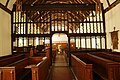
 Aberedw Church - geograph.org.uk - 4546633.jpg 1,024 × 683; 181 KB
-
 Aberedw Hill - geograph.org.uk - 4974588.jpg 3,456 × 4,608; 2.52 MB
-
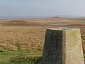
 Aberedw Hill Benchmark - geograph.org.uk - 3130088.jpg 533 × 800; 193 KB
-
 Aberedw rocks (1295070).jpg 1,000 × 1,394; 265 KB
-
 Aberedw rocks (4521200624).jpg 538 × 750; 192 KB
-
 Aberedw Rocks - geograph.org.uk - 2292800.jpg 640 × 480; 73 KB
-
 Aberedw Rocks - geograph.org.uk - 578548.jpg 640 × 426; 97 KB
-
 Aberedw station site geograph-3223946-by-Ben-Brooksbank.jpg 2,395 × 1,449; 4.05 MB
-
 Aberedw village - geograph.org.uk - 91566.jpg 480 × 640; 117 KB
-
 Aberedwy.jpeg 900 × 738; 409 KB
-
 Above Pen-blaen - geograph.org.uk - 6087536.jpg 1,024 × 768; 209 KB
-
 Above the Wye - geograph.org.uk - 682227.jpg 640 × 480; 88 KB
-
 Access to the moor - geograph.org.uk - 674044.jpg 640 × 480; 117 KB
-
 Across the hill - geograph.org.uk - 3128494.jpg 1,024 × 683; 175 KB
-
 Across the Valley - geograph.org.uk - 3128743.jpg 1,024 × 683; 179 KB
-
 Along Aberdew Hill - geograph.org.uk - 3128730.jpg 1,024 × 683; 118 KB
-
 Along by the line - geograph.org.uk - 1330595.jpg 640 × 426; 124 KB
-
 Along the walls - geograph.org.uk - 1328121.jpg 640 × 426; 123 KB
-
 Altar at St Cewydd - geograph.org.uk - 4548254.jpg 533 × 800; 99 KB
-
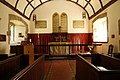
 Altar in St Padarn - geograph.org.uk - 4557170.jpg 1,024 × 683; 141 KB
-
 Another bit of wall - geograph.org.uk - 1334343.jpg 640 × 426; 123 KB
-
 Another pool - geograph.org.uk - 3137051.jpg 1,024 × 683; 145 KB
-
 Another run off - geograph.org.uk - 3128789.jpg 1,024 × 683; 168 KB
-
 Approaching an upland pool - geograph.org.uk - 3821546.jpg 640 × 480; 90 KB
-
 Arch over the River - geograph.org.uk - 4558810.jpg 1,024 × 683; 260 KB
-
 Back of St Padarn - geograph.org.uk - 4557279.jpg 1,024 × 683; 93 KB
-
 Back of the Rood Screen - geograph.org.uk - 4548429.jpg 1,024 × 683; 159 KB
-
 Back to Llanbadarn-y-garreg - geograph.org.uk - 4558834.jpg 1,024 × 683; 293 KB
-
 Back to the Road - geograph.org.uk - 4558808.jpg 1,024 × 683; 178 KB
-
 Back to the tumuli - geograph.org.uk - 3137070.jpg 1,024 × 683; 134 KB
-
 Banner ^ Plaque - geograph.org.uk - 4548580.jpg 1,024 × 683; 72 KB
-
 Barn on the hillside - geograph.org.uk - 3821486.jpg 640 × 480; 75 KB
-
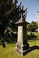
 Baskerville Memorial - geograph.org.uk - 4548448.jpg 533 × 800; 72 KB
-
 Bath by the fence - geograph.org.uk - 1334548.jpg 640 × 426; 110 KB
-
 Beacons in the distance - geograph.org.uk - 3130283.jpg 1,024 × 683; 104 KB
-

-
 Bell on St Padarn - geograph.org.uk - 4558801.jpg 1,024 × 683; 189 KB
-
 Bend in the byway - geograph.org.uk - 2986310.jpg 2,560 × 1,920; 1.13 MB
-
 Bend in the river - geograph.org.uk - 1334305.jpg 640 × 426; 104 KB
-
 Bend on the bridge - geograph.org.uk - 1040726.jpg 640 × 426; 103 KB
-
 Blaenmilo-uchaf - geograph.org.uk - 693323.jpg 639 × 479; 177 KB
-
 Bog, Pwll Brwynog - geograph.org.uk - 5692238.jpg 1,024 × 683; 304 KB
-
 Boundary on the path - geograph.org.uk - 1334500.jpg 640 × 426; 131 KB
-
 Boundary Stone - geograph.org.uk - 2986317.jpg 1,920 × 2,560; 1.08 MB
-
 Boundary stone - geograph.org.uk - 5692372.jpg 1,024 × 683; 427 KB
-
 Bracken and Fungi on Moorland near Cregrina, Powys - geograph.org.uk - 4651623.jpg 1,400 × 933; 1.37 MB
-
 Bracken straw bales, a Radnorshire oddity - geograph.org.uk - 693904.jpg 639 × 479; 181 KB
-
 Bridge at Llanbadarn-y-garreg - geograph.org.uk - 4556654.jpg 1,024 × 683; 223 KB
-
 Bridge near Llanbadarn-y-garreg - geograph.org.uk - 4558968.jpg 1,024 × 683; 240 KB
-
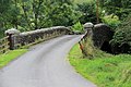
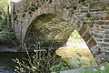
 Bridge over the Edw - geograph.org.uk - 671727.jpg 640 × 480; 103 KB
-
 Bridge over the river - geograph.org.uk - 1332416.jpg 640 × 480; 132 KB
-
 Bridge over the River Edw , Llanbadarn-y-garreg, Powys - geograph.org.uk - 5755709.jpg 4,048 × 2,029; 3.87 MB
-
 Bridge repair near Glan Edw, Powys - geograph.org.uk - 3160753.jpg 1,024 × 683; 733 KB
-
 Bridge, Llanbardan-y-garreg, Powys - geograph.org.uk - 3158321.jpg 1,024 × 683; 600 KB
-
 Broken Cast - geograph.org.uk - 4551506.jpg 1,024 × 683; 241 KB
-
 Broken Tomb - geograph.org.uk - 4550311.jpg 1,024 × 683; 193 KB
-
 Broken Top - geograph.org.uk - 4550527.jpg 533 × 800; 132 KB
-
 Bryn Aberedw Hill - geograph.org.uk - 2110491.jpg 690 × 518; 135 KB
-

-
 Candles by the Lectern - geograph.org.uk - 4550042.jpg 1,024 × 683; 97 KB
-
 Capel Salem, Llanbadarn y Garreg - geograph.org.uk - 2110469.jpg 690 × 518; 175 KB
-
 Careg Lywd - geograph.org.uk - 4785256.jpg 640 × 480; 43 KB
-
 Carving behind the Altar - geograph.org.uk - 4548256.jpg 1,024 × 683; 176 KB
-
 Castle corner - geograph.org.uk - 1328421.jpg 640 × 480; 125 KB
-
 Castle in the trees - geograph.org.uk - 1328564.jpg 640 × 480; 90 KB
-
 Castle in the woods - geograph.org.uk - 1028903.jpg 640 × 426; 63 KB
-
 Cefnhinog Farm on a January evening - geograph.org.uk - 3821822.jpg 640 × 480; 54 KB
-
 Ceiling in St Cewydd - geograph.org.uk - 4548595.jpg 533 × 800; 115 KB
-
 Chancel at St Cewydd, - geograph.org.uk - 4547184.jpg 1,024 × 683; 128 KB
-
 Chancel Ceiling - geograph.org.uk - 4548596.jpg 533 × 800; 98 KB
-
 Chest in the path - geograph.org.uk - 1330615.jpg 640 × 426; 128 KB
-
 Church at Llanbadarn-y-Garreg - geograph.org.uk - 3820541.jpg 640 × 480; 106 KB
-
 Church of St David, Rhulen, Powys - geograph.org.uk - 5755688.jpg 4,048 × 2,030; 3.14 MB
-
 Church of St David, Rhulen, Powys - geograph.org.uk - 5755692.jpg 4,048 × 2,326; 4.27 MB
-
 Church of St David, Rhulen, Powys - geograph.org.uk - 5755695.jpg 3,456 × 2,028; 2.93 MB
-
 Church of St Padarn, Llanbadarn-y-garreg, Powys - geograph.org.uk - 5755703.jpg 4,037 × 2,030; 3.26 MB
-
 Church of St Padarn, Llanbadarn-y-garreg, Powys - geograph.org.uk - 5755705.jpg 4,048 × 3,040; 4.36 MB
-
 Church of St Padarn, Llanbadarn-y-garreg, Powys - geograph.org.uk - 5755706.jpg 4,048 × 2,119; 3.57 MB
-
 Churchyard at St Cewydd, Aberedw - geograph.org.uk - 4546641.jpg 1,024 × 683; 251 KB
-
 Churchyard at St Padarn - geograph.org.uk - 4556916.jpg 1,024 × 683; 248 KB
-
 Churchyard by the East End - geograph.org.uk - 4558513.jpg 1,024 × 683; 221 KB
-
 Close up of the Arch - geograph.org.uk - 4558811.jpg 1,024 × 683; 242 KB
-
 Coed-yr-aber - geograph.org.uk - 2946429.jpg 2,592 × 1,944; 1.75 MB
-
 Coming from the North - geograph.org.uk - 4556666.jpg 1,024 × 683; 336 KB
-
 Converted Chapel, Rhulen, Powys - geograph.org.uk - 4040758.jpg 1,024 × 768; 910 KB
-
 Corner of the Tower - geograph.org.uk - 4551512.jpg 533 × 800; 145 KB
-
 Cottages at Llanbadarn-y-garreg - geograph.org.uk - 4556581.jpg 1,024 × 683; 194 KB
-
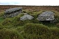
 Cradle Rocks, Llanbedr Hill - geograph.org.uk - 578217.jpg 640 × 426; 133 KB
-
 Cradle Rocks, Llanbedr Hill - geograph.org.uk - 578225.jpg 640 × 426; 126 KB
-
 Craig Aberedw - Aberedw Rocks - geograph.org.uk - 1445368.jpg 640 × 480; 136 KB
-
 Cross in the Ivy - geograph.org.uk - 4550540.jpg 1,024 × 683; 175 KB
-
 Cross in the Weeds - geograph.org.uk - 4551495.jpg 1,024 × 683; 281 KB
-
 Cross on the Top - geograph.org.uk - 4550319.jpg 533 × 800; 119 KB
-
 Crumbling walls - geograph.org.uk - 1328109.jpg 640 × 426; 122 KB
-
 Cutmark on St Cewydd - geograph.org.uk - 4551514.jpg 533 × 800; 182 KB
-
 Cwm Berllan - geograph.org.uk - 5692271.jpg 1,024 × 683; 298 KB
-
 Cwm Blaenerw - geograph.org.uk - 12471.jpg 640 × 480; 113 KB
-
 Cwm Iago - geograph.org.uk - 5693449.jpg 640 × 427; 79 KB
-
-
 Dam by the River - geograph.org.uk - 4558817.jpg 1,024 × 683; 284 KB
-
 Damaged walls - geograph.org.uk - 1328506.jpg 640 × 480; 136 KB
-
 Daniel James - geograph.org.uk - 4551584.jpg 533 × 800; 107 KB
-
 Dead Fox on Moorland near Cregrina, Powys - geograph.org.uk - 3663078.jpg 1,024 × 683; 1.04 MB
-
 Dead Fox on Moorland near Cregrina, Powys - geograph.org.uk - 3663080.jpg 1,024 × 683; 1.05 MB
-
 Dead tree on the hill - geograph.org.uk - 1027658.jpg 640 × 426; 91 KB
-
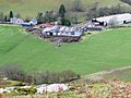
 Derelict farm house above Aberedw - geograph.org.uk - 3390536.jpg 640 × 480; 98 KB
-
 Derelict farm near Aberedw - geograph.org.uk - 2986581.jpg 640 × 480; 120 KB
-
 Descending Aberedw Hill - geograph.org.uk - 3821786.jpg 640 × 480; 60 KB
-
 Descent to the Edw - geograph.org.uk - 694042.jpg 639 × 479; 181 KB
-
 Descent towards Aberedw - geograph.org.uk - 694001.jpg 639 × 479; 151 KB
-
 Dilapidated farmhouse above Aberedw - geograph.org.uk - 2292381.jpg 640 × 480; 108 KB
-

-
 Display at the Font - geograph.org.uk - 4549947.jpg 533 × 800; 103 KB
-
 Disused quarry - geograph.org.uk - 693332.jpg 639 × 479; 208 KB
-
 Doctor's Pool - geograph.org.uk - 2986323.jpg 2,560 × 1,920; 1.12 MB
-
 Don't like the look of this lot - geograph.org.uk - 3128502.jpg 1,024 × 683; 254 KB
-
 Door at the Back - geograph.org.uk - 4549928.jpg 1,024 × 683; 126 KB
-
 Doorway ^ Window - geograph.org.uk - 4548584.jpg 1,024 × 683; 105 KB
-
 Down the hill - geograph.org.uk - 1334474.jpg 400 × 600; 119 KB
-
 Down to the Wye - geograph.org.uk - 1332328.jpg 640 × 426; 111 KB
-
 Downstream Side - geograph.org.uk - 4558823.jpg 1,024 × 683; 245 KB
-
 Dried up stream - geograph.org.uk - 1028880.jpg 640 × 426; 102 KB
-
 Dry valley - geograph.org.uk - 1167245.jpg 640 × 480; 108 KB
-
 Earthworks at Waun Gynllwch - geograph.org.uk - 558254.jpg 640 × 426; 122 KB
-
 East Wall of St Padarn - geograph.org.uk - 4558507.jpg 1,024 × 683; 231 KB
-
 Easy going - geograph.org.uk - 3137065.jpg 1,024 × 683; 128 KB
-
 Edw Flowing South - geograph.org.uk - 4556663.jpg 1,024 × 683; 300 KB
-
 Edw past the garden - geograph.org.uk - 1028866.jpg 640 × 426; 111 KB
-
 Embankment to the river - geograph.org.uk - 1330677.jpg 640 × 426; 107 KB
-
 End of the bridge - geograph.org.uk - 1330661.jpg 640 × 426; 126 KB
-
 Eroded round the base - geograph.org.uk - 3130085.jpg 533 × 800; 118 KB
-
 Evans Memorial - geograph.org.uk - 4557161.jpg 533 × 800; 62 KB
-
 Evening sun on trees in Cwm Rhiwiau - geograph.org.uk - 558858.jpg 640 × 426; 121 KB
-
 Exposed rock - geograph.org.uk - 684957.jpg 640 × 480; 109 KB
-
 Faded Coat of Arms - geograph.org.uk - 4557164.jpg 1,024 × 683; 131 KB
-
 Family Graves - geograph.org.uk - 4550309.jpg 533 × 800; 119 KB
-
 Farm at Llanbadarn-y-garreg - geograph.org.uk - 4558827.jpg 1,024 × 683; 227 KB
-
 Farmland near Cregrina, Powys - geograph.org.uk - 3662956.jpg 800 × 534; 106 KB
-
 Farmland near Cregrina, Powys - geograph.org.uk - 3662957.jpg 1,024 × 683; 663 KB
-
 Farmland near Cregrina, Powys - geograph.org.uk - 3662967.jpg 1,024 × 683; 592 KB
-
 Farmland near Cregrina, Powys - geograph.org.uk - 3663015.jpg 1,024 × 683; 659 KB
-
 Farmland near Cregrina, Powys - geograph.org.uk - 3663020.jpg 1,024 × 683; 763 KB
-
 Farmland near Cregrina, Powys - geograph.org.uk - 3663024.jpg 1,024 × 683; 840 KB
-
 Farmland near Cregrina, Powys - geograph.org.uk - 3663026.jpg 1,024 × 683; 624 KB
-
 Farmland near Cregrina, Powys - geograph.org.uk - 3663029.jpg 1,024 × 683; 760 KB
-
 Farmland near Cregrina, Powys - geograph.org.uk - 3663033.jpg 1,024 × 683; 598 KB
-
 Fenceline on Aberedw Hill - geograph.org.uk - 3821812.jpg 640 × 480; 77 KB
-
 Ffarm y Pantau - Pantau Farm - geograph.org.uk - 5720724.jpg 640 × 480; 114 KB
-
 Field by the sign - geograph.org.uk - 1336344.jpg 640 × 480; 118 KB
-
 Field edge marker for Llywelyn's cave - geograph.org.uk - 1892965.jpg 640 × 480; 135 KB
-
 Flight Lieutenant Ian Hill RAF - geograph.org.uk - 4550534.jpg 1,024 × 683; 209 KB
-
 Flowers in the Vase - geograph.org.uk - 4558500.jpg 1,024 × 683; 107 KB
-
 Flowers on the windowsill - geograph.org.uk - 4558496.jpg 1,024 × 683; 118 KB
-
 Flowing Away - geograph.org.uk - 4558980.jpg 1,024 × 683; 298 KB
-
 Flutes in the Case - geograph.org.uk - 4549941.jpg 1,024 × 683; 130 KB
-
 Follow the trail - geograph.org.uk - 3136916.jpg 1,024 × 683; 156 KB
-
 Font at St Cewydd - geograph.org.uk - 4548597.jpg 533 × 800; 106 KB
-
 Font at St Padarn - geograph.org.uk - 4557156.jpg 1,024 × 683; 111 KB
-
 Font in St Padarn - geograph.org.uk - 4558498.jpg 1,024 × 683; 66 KB
-
 Footpath at Aberedw Rocks - geograph.org.uk - 2292807.jpg 640 × 480; 117 KB
-
 Footpath near Cregrina, Powys - geograph.org.uk - 4651557.jpg 1,400 × 890; 1.17 MB
-
 Footpath Through Field near Cregrina, Powys - geograph.org.uk - 4651562.jpg 1,400 × 933; 1.32 MB
-
 Footpath Through Moorland near Cregrina, Powys - geograph.org.uk - 4651565.jpg 1,400 × 933; 1.28 MB
-
 Footpath Through Moorland near Cregrina, Powys - geograph.org.uk - 4651567.jpg 667 × 1,000; 818 KB
-
 Footpath Through Moorland near Cregrina, Powys - geograph.org.uk - 4651571.jpg 1,400 × 933; 1.62 MB
-
 Footpath Through Moorland near Cregrina, Powys - geograph.org.uk - 4651575.jpg 1,400 × 933; 1.7 MB
-
 Footpath through Moorland near Cregrina, Powys - geograph.org.uk - 4651586.jpg 1,400 × 933; 1.47 MB
-
 Footpath to Aberedw Hill - geograph.org.uk - 669117.jpg 640 × 480; 106 KB
-

-
 Former Chapel, Rhulen, Powys - geograph.org.uk - 4040509.jpg 1,024 × 768; 919 KB
-
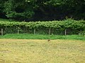 Fox fleeing - geograph.org.uk - 2986572.jpg 640 × 480; 100 KB
-
 Fox in the field - geograph.org.uk - 2986564.jpg 640 × 480; 108 KB
-
 From the second - geograph.org.uk - 3136905.jpg 1,024 × 683; 108 KB
-
 From the Trig Point - geograph.org.uk - 3130270.jpg 1,024 × 683; 106 KB
-
 Further along the valley - geograph.org.uk - 3138486.jpg 1,024 × 683; 155 KB
-
 Garreg Llwyd - geograph.org.uk - 5693439.jpg 1,024 × 683; 317 KB
-
 Gate on the hill - geograph.org.uk - 1334486.jpg 640 × 426; 114 KB
-
 George Kinloch Sheppard - geograph.org.uk - 4551574.jpg 533 × 800; 104 KB
-
 Got my beady eye on you - geograph.org.uk - 3128500.jpg 1,024 × 683; 223 KB
-

-
 Grave on the East End - geograph.org.uk - 4550060.jpg 533 × 800; 158 KB
.jpg)
.jpg)


.jpg)


.jpg)
.jpg)


