Category:Aberavon
Jump to navigation
Jump to search
town and community in Neath Port Talbot, Wales, UK | |||||
| Upload media | |||||
| Instance of | |||||
|---|---|---|---|---|---|
| Location | Neath Port Talbot, Wales | ||||
| Population |
| ||||
| Area |
| ||||
 | |||||
Cymraeg: Tref yng Nghastell-nedd Port Talbot yw Aberafan (Saesneg Aberavon), yng nghanol Port Talbot ar lan orllewinol Afon Afan. Mae 5,157 o bobl yn byw yng nghymuned Aberafan, 8% ohonynt yn siarad Cymraeg (Cyfrifiad 2001).
English: Aberavon is a settlement in Neath Port Talbot county borough, Wales. The town derived its name from the river Afan, which also gave its name to a medieval lordship. Today it is essentially a district of Port Talbot, covering the central and south western part of the town. Aberavon is also the name of the nearby Blue Flag beach and the parish covering the same area.
Português: Aberavon é uma localidade do País de Gales, condado de Glamorgan, na foz do rio costeiro Avon.
Subcategories
This category has the following 4 subcategories, out of 4 total.
A
E
P
S
Media in category "Aberavon"
The following 101 files are in this category, out of 101 total.
-
2010 Wales Neath Port Talbot Community Aberavon map.svg 512 × 666; 423 KB
-
2024 Wales Neath Port Talbot Community Aberavon map.svg 512 × 666; 548 KB
-
A48 and footpath beneath the M4 in Port Talbot - geograph.org.uk - 4941779.jpg 4,000 × 3,000; 3.17 MB
-
Aberafan Beach near Sandfields ^ Port Talbot - panoramio.jpg 2,592 × 1,936; 1.59 MB
-
Aberafan Beach Sandfields Port Talbot - panoramio.jpg 2,592 × 1,936; 1.51 MB
-
Aberavon Beach - geograph.org.uk - 41808.jpg 640 × 480; 58 KB
-
Aberavon Beach Hotel - geograph.org.uk - 41809.jpg 640 × 480; 52 KB
-
Aberavon Beach view seafront from beach, with Kitetrail sculpture in view.jpg 3,888 × 2,592; 2.53 MB
-
Aberavon Beach view seafront.jpg 3,888 × 2,592; 3.36 MB
-
Aberavon Beach view to Swansea Bay.jpg 4,032 × 1,960; 2.04 MB
-
Aberavon Beach view to Swansea Bay.ogv 16 s, 1,920 × 1,080; 32.91 MB
-
Aberavon Beach view, seafront.jpg 3,888 × 2,592; 2.46 MB
-
Aberavon Beach, Neath and Port Talbot, South Wales. View east.jpg 5,152 × 3,864; 2.94 MB
-
Aberavon Beach, Neath and Port Talbot, South Wales. View west.jpg 5,152 × 3,864; 2.83 MB
-
Aberavon Bridge - geograph.org.uk - 41820.jpg 640 × 480; 90 KB
-
Aberavon Bridge 2 2021.jpg 4,032 × 3,024; 2.94 MB
-
Aberavon Bridge 2021.jpg 4,032 × 3,024; 3.47 MB
-
Aberavon from Mynydd Dinas - geograph.org.uk - 4941768.jpg 4,000 × 3,000; 3.94 MB
-
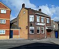
Aberavon Liberal Club, Port Talbot - geograph.org.uk - 3381492.jpg 640 × 531; 84 KB
-
Aberavon North.jpg 640 × 480; 98 KB
-
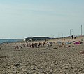
Aberavon Sands - geograph.org.uk - 41836.jpg 549 × 480; 52 KB
-
Aberavon Sands - geograph.org.uk - 41837.jpg 640 × 480; 68 KB
-
Aberavon Seafront Sculpture.jpg 500 × 817; 71 KB
-
Aberavon, St Mary - geograph.org.uk - 6372688.jpg 3,000 × 4,000; 4.14 MB
-
Aberavon-geograph.org.uk-4058559.jpg 640 × 480; 244 KB
-
Afan Way, Aberavon.jpg 4,000 × 3,000; 1.91 MB
-
ATS Euromaster, Port Talbot - geograph.org.uk - 3218027.jpg 640 × 432; 63 KB
-
Baglan Bay abandoned plant (32574723696).jpg 3,264 × 1,836; 2.03 MB
-
Beach Street, Port Talbot - geograph.org.uk - 3381466.jpg 640 × 409; 58 KB
-
Bethlehem Evangelical Church, Sandfields, Aberavon - geograph.org.uk - 2506099.jpg 4,000 × 3,000; 2.23 MB
-
Blanco's Hotel, Port Talbot (2) - geograph.org.uk - 5285504.jpg 2,592 × 1,944; 1.39 MB
-
Blanco's Hotel, Port Talbot - geograph.org.uk - 5285498.jpg 2,592 × 1,944; 1.4 MB
-
Bridge over Afon Afan, Port Talbot - geograph.org.uk - 2779086.jpg 2,592 × 1,944; 1.32 MB
-
Burgess Green, Port Talbot - geograph.org.uk - 3381511.jpg 640 × 472; 72 KB
-
Copper works - a view near Aberavon, Glamorganshire, south Wales.jpeg 700 × 509; 111 KB
-
Empty Bus Station, Port Talbot (2) - geograph.org.uk - 5543677.jpg 2,592 × 1,944; 1.35 MB
-
Gantry at M4 westbound, junction 41 - geograph.org.uk - 5824563.jpg 1,600 × 1,066; 537 KB
-
Gerald Street, Port Talbot - geograph.org.uk - 3381627.jpg 640 × 640; 84 KB
-
High Street, Aberavon (4641726).jpg 1,200 × 843; 127 KB
-
Kitetrail sculpture, Aberavon, Neath and Port Talbot, South Wales.jpg 4,650 × 3,685; 2.45 MB
-
M4 approaching Junction 41 - geograph.org.uk - 3688566.jpg 640 × 430; 39 KB
-
M4 sign gantry ahead of junction 41 - geograph.org.uk - 5824442.jpg 1,600 × 1,066; 462 KB
-
M4, Junction 41 - geograph.org.uk - 3688557.jpg 640 × 430; 42 KB
-
M4, Junction 41 - geograph.org.uk - 3688587.jpg 640 × 396; 38 KB
-
Motorway sign gantry ahead of junction 41 westbound - geograph.org.uk - 5824448.jpg 1,600 × 1,066; 473 KB
-
Neath Port Talbot County Borough Council HQ.jpg 1,000 × 750; 327 KB
-
Neath Port Talbot UK ward location - Aberavon.png 570 × 720; 118 KB
-
New footbridge over Afan Way - geograph.org.uk - 2019362.jpg 1,600 × 1,200; 344 KB
-
NMW - Steinaxt.jpg 1,712 × 2,560; 1.15 MB
-
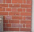
Ordnance Survey Cut Mark - geograph.org.uk - 3896222.jpg 640 × 480; 92 KB
-
Ordnance Survey Cut Mark - geograph.org.uk - 3896227.jpg 640 × 480; 65 KB
-
Ordnance Survey Cut Mark - geograph.org.uk - 3896230.jpg 480 × 640; 74 KB
-
Ordnance Survey Cut Mark - geograph.org.uk - 3896250.jpg 471 × 450; 81 KB
-
Ordnance Survey Cut Mark - geograph.org.uk - 3896255.jpg 640 × 480; 87 KB
-
Ordnance Survey Cut Mark - geograph.org.uk - 3896262.jpg 480 × 640; 72 KB
-
Ordnance Survey Cut Mark - geograph.org.uk - 3896268.jpg 480 × 640; 91 KB
-
Ordnance Survey Cut Mark - geograph.org.uk - 3896274.jpg 480 × 640; 113 KB
-
Ordnance Survey Cut Mark - geograph.org.uk - 6504379.jpg 1,024 × 731; 272 KB
-
Port Talbot , Green Park Street - geograph.org.uk - 5474358.jpg 6,000 × 4,000; 6.23 MB
-
Port Talbot Civic Centre - geograph.org.uk - 2851587.jpg 640 × 480; 83 KB
-
Port Talbot panorama from hillside - Swansea Bay - panoramio (1) (cropped).jpg 4,500 × 3,000; 4.53 MB
-
Princess Royal Theatre - geograph.org.uk - 381872.jpg 640 × 471; 130 KB
-
Refurbishment work, Water St, Aberavon - geograph.org.uk - 2506105.jpg 4,000 × 3,000; 1.86 MB
-
River Afan, Port Talbot - geograph.org.uk - 3829574.jpg 1,200 × 803; 1.25 MB
-
River Avan at Port Talbot October 13th 2015 - geograph.org.uk - 5200030.jpg 3,264 × 1,836; 1.92 MB
-
River Avan in Port Talbot - geograph.org.uk - 4941785.jpg 4,000 × 3,000; 3.77 MB
-
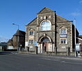
Riverside chapel and hall, Aberavon - geograph.org.uk - 2851568.jpg 640 × 546; 88 KB
-
RNLI Port Talbot Lifeboat Station at Aberavon Beach.jpg 3,693 × 1,689; 3.8 MB
-
Salem Chapel - geograph.org.uk - 3896258.jpg 640 × 480; 42 KB
-
St Mary St, Port Talbot - geograph.org.uk - 2506124.jpg 4,000 × 3,000; 2.33 MB
-
St Mary's Church, Aberavon - geograph.org.uk - 2506119.jpg 4,000 × 3,000; 2.73 MB
-
St Mary's Church, Port Talbot - geograph.org.uk - 5839987.jpg 1,704 × 2,437; 4.02 MB
-
St Paul's Church, Aberavon - geograph.org.uk - 2506088.jpg 4,000 × 3,000; 2.31 MB
-
St Paul's church, Port Talbot - geograph.org.uk - 3381618.jpg 640 × 501; 86 KB
-
Swansea Bay - panoramio (1).jpg 12,193 × 3,151; 12.71 MB
-
Talbot Glass, Port Talbot - geograph.org.uk - 3218038.jpg 640 × 485; 60 KB
-
The Burgess Green, Aberavon - geograph.org.uk - 2506103.jpg 4,000 × 3,000; 2.22 MB
-
The Craddock Arms, Aberavon - geograph.org.uk - 2506112.jpg 4,000 × 3,000; 2.14 MB
-
Under the M4 viaduct, Port Talbot - geograph.org.uk - 2851810.jpg 640 × 480; 61 KB
-
Water Street houses, Port Talbot - geograph.org.uk - 3218034.jpg 640 × 507; 66 KB
-
A sea view^ - geograph.org.uk - 1008419.jpg 640 × 480; 53 KB
-
Aberavon Sands in Port Talbot - geograph.org.uk - 1462697.jpg 640 × 447; 51 KB
-
Tidal defences - geograph.org.uk - 668677.jpg 640 × 293; 35 KB


