Category:A724 road (Scotland)
Jump to navigation
Jump to search
road in Scotland | |||||
| Upload media | |||||
| Instance of | |||||
|---|---|---|---|---|---|
| Location | South Lanarkshire, Scotland | ||||
| Transport network |
| ||||
 | |||||
Subcategories
This category has the following 4 subcategories, out of 4 total.
C
L
M
Media in category "A724 road (Scotland)"
The following 74 files are in this category, out of 74 total.
-
A view across Brandon Street - geograph.org.uk - 1660405.jpg 640 × 480; 66 KB
-
A725 bridge over A724, Blantyre (geograph 6966736).jpg 640 × 480; 81 KB
-
Billboard on side of house - geograph.org.uk - 1359338.jpg 640 × 480; 118 KB
-
Bus stop and shelter on Burnbank Road (A724) (geograph 6967352).jpg 1,024 × 662; 114 KB
-
Bus stop and shelter on Cambuslang Road (A724) (geograph 6966614).jpg 1,024 × 768; 150 KB
-
Businesses on Glasgow Road (A724), Hamilton (geograph 6966758).jpg 800 × 555; 102 KB
-
Cambuslang Karting - geograph.org.uk - 1230024.jpg 640 × 480; 115 KB
-
Cambuslang Road (A724), Rutherglen (geograph 6970536).jpg 1,024 × 705; 136 KB
-
Cambuslang Road - geograph.org.uk - 1230009.jpg 640 × 480; 113 KB
-
Church on Hamilton Road - geograph.org.uk - 1359345.jpg 640 × 480; 105 KB
-
Croft Road crossing railway, Cambuslang (geograph 6966657).jpg 1,024 × 693; 139 KB
-
Crossroads on the A724 in Blantyre (geograph 3230429).jpg 640 × 481; 73 KB
-
Duchess Road - geograph.org.uk - 1230007.jpg 640 × 480; 126 KB
-
Eastfield Building.jpg 3,264 × 2,448; 3.64 MB
-
Eastfield Shops.jpg 3,264 × 2,448; 3.43 MB
-
Flats in Halfway - geograph.org.uk - 1359365.jpg 640 × 480; 125 KB
-
Fratelli, Cambuslang (geograph 4120971).jpg 5,184 × 3,456; 7.53 MB
-
Gallowflat roundabout - geograph.org.uk - 1230012.jpg 640 × 480; 96 KB
-
Gallowflat Roundabout - geograph.org.uk - 2109730.jpg 640 × 480; 56 KB
-
Gallowflat Roundabout - geograph.org.uk - 50983.jpg 640 × 480; 120 KB
-
Glasgow Road (A724) approaching roundabout (geograph 6967343).jpg 800 × 600; 113 KB
-
Glasgow Road (A724) towards Hamilton (geograph 6966748).jpg 800 × 600; 86 KB
-
Glasgow Road (A724), Blantyre (geograph 6966728).jpg 800 × 518; 82 KB
-
Glasgow Road, Blantyre (A724) - geograph.org.uk - 1670329.jpg 640 × 480; 70 KB
-
Glasgow Road, Blantyre (geograph 4121234).jpg 5,184 × 3,456; 7.15 MB
-
Glasgow Road, Cambuslang (geograph 4120982).jpg 1,600 × 1,067; 486 KB
-
Hamilton Grammar School (geograph 6739774).jpg 1,024 × 768; 258 KB
-
Hamilton Road - geograph.org.uk - 1230036.jpg 640 × 480; 115 KB
-
Hamilton Road at Mill Road - geograph.org.uk - 1359370.jpg 640 × 480; 130 KB
-
Hamilton Road, Halfway (geograph 1666942).jpg 640 × 480; 74 KB
-
Hamilton Road, Halfway - geograph.org.uk - 4121008.jpg 5,184 × 3,456; 7.11 MB
-
Hamilton Road, near Dalton (geograph 1667085).jpg 640 × 480; 102 KB
-
Heading towards a railway bridge - geograph.org.uk - 3729681.jpg 640 × 480; 57 KB
-
High flat in Cambuslang - geograph.org.uk - 1230022.jpg 480 × 640; 99 KB
-
Hotel in Blantyre - geograph.org.uk - 1253782.jpg 640 × 480; 52 KB
-
Houses in Cambuslang - geograph.org.uk - 1230021.jpg 640 × 480; 144 KB
-
Houses on Cambuslang Road (A724) (geograph 6966610).jpg 1,024 × 710; 137 KB
-
Logan Court - geograph.org.uk - 1359347.jpg 640 × 480; 136 KB
-
M74 extension - geograph.org.uk - 1230011.jpg 640 × 480; 130 KB
-
Peebles Drive housing - geograph.org.uk - 1230014.jpg 640 × 480; 108 KB
-
Pylons cross the A724 - geograph.org.uk - 2042471.jpg 640 × 480; 109 KB
-
Railway bridge over Cambuslang Road (A724) (geograph 6966604).jpg 640 × 480; 71 KB
-
Railway bridge over Hamilton Road - geograph.org.uk - 1230043.jpg 640 × 480; 138 KB
-
Restaurant on Burnbank Road (A724) (geograph 6967356).jpg 1,024 × 681; 148 KB
-
Roadworks on Cambuslang Road - geograph.org.uk - 1230010.jpg 640 × 480; 136 KB
-
Roundabout in Burnbank - geograph.org.uk - 1721618.jpg 640 × 480; 60 KB
-
Roundabout on Glasgow Road (A724), Blantyre (geograph 6966734).jpg 640 × 480; 74 KB
-
Rutherglen, Aldi.jpg 3,264 × 2,448; 3.96 MB
-
Salvation Army, Eastfield.jpg 3,264 × 2,448; 3.9 MB
-
Site of former South Lanarkshire College - geograph.org.uk - 1230041.jpg 640 × 480; 118 KB
-
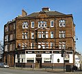
South Lanarkshire - Public House, 41 Dalmarnock Road, Glasgow - 20240729093858.jpg 1,983 × 1,335; 1.09 MB
-
South Lanarkshire Council Buildings - geograph.org.uk - 2903561.jpg 640 × 480; 121 KB
-
The Empire Bar, Hamilton (geograph 6966756).jpg 640 × 472; 75 KB
-
The First Glass, Hamilton Road, Cambuslang - geograph.org.uk - 4121027.jpg 5,184 × 3,456; 7.54 MB
-
The Glenlee Bar, Hamilton (geograph 6966750).jpg 640 × 502; 84 KB
-
The Langfield Inn - geograph.org.uk - 50784.jpg 640 × 480; 131 KB
-
The Old Original Bar, Blantyre (geograph 6966730).jpg 800 × 587; 105 KB
-
The Parkville Hotel, Glasgow Road, Blantyre (geograph 4121181).jpg 5,184 × 3,456; 6.71 MB
-
The Peacock and Ivy, Hamilton (geograph 6967365).jpg 800 × 551; 79 KB
-
The roundabout at Burnbank - geograph.org.uk - 1224702.jpg 640 × 481; 58 KB
-
The Sun Inn, Halfway - geograph.org.uk - 1359354.jpg 640 × 480; 105 KB
-
The West End Bar, Blantyre (geograph 6966724).jpg 800 × 517; 97 KB
-
Total Impact Fighting Fitness Gym, Hamilton Road, Cambuslang - geograph.org.uk - 4120994.jpg 5,184 × 3,456; 7.36 MB
-
UK road A724.PNG 597 × 184; 7 KB
-
UK road A724.svg 487 × 190; 2 KB
-
Wee Mill, Farme Cross, Rutherglen (ex-Tennents Bar) 2016-02-28.jpg 1,248 × 1,129; 553 KB
-
West End Bar, Blantyre (geograph 2042468).jpg 640 × 480; 101 KB


