Category:A624 road (England)
Jump to navigation
Jump to search
road in England   | |||||
| Upload media | |||||
| Instance of | |||||
|---|---|---|---|---|---|
| Location | Derbyshire, East Midlands, England | ||||
| Transport network |
| ||||
| Length |
| ||||
 | |||||
The A624.
Subcategories
This category has the following 3 subcategories, out of 3 total.
C
- Chapel Milton Viaduct (42 F)
- The Crown Inn, Glossop (8 F)
G
Media in category "A624 road (England)"
The following 57 files are in this category, out of 57 total.
-
 "Lantern Pike Inn", Little Hayfield - geograph.org.uk - 5087065.jpg 4,978 × 3,572; 3.9 MB
-
 A624 and lay-by at Chinley Head - geograph.org.uk - 3362464.jpg 4,320 × 3,240; 4.82 MB
-
 A624 at Chinley Head - geograph.org.uk - 2509608.jpg 3,939 × 2,454; 2.92 MB
-
 A624 at Chunal - geograph.org.uk - 1479826.jpg 640 × 480; 43 KB
-
 A624 at Little Hayfield - geograph.org.uk - 1479815.jpg 640 × 480; 49 KB
-
 A624 at The Heys on Chinley Head - geograph.org.uk - 1479809.jpg 640 × 480; 43 KB
-
 A624 Chapel Road towards Hayfield - geograph.org.uk - 26854.jpg 640 × 480; 88 KB
-
 A624 Chapel Road, Hayfield - geograph.org.uk - 1479811.jpg 640 × 480; 50 KB
-
 A624 Chunal - looking towards Glossop - geograph.org.uk - 22277.jpg 640 × 480; 93 KB
-
 A624 Chunal and Whitley Nab - geograph.org.uk - 26839.jpg 640 × 480; 100 KB
-
 A624 from Monk's Road - geograph.org.uk - 221622.jpg 480 × 640; 257 KB
-
 A624 Glossop Road at Marl House farm - geograph.org.uk - 1479818.jpg 640 × 480; 81 KB
-
 A624 Hayfield Road - geograph.org.uk - 2509603.jpg 3,984 × 2,730; 3.64 MB
-
 A624 Hayfield Road at Bole Hill - geograph.org.uk - 1479804.jpg 640 × 480; 62 KB
-
 A624 Lay-by near Chinley Head - geograph.org.uk - 1504527.jpg 640 × 480; 69 KB
-
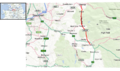 A624 map.png 1,655 × 979; 1.14 MB
-
 A624 Moorfield Junction at Gnat Hole - geograph.org.uk - 1479830.jpg 640 × 480; 56 KB
-
 A624 road, Chunal - 252335.jpg 640 × 480; 49 KB
-
 A624 Roundabout, Chapel-en-le-Frith - geograph.org.uk - 3167880.jpg 640 × 480; 453 KB
-
 A624 through Hayfield - geograph.org.uk - 3208201.jpg 1,024 × 769; 204 KB
-
 A624 under railway bridge - Geograph - 2490436.jpg 3,648 × 2,736; 4.83 MB
-
 A624, Chapel Milton - geograph.org.uk - 2982953.jpg 640 × 480; 145 KB
-
 Alliterative Chapel shop - geograph.org.uk - 2223846.jpg 1,600 × 1,141; 296 KB
-

-
 Approaching The Heys on the A624 - geograph.org.uk - 2509612.jpg 4,000 × 2,048; 2.53 MB
-
 Carr Meadow - geograph.org.uk - 4331772.jpg 1,800 × 1,350; 491 KB
-
 Carr Meadow Cottages - geograph.org.uk - 4329699.jpg 1,800 × 1,350; 580 KB
-
 Carr Meadow Cottages.jpg 4,000 × 3,000; 4.7 MB
-
 Cheshire 2 - Coppermine - 292.jpg 402 × 599; 75 KB
-
 Cottages on the A624 out of Chapel-en-le-Frith - geograph.org.uk - 3118113.jpg 4,429 × 2,658; 2.49 MB
-
 Eating and drinking in Glossop - geograph.org.uk - 5270260.jpg 1,000 × 637; 459 KB
-
 Glossop Road (A624) - geograph.org.uk - 1950005.jpg 640 × 480; 65 KB
-
 Glossop Town Centre - geograph.org.uk - 1479840.jpg 640 × 480; 63 KB
-

-
 Hayfield across the A624 - geograph.org.uk - 2298538.jpg 3,872 × 2,592; 3.41 MB
-
 Hayfield Road at Greenacre Farm - geograph.org.uk - 2509599.jpg 3,934 × 2,334; 3.03 MB
-
 Hayfield Village (geograph 2420013).jpg 640 × 392; 156 KB
-
 Junction of Monk's Road and A624 - geograph.org.uk - 2981640.jpg 640 × 478; 97 KB
-
 Lantern Pike - geograph.org.uk - 4501421.jpg 4,601 × 2,538; 1.75 MB
-
 Little Hayfield 0525.jpg 2,592 × 1,944; 1.21 MB
-
 Monk's Road - Looking SSE - geograph.org.uk - 22268.jpg 640 × 480; 101 KB
-
 Park Hall Entrance - geograph.org.uk - 40282.jpg 640 × 480; 223 KB
-

-
 River Sett 157385 73847fc6.jpg 640 × 480; 185 KB
-

-
 Street art under the A624 - geograph.org.uk - 3428832.jpg 640 × 427; 98 KB
-
 The A624 Glossop Road - geograph.org.uk - 3665285.jpg 2,175 × 1,645; 894 KB
-
 The A624 Hayfield Road - geograph.org.uk - 2975765.jpg 3,296 × 2,472; 1.07 MB
-

-
 The O' Sole' Mio, Charlestown - geograph.org.uk - 3270245.jpg 800 × 600; 121 KB
-

-
 The town of Glossop. - geograph.org.uk - 5827185.jpg 1,024 × 683; 189 KB
-
 UK road A624.PNG 597 × 184; 9 KB
-
 Victoria Street - geograph.org.uk - 263318.jpg 640 × 378; 38 KB
-
 Victoria Street, Glossop - geograph.org.uk - 1755100.jpg 640 × 458; 96 KB
-
 View across Valley from Chinley Head - geograph.org.uk - 340961.jpg 640 × 480; 63 KB
-
 A624 Chinley Head - geograph.org.uk - 26847.jpg 640 × 480; 106 KB


_-_geograph.org.uk_-_1950005.jpg)


.jpg)


