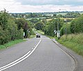
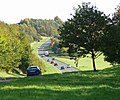
Category:A606 road (England)
Jump to navigation
Jump to search
road in England | |||||
| Upload media | |||||
| Instance of | |||||
|---|---|---|---|---|---|
| Location |
| ||||
| Transport network |
| ||||
 | |||||
Main Wikipedia article: A606 road.
Subcategories
This category has the following 3 subcategories, out of 3 total.
Media in category "A606 road (England)"
The following 70 files are in this category, out of 70 total.
-
A606 at Tollerton - geograph.org.uk - 1614764.jpg 640 × 479; 115 KB
-
A606 Melton Road in Upper Broughton - geograph.org.uk - 908329.jpg 640 × 413; 81 KB
-
A606 Melton Road near Upper Broughton - geograph.org.uk - 908313.jpg 640 × 552; 95 KB
-
A606 Melton to Oakham road - geograph.org.uk - 149047.jpg 640 × 420; 66 KB
-
A606 near Langham - geograph.org.uk - 149022.jpg 640 × 427; 130 KB
-
A606 near Oakham - geograph.org.uk - 1003520.jpg 480 × 640; 91 KB
-
A606 Oakham Road - geograph.org.uk - 772926.jpg 640 × 420; 49 KB
-
A606 towards Burton Lazars - geograph.org.uk - 149185.jpg 640 × 480; 96 KB
-
A606 towards Melton - geograph.org.uk - 149074.jpg 640 × 352; 46 KB
-
A606-Whissendine Road Junction - geograph.org.uk - 149121.jpg 640 × 369; 40 KB
-
Andy's Tyres - geograph.org.uk - 1276794.jpg 640 × 421; 152 KB
-
Approaching Broughton Hill - geograph.org.uk - 908368.jpg 542 × 640; 74 KB
-
Asfordby Road - geograph.org.uk - 1280143.jpg 640 × 440; 163 KB
-
Bridge Over A46(T) - geograph.org.uk - 102589.jpg 640 × 482; 43 KB
-
Burton Street - geograph.org.uk - 1277054.jpg 640 × 427; 148 KB
-
Burton Street - geograph.org.uk - 1284359.jpg 640 × 447; 178 KB
-
Burton Street Railway Bridge - geograph.org.uk - 1465961.jpg 640 × 480; 66 KB
-
Bus to Oakham - geograph.org.uk - 778947.jpg 640 × 353; 51 KB
-
Descending Broughton Hill - geograph.org.uk - 908369.jpg 640 × 397; 77 KB
-
Harboro Hotel - geograph.org.uk - 1273678.jpg 640 × 426; 68 KB
-
Harboro Hotel - geograph.org.uk - 1280034.jpg 640 × 479; 97 KB
-
Melton Mowbray Burton Street.JPG 3,768 × 2,464; 3.34 MB
-
Melton Mowbray Fire Station - geograph.org.uk - 418389.jpg 640 × 427; 188 KB
-
Melton Mowbray Harboro Hotel.JPG 3,596 × 2,356; 2.87 MB
-
Melton Road descends Leesthorpe Hill - geograph.org.uk - 774222.jpg 640 × 438; 59 KB
-
Mill House in Nether Broughton - geograph.org.uk - 908350.jpg 509 × 640; 115 KB
-
Noel's Arms - geograph.org.uk - 1273697.jpg 426 × 640; 60 KB
-
Road junction in Upper Broughton - geograph.org.uk - 908309.jpg 640 × 360; 62 KB
-
Small green in Upper Broughton - geograph.org.uk - 908324.jpg 640 × 403; 102 KB
-
St James Church in Burton Lazars - geograph.org.uk - 779516.jpg 640 × 520; 91 KB
-
Station Road, Widmerpool - geograph.org.uk - 1614772.jpg 640 × 479; 162 KB
-
The A606 and the Hereward Way - geograph.org.uk - 1003546.jpg 640 × 610; 99 KB
-
The Crown Inn, Melton Mowbray.jpg 4,000 × 3,000; 3.14 MB
-
The Danish Invader - geograph.org.uk - 213972.jpg 640 × 427; 46 KB
-
The Harboro Hotel, Melton Mowbray. - geograph.org.uk - 398609.jpg 640 × 424; 144 KB
-
The Sugar Loaf, Ab Kettleby - geograph.org.uk - 909439.jpg 640 × 422; 76 KB
-
The top of Burton Street - geograph.org.uk - 1280376.jpg 479 × 640; 131 KB
-
The White Horse, Empingham - geograph.org.uk - 456705.jpg 640 × 477; 75 KB
-
The White Horse, Empingham, Rutland - geograph.org.uk - 161608.jpg 640 × 427; 109 KB
-
UK road A606.PNG 568 × 184; 8 KB
-
The Noel - geograph.org.uk - 376116.jpg 640 × 480; 123 KB
-
A606 Melton Road - geograph.org.uk - 774221.jpg 640 × 398; 44 KB
-
A606 Melton Road in Burton Lazars - geograph.org.uk - 779591.jpg 640 × 496; 92 KB
-
A606 north of Rutland Water - geograph.org.uk - 1003604.jpg 640 × 535; 111 KB
-
A606 Oakham Road - geograph.org.uk - 772985.jpg 640 × 461; 65 KB
-
A606 Oakham Road - geograph.org.uk - 773000.jpg 640 × 392; 67 KB
-
A606 Oakham Road enters Rutland - geograph.org.uk - 772987.jpg 640 × 417; 81 KB
-
A606, Nottingham to Melton Mowbray road - geograph.org.uk - 185849.jpg 640 × 427; 117 KB
-
Burton Bridge - geograph.org.uk - 778948.jpg 640 × 480; 115 KB
-
Old Melton Road - geograph.org.uk - 668512.jpg 640 × 427; 117 KB
-
Potter Hill near Melton Mowbray - geograph.org.uk - 142752.jpg 640 × 427; 100 KB
-
Stygate Lane junction with the A606 - geograph.org.uk - 147140.jpg 640 × 427; 130 KB
-
The Red House at Nether Broughton - geograph.org.uk - 159793.jpg 640 × 427; 129 KB


