Category:A449 road (Great Britain)
Jump to navigation
Jump to search
Cymraeg: Priffordd yn ne Cymru a gorllewin canolbarth Lloegr yw'r A449. Mae'n cysylltu Casnewydd a Stafford yn Swydd Stafford. (→A449)
English: The A449 is a major road in the United Kingdom. It runs north from junction 24 of the M4 motorway at Newport in South Wales to Stafford in Staffordshire. (→A449 road)

road in England and Wales   | |||||
| Upload media | |||||
| Instance of | |||||
|---|---|---|---|---|---|
| Location | Staffordshire, West Midlands, England | ||||
| Transport network |
| ||||
| Length |
| ||||
 | |||||
Subcategories
This category has the following 8 subcategories, out of 8 total.
- A449 road, Penkridge (13 F)
- A449 road, Wolverhampton (12 F)
- A449 road, Wombourne (35 F)
D
G
W
- A449 road in Wales (14 F)
Media in category "A449 road (Great Britain)"
The following 77 files are in this category, out of 77 total.
-
 A449 - Four Ashes traffic lights - geograph.org.uk - 2056744.jpg 640 × 480; 52 KB
-
 A449 at the bottom of Chance's Pitch - geograph.org.uk - 895360.jpg 640 × 343; 65 KB
-
 A449 at the Travellers Rest - geograph.org.uk - 1527488.jpg 640 × 480; 89 KB
-
 A449 Bridge - geograph.org.uk - 1349721.jpg 640 × 455; 105 KB
-
 A449 bridge of canal - geograph.org.uk - 1709801.jpg 640 × 426; 74 KB
-
-
-
 A449 north of Prestwood, Staffordshire - geograph.org.uk - 984588.jpg 640 × 480; 129 KB
-

-
 A449 Ross Spur 1 - geograph.org.uk - 1706366.jpg 640 × 480; 209 KB
-
 A449 Ross Spur 2 - geograph.org.uk - 1706374.jpg 640 × 480; 185 KB
-
 A449 Ross Spur 3 - geograph.org.uk - 1706381.jpg 640 × 480; 170 KB
-
 A449 Ross Spur 4 - geograph.org.uk - 1706383.jpg 640 × 480; 169 KB
-
 A449 to Ledbury - geograph.org.uk - 659667.jpg 640 × 437; 103 KB
-

-

-
 Car wash and valeting business - geograph.org.uk - 1073268.jpg 640 × 456; 94 KB
-
 Hereford and Worcester.jpg 1,172 × 795; 187 KB
-
 Comfort stop at British Camp - geograph.org.uk - 649479.jpg 640 × 480; 200 KB
-
 Droitwich Barge Canal tunnel under A449 - geograph.org.uk - 1589822.jpg 640 × 481; 116 KB
-
 Farmland north of Ross - geograph.org.uk - 1529539.jpg 640 × 480; 113 KB
-
 Farmland north of Ross - geograph.org.uk - 1529544.jpg 640 × 480; 102 KB
-
 Gatsford crossroads - geograph.org.uk - 991103.jpg 640 × 480; 74 KB
-
 Limited services - geograph.org.uk - 1073276.jpg 640 × 395; 103 KB
-
 Malvern Hills Hotel, British Camp - geograph.org.uk - 2542208.jpg 1,280 × 855; 181 KB
-
 Milestone on Malvern Common - geograph.org.uk - 392824.jpg 468 × 640; 311 KB
-
 Much Marcle Garage - geograph.org.uk - 1123137.jpg 640 × 480; 58 KB
-
 Much Marcle Stores - geograph.org.uk - 1217045.jpg 640 × 424; 50 KB
-
 New Wood and the A449 - geograph.org.uk - 359892.jpg 640 × 480; 57 KB
-
 Old Gore geograph-3386956-by-Ben-Brooksbank.jpg 773 × 409; 423 KB
-

-
 Old Milepost by the A449, Coldborough Park (geograph 6049050).jpg 1,145 × 1,685; 433 KB
-
 Old Milepost, A449, Whittington, Parish of Kinver (geograph 6845239).jpg 3,024 × 4,032; 3.68 MB
-

-
 Old Milestone by the A449, south of railway bridge, Himley parish (geograph 6055919).jpg 1,497 × 1,704; 487 KB
-
 Old Wharf Roundabout, Ledbury - geograph.org.uk - 1755699.jpg 640 × 426; 63 KB
-
 Pedestrian warning on the A449 - geograph.org.uk - 1135982.jpg 640 × 427; 281 KB
-
 Preston Cross roundabout - geograph.org.uk - 1217102.jpg 640 × 424; 73 KB
-
 Preston Cross roundabout - geograph.org.uk - 519375.jpg 640 × 388; 301 KB
-
 Rejoining the dual carriageway - geograph.org.uk - 1073271.jpg 640 × 480; 75 KB
-
 Road junction near "Posterity" - geograph.org.uk - 1294479.jpg 640 × 480; 106 KB
-
 Ross Spur road sign - geograph.org.uk - 965070.jpg 640 × 380; 48 KB
-
-
 The A449 at Dunston in Staffordshire - geograph.org.uk - 1435273.jpg 640 × 480; 64 KB
-

-
 The Four Ashes - geograph.org.uk - 424737.jpg 640 × 480; 108 KB
-

-

-

-
 The Royal Oak Inn near Much Marcle - geograph.org.uk - 1010899.jpg 640 × 426; 61 KB
-
 UK road A449.PNG 568 × 184; 9 KB
-
 Underpass under the A449 - geograph.org.uk - 360160.jpg 640 × 439; 83 KB
-
 Wells Road, Lower Wyche - geograph.org.uk - 1005594.jpg 640 × 426; 84 KB
-
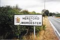
 Worcester, Hereford Border - geograph.org.uk - 711523.jpg 640 × 426; 65 KB
-
 Wyche Road meets Wells Road - geograph.org.uk - 1336923.jpg 640 × 448; 130 KB
-
 A449 crosses B4224 north of Crow Hill - geograph.org.uk - 459334.jpg 640 × 470; 360 KB
-
 A449 heading for Ross-on-Wye - geograph.org.uk - 658986.jpg 640 × 480; 113 KB
-
 A449 on its way to Ledbury - geograph.org.uk - 658976.jpg 640 × 475; 162 KB
-
 A449 passes through mixed woodland - geograph.org.uk - 636471.jpg 640 × 480; 226 KB
-
 A449 Ross-on-Wye to Ledbury - geograph.org.uk - 451578.jpg 640 × 510; 431 KB
-

-
 Box Borders near Ledbury - geograph.org.uk - 70107.jpg 640 × 426; 134 KB
-

-
 Cottages by the A449 - geograph.org.uk - 658979.jpg 640 × 480; 113 KB
-

-
 Dunhampton - geograph.org.uk - 222727.jpg 639 × 464; 38 KB
-
 Hereford-Worcester Border - geograph.org.uk - 711531.jpg 640 × 424; 94 KB
-
 Junction on the A449 at Much Marcle - geograph.org.uk - 511200.jpg 640 × 449; 313 KB
-

-
 Refreshments at Wynds Point - geograph.org.uk - 705413.jpg 640 × 427; 302 KB
-
 Road junction at Preston Cross - geograph.org.uk - 70048.jpg 640 × 426; 103 KB
-

-
 The Cookley Arms - geograph.org.uk - 384224.jpg 640 × 426; 97 KB
-

-
 The unusual shaped garage at Much Marcle - geograph.org.uk - 418411.jpg 640 × 424; 188 KB
-
 The Wellington, Chances Pitch - geograph.org.uk - 6057.jpg 640 × 479; 97 KB
-
 Wells Road - Wyche Road Junction - geograph.org.uk - 299182.jpg 640 × 427; 288 KB


.jpg)
.jpg)
.jpg)
.jpg)
.jpg)


