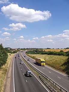
Category:A42 road (England)
Jump to navigation
Jump to search
major trunk road in the East Midlands region of the United Kingdom | |||||
| Upload media | |||||
| Instance of | |||||
|---|---|---|---|---|---|
| Location | Leicestershire, East Midlands, England | ||||
| Transport network |
| ||||
| Length |
| ||||
 | |||||
Media in category "A42 road (England)"
The following 21 files are in this category, out of 21 total.
-
A42 bridge over minor road - geograph.org.uk - 105715.jpg 640 × 480; 101 KB
-
A42 eastbound - geograph.org.uk - 1526779.jpg 640 × 480; 94 KB
-
A42 near Nook Farm - geograph.org.uk - 1524734.jpg 640 × 480; 129 KB
-
A42 on a wet Saturday afternoon - geograph.org.uk - 105694.jpg 640 × 480; 86 KB
-
A42 westbound - geograph.org.uk - 1526782.jpg 640 × 480; 108 KB
-
A42NWLeics.jpg 510 × 680; 328 KB
-
Emergency phone 6819A - geograph.org.uk - 960487.jpg 640 × 339; 46 KB
-
On the A42 - geograph.org.uk - 1888065.jpg 640 × 480; 43 KB
-
South west along the A42 - geograph.org.uk - 797755.jpg 640 × 438; 61 KB
-
The A42 crossing the River Mease - geograph.org.uk - 745181.jpg 640 × 450; 97 KB
-
The A42 near Diseworth - geograph.org.uk - 1343013.jpg 640 × 480; 71 KB
-
The A42 south - geograph.org.uk - 810919.jpg 640 × 367; 54 KB
-
The A42 towards junction 11 - geograph.org.uk - 745185.jpg 640 × 399; 66 KB
-
UK road A42.PNG 568 × 184; 6 KB
-
UK road A42.svg 387 × 191; 2 KB
-
A42 Junction 12 - geograph.org.uk - 1500810.jpg 640 × 480; 63 KB
-
A42 south of Ashby - geograph.org.uk - 1504140.jpg 640 × 469; 89 KB
-
Footpath and road side by side - geograph.org.uk - 387808.jpg 640 × 480; 82 KB
-
Long Mere Lane - geograph.org.uk - 294046.jpg 640 × 480; 226 KB
-
The A42 at junction 23a of the M1 - geograph.org.uk - 559081.jpg 640 × 475; 97 KB


