Category:A30 road in Hampshire
Jump to navigation
Jump to search
Subcategories
This category has the following 3 subcategories, out of 3 total.
Media in category "A30 road in Hampshire"
The following 67 files are in this category, out of 67 total.
-
 50 mph on the A30 - geograph.org.uk - 1691514.jpg 640 × 417; 73 KB
-
 A spot of colour - geograph.org.uk - 1650201.jpg 640 × 444; 50 KB
-
 A30 approaching Basingstoke - geograph.org.uk - 1691512.jpg 640 × 437; 55 KB
-
 A30 by Dummer Garden Centre - geograph.org.uk - 1691507.jpg 640 × 480; 115 KB
-
 A30 by Oakdown Farm - geograph.org.uk - 3210193.jpg 640 × 480; 64 KB
-
 A30 heading west. - geograph.org.uk - 636008.jpg 640 × 480; 104 KB
-
 A30 meets Huish Lane - geograph.org.uk - 1739999.jpg 640 × 480; 75 KB
-
 A30 meets the A323 from the left - geograph.org.uk - 622363.jpg 640 × 480; 89 KB
-
 A30 meets the A323 from the right - geograph.org.uk - 622357.jpg 640 × 480; 81 KB
-
 A30 passing Leckford Hutt pub - geograph.org.uk - 822094.jpg 640 × 427; 100 KB
-
 A30 passing through Hatch - geograph.org.uk - 1739995.jpg 640 × 480; 87 KB
-
 A30 road north-west of Woolbury - geograph.org.uk - 1243450.jpg 640 × 480; 114 KB
-
 A30 to Old Basing - geograph.org.uk - 1182314.jpg 640 × 439; 53 KB
-
 An empty A30 - geograph.org.uk - 1519007.jpg 640 × 480; 73 KB
-
 An empty A30 - geograph.org.uk - 1650196.jpg 640 × 438; 47 KB
-
 Approach to Hook from the west along the A30 London Road - geograph.org.uk - 1745557.jpg 2,848 × 2,144; 2.04 MB
-
 Crossing the A30 - geograph.org.uk - 1519015.jpg 640 × 480; 63 KB
-
 Crossroads on old A30 - geograph.org.uk - 153073.jpg 640 × 512; 295 KB
-
 Crossroads on the A30 - geograph.org.uk - 120648.jpg 640 × 480; 271 KB
-
 Hampshire - Flickr - HerryLawford.jpg 3,757 × 3,240; 4.16 MB
-
 Hartley Wintney - geograph.org.uk - 307.jpg 640 × 427; 42 KB
-
 Hill Farm Garage - geograph.org.uk - 61250.jpg 640 × 480; 101 KB
-
 Junction of A272, A30 and B3420 - geograph.org.uk - 822997.jpg 640 × 427; 102 KB
-
 Kempshott Roundabout, Basingstoke - geograph.org.uk - 125078.jpg 640 × 480; 317 KB
-
 No entry - A30 - geograph.org.uk - 1519010.jpg 640 × 480; 69 KB
-

-
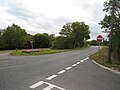
 Old Milestone by the A30 in Hook (geograph 6102908).jpg 473 × 640; 80 KB
-
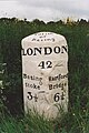
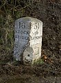
 Old Milestone by the A30, Chilbolton Down (geograph 6060959).jpg 473 × 640; 102 KB
-
 Old Milestone by the A30, Ganderdown Copse (geograph 6037108).jpg 436 × 640; 386 KB
-

-

-

-
-

-

-

-
-

-

-

-
-

-
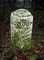
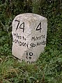 Old Milestone by the A30, west of London Cottage (geograph 6102489).jpg 473 × 640; 101 KB
-

-

-

-
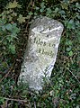
 Old Milestone, former A30, Wonston Parish (geograph 6038096).jpg 473 × 640; 98 KB
-
 Phoenix Green - geograph.org.uk - 859.jpg 640 × 427; 34 KB
-
 Ringway South - geograph.org.uk - 609582.jpg 640 × 480; 97 KB
-
 Ringway South - geograph.org.uk - 634501.jpg 640 × 480; 53 KB
-
 Road sign in Hook - geograph.org.uk - 1745686.jpg 2,144 × 2,848; 1.51 MB
-
 Stockbridge - Carbery House - geograph.org.uk - 1027000.jpg 640 × 480; 83 KB
-
 Stockbridge - geograph.org.uk - 32639.jpg 640 × 480; 82 KB
-
 Stockbridge - High Street - geograph.org.uk - 99050.jpg 640 × 480; 52 KB
-
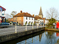 Stockbridge - River Test - geograph.org.uk - 779840.jpg 640 × 480; 101 KB
-
 The A30 at Nine Mile Water Farm - geograph.org.uk - 151954.jpg 640 × 480; 338 KB
-
 The A30 near Phoenix Green - geograph.org.uk - 140429.jpg 640 × 480; 98 KB
-
 The A30, Chilbolton - geograph.org.uk - 457241.jpg 640 × 480; 154 KB
-
 The A30, Hook - geograph.org.uk - 956193.jpg 480 × 640; 114 KB
-
 The A30, Nately Scures - geograph.org.uk - 146098.jpg 640 × 480; 140 KB
-
-
 The Leckford Hutt and the A30 - geograph.org.uk - 120641.jpg 640 × 480; 267 KB
-
 The Red Lion, Water End - geograph.org.uk - 147156.jpg 640 × 480; 103 KB
-
 The Sun Inn on A30 - geograph.org.uk - 384009.jpg 640 × 477; 76 KB
-
 Traffic information - Winchester Road - geograph.org.uk - 702558.jpg 640 × 456; 64 KB
-
 White Lion, Hartfordbridge - geograph.org.uk - 1195340.jpg 640 × 426; 159 KB
-
 White Lion, Hartfordbridge - geograph.org.uk - 1195346.jpg 640 × 426; 163 KB


.jpg)
.jpg)
.jpg)
.jpg)
.jpg)
.jpg)
.jpg)
.jpg)
.jpg)
.jpg)
.jpg)
.jpg)
.jpg)
.jpg)
.jpg)
.jpg)
.jpg)
.jpg)
.jpg)
.jpg)
.jpg)
.jpg)


_RMG_PW4934.jpg)


