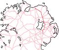
Category:A26 road (Northern Ireland)
Jump to navigation
Jump to search
road in Northern Ireland | |||||
| Upload media | |||||
| Instance of | |||||
|---|---|---|---|---|---|
| Location | Northern Ireland | ||||
| Length |
| ||||
 | |||||
Media in category "A26 road (Northern Ireland)"
The following 13 files are in this category, out of 13 total.
-
A26 Lisnevenagh Road at Tavanaghmore - geograph.org.uk - 1636684.jpg 640 × 480; 94 KB
-
A26 road (Ireland).jpg 1,048 × 880; 123 KB
-
A26 Road near Carnbeg - geograph.org.uk - 866995.jpg 640 × 479; 69 KB
-
Dwellings off A26 - geograph.org.uk - 929775.jpg 640 × 480; 68 KB
-
Petrol filling station - geograph.org.uk - 721385.jpg 640 × 360; 38 KB
-
Railway Bridge - geograph.org.uk - 555429.jpg 640 × 379; 73 KB
-
Route confirmatory sign, Ballinderry - geograph.org.uk - 2584121.jpg 640 × 383; 93 KB
-
The A26 at Ballymuckvea - geograph.org.uk - 1636909.jpg 640 × 480; 109 KB
-
The Antrim-Ballymena road - geograph.org.uk - 290729.jpg 640 × 426; 86 KB
-
A26 at Mullaghgarley - geograph.org.uk - 673752.jpg 640 × 479; 36 KB
-
A26, Moira Road - geograph.org.uk - 1515551.jpg 640 × 479; 64 KB
-
Crossroads - geograph.org.uk - 118860.jpg 640 × 480; 95 KB
-
The Antrim - Ballymena road (2) - geograph.org.uk - 596246.jpg 640 × 372; 52 KB


