Category:A112 road (England)
Jump to navigation
Jump to search
road starting in the Epping Forest District _Chingford_-_geograph.org.uk_-_2638823.jpg)  | |||||
| Upload media | |||||
| Instance of | |||||
|---|---|---|---|---|---|
| Location |
| ||||
| Transport network |
| ||||
| Connects with | |||||
 | |||||
English: The A112 is a road starting in the Epping Forest District in the county of Essex. It runs through North East and East London to North Woolwich in the London Borough of Newham. (→A112 road (Great Britain))
Subcategories
This category has the following 4 subcategories, out of 4 total.
A
G
H
L
Media in category "A112 road (England)"
The following 76 files are in this category, out of 76 total.
-
 Flower planter on fence, Chingford Mount Road, London Borough of Waltham Forest, England.jpg 4,000 × 3,200; 7.77 MB
-
 A112 Chingford Mount Road, London Borough of Waltham Forest, England.jpg 4,000 × 3,000; 8.3 MB
-
 Bicycle rack, Chingford Mount Road, Waltham Forest, England.jpg 4,000 × 3,200; 8.75 MB
-
 Dappled sunlight, Chingford Mount Road, Waltham Forest, England.jpg 4,000 × 3,000; 9.22 MB
-
 Building construction, Chingford Mount Road, Waltham Forest, England.jpg 4,000 × 3,000; 6.4 MB
-
 A112 - geograph.org.uk - 3283023.jpg 640 × 510; 115 KB
-
 A112 - geograph.org.uk - 5827300.jpg 1,024 × 681; 161 KB
-
 A112 - geograph.org.uk - 5827308.jpg 1,024 × 681; 136 KB
-
 A112 - geograph.org.uk - 5939472.jpg 1,024 × 681; 180 KB
-
 A112 - geograph.org.uk - 5939545.jpg 1,024 × 681; 154 KB
-
 A112 - geograph.org.uk - 5939565.jpg 1,024 × 681; 225 KB
-
 A112, High Rd - geograph.org.uk - 5818704.jpg 1,024 × 681; 176 KB
-
 A112, High Rd - geograph.org.uk - 5822946.jpg 1,024 × 681; 132 KB
-
 A112, Leyton - geograph.org.uk - 5822758.jpg 1,024 × 681; 230 KB
-
 A112, Walthamstow - geograph.org.uk - 5939550.jpg 1,024 × 681; 153 KB
-
 Au Morandarte Flickr IMG 6001 (15178083081).jpg 3,888 × 2,592; 3.43 MB
-
 Chingford Mount (Old Church Road) Chingford - geograph.org.uk - 2638823.jpg 1,600 × 1,200; 433 KB
-
 Chingford Mount Cemetery - Old Church Road London E4 6ST.jpg 2,000 × 1,500; 1.28 MB
-
 Chingford Road (A112) Walthamstow - geograph.org.uk - 2638825.jpg 1,600 × 1,200; 464 KB
-
 DLR Viaduct, Gallions Reach - geograph.org.uk - 222773.jpg 640 × 447; 30 KB
-
 Essex County.jpg 1,177 × 796; 151 KB
-
 High Road Leyton at night in December 2012.jpg 3,872 × 2,592; 2.63 MB
-
 High Street, Plaistow, London E13 - geograph.org.uk - 1471308.jpg 640 × 480; 78 KB
-
 Hoe St, A112 - geograph.org.uk - 5939463.jpg 1,024 × 681; 164 KB
-
 Hoe St, A112 - geograph.org.uk - 5939490.jpg 1,024 × 681; 202 KB
-
 Hoe Street - geograph.org.uk - 2232786.jpg 1,600 × 1,094; 615 KB
-

-
 Leyton High Road - geograph.org.uk - 18531.jpg 640 × 480; 94 KB
-
 Leyton High Road - geograph.org.uk - 18532.jpg 640 × 480; 99 KB
-
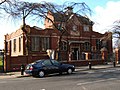
 Leyton Library - Leyton Municipal Offices High Road London E10 5PS.jpg 2,000 × 1,500; 813 KB
-
 London Walthamstow geograph-3065624-by-Ben-Brooksbank.jpg 2,250 × 1,449; 1.52 MB
-
 London-North Woolwich, Albert Road 38.jpg 2,400 × 1,858; 1.57 MB
-
 London-North Woolwich, Albert Road 39.jpg 2,400 × 1,568; 1.35 MB
-
 Part of Netherhouse Farm - geograph.org.uk - 782237.jpg 640 × 480; 58 KB
-
 Plaistow High St - geograph.org.uk - 61612.jpg 640 × 557; 96 KB
-
 Plaistow Road, West Ham - geograph.org.uk - 5524056.jpg 640 × 480; 61 KB
-

-

-

-

-

-
 Plaistow Station to The Greenway (18) - geograph.org.uk - 3311918.jpg 640 × 480; 103 KB
-
 Plaistow Station to The Greenway (19) - geograph.org.uk - 3311919.jpg 640 × 480; 122 KB
-

-

-

-

-

-

-

-

-
 Plaistow Station to The Greenway (3) - geograph.org.uk - 3311880.jpg 640 × 480; 45 KB
-

-

-

-

-
 Plaistow Station to The Greenway (4) - geograph.org.uk - 3311882.jpg 640 × 480; 50 KB
-
 Plaistow Station to The Greenway (5) - geograph.org.uk - 3311887.jpg 640 × 480; 69 KB
-

-

-

-

-
 Plaistow Station to The Greenway (7) - geograph.org.uk - 3311897.jpg 640 × 480; 50 KB
-
 Plaistow Station to The Greenway (8) - geograph.org.uk - 3311898.jpg 640 × 480; 69 KB
-
 Plaistow Station to The Greenway (9) - geograph.org.uk - 3311899.jpg 640 × 480; 53 KB
-

-
 Railway Tavern, Stratford, E15 (2477066040).jpg 1,280 × 960; 316 KB
-
 Sewardstone - geograph.org.uk - 672808.jpg 640 × 480; 72 KB
-
 Stratford - Tramway Avenue - geograph.org.uk - 679153.jpg 640 × 360; 48 KB
-
 The 'Goose', Walthamstow - geograph.org.uk - 757995.jpg 640 × 427; 60 KB
-
 Traffic, A112 - geograph.org.uk - 5939468.jpg 1,024 × 681; 199 KB
-
 UK road A112.PNG 597 × 184; 6 KB
-
 UK road A112.svg 405 × 190; 4 KB
-
 UK road A112v2.svg 746 × 230; 4 KB
-
 West Ham (WH) bus garage, 26 September 1992.jpg 1,536 × 1,024; 1.07 MB
-
 West Ham Library - geograph.org.uk - 132755.jpg 640 × 480; 90 KB


.jpg)

_Walthamstow_-_geograph.org.uk_-_2638825.jpg)


_-_geograph.org.uk_-_3311901.jpg)
_-_geograph.org.uk_-_3311902.jpg)
_-_geograph.org.uk_-_3311912.jpg)
_-_geograph.org.uk_-_3311914.jpg)
_-_geograph.org.uk_-_3311916.jpg)
_-_geograph.org.uk_-_3311918.jpg)
_-_geograph.org.uk_-_3311919.jpg)
_-_geograph.org.uk_-_3311921.jpg)
_-_geograph.org.uk_-_3311922.jpg)
_-_geograph.org.uk_-_3311924.jpg)
_-_geograph.org.uk_-_3311927.jpg)
_-_geograph.org.uk_-_3311928.jpg)
_-_geograph.org.uk_-_3311929.jpg)
_-_geograph.org.uk_-_3311931.jpg)
_-_geograph.org.uk_-_3311932.jpg)
_-_geograph.org.uk_-_3311880.jpg)
_-_geograph.org.uk_-_3311933.jpg)
_-_geograph.org.uk_-_3311936.jpg)
_-_geograph.org.uk_-_3311937.jpg)
_-_geograph.org.uk_-_3311942.jpg)
_-_geograph.org.uk_-_3311882.jpg)
_-_geograph.org.uk_-_3311887.jpg)
_-_geograph.org.uk_-_3312312.jpg)
_-_geograph.org.uk_-_3312313.jpg)
_-_geograph.org.uk_-_3312316.jpg)
_-_geograph.org.uk_-_3312318.jpg)
_-_geograph.org.uk_-_3311897.jpg)
_-_geograph.org.uk_-_3311898.jpg)
_-_geograph.org.uk_-_3311899.jpg)

.jpg)


_bus_garage,_26_September_1992.jpg)
