Category:Aïn Témouchent
Jump to navigation
Jump to search
municipality of Algeria | |||||
| Upload media | |||||
| Instance of | |||||
|---|---|---|---|---|---|
| Location | Aïn Témouchent District, Aïn Témouchent Provincee, Algeria | ||||
| Inception |
| ||||
| Population |
| ||||
| Area |
| ||||
| Elevation above sea level |
| ||||
| Replaces |
| ||||
 | |||||
Subcategories
This category has the following 3 subcategories, out of 3 total.
Media in category "Aïn Témouchent"
The following 55 files are in this category, out of 55 total.
-
Acte mariage 1894 (Algérie).jpg 1,980 × 1,355; 408 KB
-
Ahmed madaghri hospital ain temouchent algeria.jpg 2,048 × 1,536; 701 KB
-
Ain Temouchent عين تيموشنت - panoramio (1).jpg 3,000 × 1,688; 530 KB
-
Ain Temouchent عين تيموشنت - panoramio (2).jpg 3,000 × 1,688; 765 KB
-
Ain Temouchent عين تيموشنت - panoramio (3).jpg 3,000 × 1,688; 775 KB
-
Ain Temouchent عين تيموشنت - panoramio (4).jpg 3,000 × 1,688; 682 KB
-
Ain Temouchent عين تيموشنت - panoramio (5).jpg 3,000 × 1,688; 985 KB
-
Ain Temouchent عين تيموشنت - panoramio.jpg 3,000 × 1,688; 713 KB
-
Ain Temouchent مسجد عبد الرحمان بن عوف - عين تيموشنت - panoramio.jpg 3,000 × 1,687; 643 KB
-
Ain Temouchent, Algeria - panoramio.jpg 2,592 × 1,944; 2.65 MB
-
Aint (5821952025).jpg 986 × 665; 137 KB
-
Algerie.Ain Temouchent.Eglise.Boulevard National.jpg 1,143 × 732; 111 KB
-
Aïn Temouchent.JPG 3,648 × 2,736; 1.74 MB
-
Aïn Témouchent Coat of Arms (French Algeria).svg 184 × 212; 17 KB
-
Aïn Témouchent église en construction.jpg 967 × 667; 78 KB
-
Aïn Témouchent église en transformation.jpg 1,248 × 1,028; 98 KB
-
Aïn Témouchent.JPG 1,573 × 1,080; 149 KB
-
Boucherie El feth - Ain Temouchent قصابة الفتح - عين تيموشنت - panoramio.jpg 3,000 × 1,687; 734 KB
-
Champ de blé en Algérie panoramique.jpg 4,128 × 2,322; 4.25 MB
-
Champ de blé en Algérie.jpg 4,128 × 2,322; 5.17 MB
-
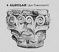
Chapiteau Albulae.JPG 239 × 210; 14 KB
-
Hopital Benzerdjeb - Ain Temouchent مستشفى الدكتور بن زرجب - عين تيموشنت - panoramio.jpg 3,000 × 1,688; 531 KB
-
Inventaire de nationalisation.JPG 2,465 × 3,202; 744 KB
-
Kahf fi ghabat crosse en aun temmouchet.jpg 1,600 × 1,200; 678 KB
-
Madagh ain temouchent.jpg 3,096 × 4,128; 4.23 MB
-
MADAGH BEACH-3-ORAN.JPG 1,280 × 720; 229 KB
-
MADAGH BEACH-ORAN.JPG 1,280 × 720; 206 KB
-
Middle Coat of arms of Aïn-Temouchent.svg 415 × 500; 59 KB
-
MONUMENT BABA AROUDJ AINTEMOUCHENT.jpg 5,035 × 3,765; 990 KB
-
Photo panoramique au milieu d'un champ.jpg 3,232 × 656; 681 KB
-
Photo panoramique en dehors de la ferme.jpg 3,840 × 1,184; 1.82 MB
-
Photo que je l'ai pris à Ain temouchent.jpg 2,448 × 3,264; 2.29 MB
-
Sceau consulat de France.JPG 3,207 × 2,472; 830 KB
-
Sous préfecture.jpg 1,280 × 836; 135 KB
-
Stade Omar Oucief (Aïn Témouchent).jpg 1,100 × 825; 107 KB
-
Statue du monument aux morts d'Aïn Témouchent.jpg 219 × 371; 9 KB
-
Temouchent.gif 304 × 288; 13 KB
-
Un champ de blé et la montagne sidi kassem Ain Temouchent.jpg 4,128 × 2,322; 3.76 MB
-
Un grand fellah algérien -Ain Temouchent-.jpg 4,128 × 2,322; 3.76 MB
-
USSC TEMOUCHENT 1954.jpg 648 × 344; 92 KB
-
بحيرة جميلة.jpg 1,600 × 1,200; 271 KB
-
حديقة عامة بعين تموشنت.jpg 1,600 × 1,200; 611 KB
-
شجرة التفاح بحديقة.jpg 1,600 × 960; 330 KB
-
شجرة عين تموشنت.jpg 1,200 × 1,600; 347 KB
-
شجرة مند ملايين السنين بعين تموشنت.jpg 1,200 × 1,600; 860 KB
-
غابة بمدينة عين تموشنت.jpg 1,600 × 1,200; 350 KB
-
غابة جميلة بمدينة عين تموشنت.jpg 1,600 × 1,200; 729 KB
-
غابة كروس بولاية عين تموشنت.jpg 1,600 × 1,200; 524 KB
-
غابة كروس بولاية46.jpg 1,600 × 1,200; 509 KB
-
غابة كروس.jpg 1,600 × 1,200; 547 KB
-
غروب الشمس بشاطئ بوزجار ولاية عين تموشنت.jpg 400 × 240; 26 KB
-
كهف صغير بغابة كروس بولاية عين تموشنت.jpg 1,600 × 1,200; 660 KB
-
محمية غابة.jpg 1,600 × 1,200; 498 KB
-
منزل بشاطئ بو زجار.jpg 351 × 240; 43 KB
-
نبتة تحمل اسماء زاءريها بغابة كروس.jpg 1,600 × 1,200; 433 KB


