Category:50 km/h speed limit road signs in Luxembourg
Jump to navigation
Jump to search
Media in category "50 km/h speed limit road signs in Luxembourg"
The following 131 files are in this category, out of 131 total.
-
 Aangelsbierg, CR117 O.jpg 3,573 × 2,680; 4.61 MB
-
 Alschent CR 331.jpg 5,995 × 3,988; 10.09 MB
-
 Bech, Altrier (1).jpg 3,879 × 3,879; 4.39 MB
-
 Bech, Hemstal (1).jpg 5,847 × 3,899; 4 MB
-
 Bech, Kobenbour (1).jpg 5,847 × 3,899; 4.35 MB
-
 Belval CR 168.JPG 5,184 × 3,456; 6.2 MB
-
 Biereng, rue de la gare, city-limit-101.jpg 3,589 × 4,396; 8.7 MB
-
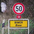 Biwer (1).jpg 3,855 × 3,854; 2.96 MB
-
 Biwer, Brouch (1).jpg 5,335 × 3,576; 4.19 MB
-
 Biwer, Buddelerbaach (1).jpg 4,658 × 3,999; 3.38 MB
-
 Boufer 2017.jpg 2,560 × 1,920; 2.39 MB
-
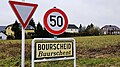 Bourscheid (101).jpg 3,250 × 1,813; 1.49 MB
-
 Bourscheid, Schlindermanderscheid (101).jpg 3,226 × 1,814; 1.19 MB
-
 Buerschent Bourschent.jpg 5,259 × 3,510; 11.99 MB
-
 Bur, Schëld Hinkel.jpg 1,751 × 2,636; 3.56 MB
-
 Chemin de Kréintgeshaff-101.jpg 4,140 × 2,760; 9.57 MB
-
 Chemin de Kréintgeshaff-102.jpg 4,140 × 2,760; 9.61 MB
-
 CR 107 Simmer.jpg 3,814 × 2,861; 8.05 MB
-
 CR321 zu Géisdref vu Boukels-101.jpg 7,360 × 4,912; 22.94 MB
-
 CR321, am Duerf, Boukels-101.jpg 4,384 × 2,923; 8.66 MB
-
 CR331, Nacher-101.jpg 1,300 × 1,592; 1.89 MB
-
 Dippechgare01.jpg 1,270 × 947; 890 KB
-
 Dol 321A-101.jpg 4,383 × 4,383; 11.21 MB
-
 Echternach Border, AUG2016.jpg 6,000 × 4,000; 13.68 MB
-
 Erpeldange, CR351.jpg 3,611 × 2,708; 8.19 MB
-
 Ersange, panneau de localisation N2.jpg 3,648 × 2,736; 2.94 MB
-
 Ersange, panneau de localisation.jpg 3,648 × 2,736; 2.82 MB
-
 Eschdorf, panneau de localisation.jpg 3,812 × 3,812; 2.01 MB
-
 Exit Grandsen, CR339A-101.jpg 7,087 × 4,730; 19.88 MB
-
 Exit Kierchen, CR337.jpg 4,959 × 4,912; 17.03 MB
-
 Exit Konter, CR226-101.jpg 2,575 × 2,575; 7.1 MB
-
 Fëschbech Schëld CR125.jpg 3,163 × 4,739; 10.08 MB
-
 Geyeschhaff 3.jpg 5,312 × 2,988; 1.1 MB
-
 Gondelange (Waldbredimus) (101).jpg 5,120 × 3,840; 5.94 MB
-
 Grandsen, CR339A-101.jpg 3,006 × 4,504; 10.11 MB
-
 Greiweldeng CR145.jpg 3,770 × 2,504; 7.47 MB
-
 Greiweldeng Hëttermillen.jpg 3,684 × 2,599; 6.89 MB
-
 Greiweldeng op Kanech CR145.jpg 3,975 × 2,640; 6.18 MB
-
 Greiweldeng vu Kanech CR145.jpg 4,017 × 2,668; 6.7 MB
-
 Grenze by Niederkasseler - panoramio.jpg 1,024 × 684; 533 KB
-
 Géisdref, CR321, Richtung Süden-101.jpg 3,956 × 5,927; 19.96 MB
-
 Hinkel, panneau de localisation.jpg 3,335 × 2,476; 2.3 MB
-
 Holzthum Luxembourg 01.jpg 3,072 × 2,304; 696 KB
-
 Iernster, Rue du Gruenewald-101.jpg 4,450 × 4,450; 20.27 MB
-
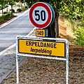 Ierpeldeng CR149-101.jpg 3,635 × 3,635; 10.52 MB
-
 Iwwersienbrëck.JPG 2,693 × 1,938; 534 KB
-
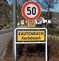 Kautebaach CR331-101.jpg 3,582 × 3,648; 8.76 MB
-
 Keelerstrooss zu Diddeleng-102.jpg 3,664 × 2,748; 8.04 MB
-
 Kockelscheuer CR158.jpg 3,159 × 2,369; 2.35 MB
-
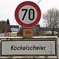 Kockelscheuer CR186.jpg 1,069 × 1,068; 418 KB
-
 Leudelange, Leidelenger Gare (101).jpg 3,827 × 3,827; 2.63 MB
-
 Leudelange-Gare 2013 01.jpg 2,745 × 1,720; 3.35 MB
-
 Luxembourg Beggen, panneau de localisation (1).jpg 5,819 × 3,879; 3.59 MB
-
 Luxembourg road sign C,14 (50 kmh).jpg 3,374 × 3,375; 1.31 MB
-
 Luxembourg road sign C,14 (illuminated).jpg 1,536 × 2,048; 1.09 MB
-
 Luxembourg road sign C,14 - mod. 3e.JPG 3,456 × 2,592; 3.87 MB
-
 Luxembourg road sign E,9a Helfent.jpg 3,202 × 2,446; 1.67 MB
-
 Luxembourg road sign F,14a Mëllerdall.jpg 1,987 × 2,306; 3.19 MB
-
 Luxembourg road sign F,14a.jpg 3,456 × 2,592; 3.88 MB
-
 Luxembourg Steinfort LB frontier.jpg 3,927 × 2,142; 5.94 MB
-
 Miersch, rue de la Gare, City-limit-102.jpg 6,831 × 4,559; 21.33 MB
-
 Millbech (Mutfert).jpg 6,353 × 4,240; 12.42 MB
-
 Moutfort, panneau de localisation.jpg 3,648 × 2,736; 3.56 MB
-
 Méchela.JPG 3,675 × 2,451; 5.34 MB
-
 Müllerthal.JPG 1,600 × 1,200; 642 KB
-
 Neihaischen CR185-001.jpg 5,893 × 4,189; 15.32 MB
-
 Neihaischen CR185.jpg 4,638 × 3,095; 6.84 MB
-
 Niederfeulen (101).jpg 3,170 × 1,783; 1.26 MB
-
 Obenthalt.jpg 2,048 × 1,536; 409 KB
-
 Oberdonven, CR143-101.jpg 4,491 × 4,491; 12 MB
-
 Oberfeulen (101).jpg 3,018 × 1,698; 1.86 MB
-
 Op der Mäs, Siren-101.jpg 5,202 × 3,989; 16.57 MB
-
 Openthalt-101.jpg 6,302 × 4,206; 18.95 MB
-
 Randschelt Schëld 4372.jpg 3,456 × 2,304; 1.36 MB
-
 Remich, panneau de localisation.jpg 3,648 × 2,736; 3.81 MB
-
 Route d'Arlon, Oberfeulen-106.jpg 4,151 × 6,220; 21.34 MB
-
 Rue de Gondelange, Waldbriedemes-101.jpg 6,666 × 4,449; 19.71 MB
-
 Rue de Luxembourg, Contern-102.jpg 2,568 × 1,706; 3.62 MB
-
 Rue St Willibrord (Bech-Kleinmacher)-102.jpg 4,912 × 4,912; 25.27 MB
-
 Réiser CR158-101.jpg 3,280 × 2,460; 3.79 MB
-
 Schengen city limit sign.JPG 2,592 × 1,944; 1.52 MB
-
 Schëld Birelergrond-101.jpg 3,834 × 2,547; 5.46 MB
-
 Schëld Biwer-101.jpg 6,194 × 4,133; 18.53 MB
-
 Schëld Born Bur.jpg 1,826 × 2,748; 3.7 MB
-
 Schëld Bruch.jpg 5,734 × 4,236; 11.58 MB
-
 Schëld Buerschdref.jpg 3,296 × 2,189; 4.87 MB
-
 Schëld Bungeref, CR310-101.jpg 3,521 × 2,339; 7.62 MB
-
 Schëld Bus Richtung Norden.jpg 3,404 × 4,746; 9.99 MB
-
 Schëld Kiirchen, Kierchen, CR337.jpg 3,799 × 4,708; 13.71 MB
-
 Schëld Kréintgeshaff, Sandweiler Bësch-101.jpg 4,674 × 3,116; 11.1 MB
-
 Schëld Méischdref (falsch).jpg 4,383 × 3,289; 4.55 MB
-
 Schëld Méischdref (richteg).jpg 3,565 × 2,675; 2.56 MB
-
 Schëld Méischdref.jpg 2,513 × 3,784; 6.94 MB
-
 Schëld Schwéidsbeng, CR152F Rue du Port.jpg 4,912 × 4,912; 19.58 MB
-
 Schëld Senneng N1.jpg 3,746 × 2,488; 7.11 MB
-
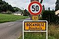
 Schëld Uertschaft Buckels.jpg 3,557 × 2,668; 6 MB
-
 Schëld Éiter, rue de la Gare-101.jpg 3,827 × 2,554; 9.44 MB
-
 Schëld Ëlwen, Rue Massen-101.jpg 4,839 × 3,230; 11.56 MB
-
 Sir Schëld.jpg 1,415 × 1,326; 264 KB
-
 Sortie Diddeleng, Keelerstrooss.jpg 2,468 × 1,851; 3.68 MB
-
 Steesel CR123.jpg 2,432 × 2,992; 4.69 MB
-
 Tandel, Landscheid (101).jpg 3,203 × 1,802; 1.56 MB
-
 Trintange, panneau de localisation.jpg 3,648 × 2,736; 2.66 MB
-
 Uebersyrenbr.JPG 2,528 × 1,879; 570 KB
-
 Uerstschëld Miedernach-101.jpg 6,525 × 4,355; 21.09 MB
-
 Uertschaftsschëld Géidgen, CR336-101.jpg 3,847 × 4,007; 12.27 MB
-
 Uertschaftsschëld Wilwerdang, CR336-101.jpg 5,732 × 4,604; 19.81 MB
-
 Uertschaftsschëld Wilwerdang, CR336-102.jpg 6,242 × 4,166; 21.09 MB
-
 Uertschaftsschëld Wilwerdang, CR336-103.jpg 4,931 × 4,532; 15.4 MB
-
 Uertsschëld Brattert-101.jpg 6,573 × 4,387; 15.39 MB
-
 Uertsschëld Bëschrued-101.jpg 3,289 × 2,728; 7.11 MB
-
 Uertsschëld Gréiweknapp-101.jpg 4,057 × 4,345; 11.95 MB
-
 Uertsschëld Iischpelt, nordost-101.jpg 4,776 × 7,156; 29.08 MB
-
 Uertsschëld Noumer, CR306 - Rue Principale-101.jpg 4,395 × 6,585; 22.41 MB
-
 Uertsschëld Sir an der Rue du pont-101.jpg 2,848 × 2,848; 7.43 MB
-
 Uertsschëld Soller-101.jpg 4,639 × 4,639; 17.23 MB
-
 Uertsschëld Uewerfeelen, CR314-101.jpg 3,811 × 5,710; 17.56 MB
-
 Uertsschëld zu Deewelt-101.jpg 4,912 × 4,912; 20.91 MB
-
 Uertsschëld zu Diänjen-101.jpg 4,866 × 4,866; 18.29 MB
-
 Uertsschëld zu Lenzweiler-101.jpg 4,715 × 4,715; 17.77 MB
-
 Uertsschëld zu Walter-101.jpg 4,912 × 4,912; 18.82 MB
-
 Uewaan12.JPG 2,796 × 1,492; 336 KB
-
 Uewerwampech 0001.jpg 4,276 × 2,300; 6.65 MB
-
 Waalsdref Stroossescheld.jpg 1,500 × 1,665; 617 KB
-
 Waldbriedemes CR148.jpg 5,164 × 4,552; 12.58 MB
-
 Waldbriedemes Exit CR148.jpg 4,867 × 4,649; 13.23 MB
-
 Walferdange, panneau de localisation (2).jpg 5,753 × 3,835; 2.91 MB
-
 Weiler Putscheid.jpg 800 × 506; 129 KB
-
 Weller--Pëtscht--w.jpg 777 × 376; 94 KB
-
 Welsd12.JPG 2,697 × 1,372; 4.49 MB
-
 Wëntreng, CR152 Richtung Süden.jpg 7,360 × 4,912; 24.73 MB


.jpg)
.jpg)
.jpg)


.jpg)
.jpg)
.jpg)

.jpg)
.jpg)


_(101).jpg)


.jpg)

.jpg)
.jpg)
.jpg)


.jpg)


.jpg)


.jpg)


-102.jpg)


.jpg)
.jpg)


.jpg)


.jpg)


