Category:4.50.1 (road sign, Switzerland)
Jump to navigation
Jump to search
Deutsch: Hinweissignal: Wegweiser «Empfohlene Route für Radfahrer»
Français : Signal d’indication : Indicateur de direction « Itinéraire recommandé aux cyclistes »
Media in category "4.50.1 (road sign, Switzerland)"
The following 36 files are in this category, out of 36 total.
-
 CH-Hinweissignal-Wegweiser «Empfohlene Route für Radfahrer».svg 231 × 45; 14 KB
-
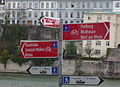
 (Velo)Wegweiser in Schaffhausen.jpg 4,200 × 2,800; 4.47 MB
-
 15-41-26-front.jpg 4,228 × 2,768; 8.41 MB
-
 2012 05 28 ROK P1000119 Hiking and footpath signs Cycling route signs.JPG 4,320 × 2,880; 4.39 MB
-
 Avenue Wendt - panoramio.jpg 956 × 602; 77 KB
-
 Basel Fahrradschilder.JPG 2,048 × 1,536; 618 KB
-
 Basel Rheinufer Fahrrad 0181-dah.jpg 1,585 × 1,155; 387 KB
-
 Bodenseeradwegschildschweiz.jpg 1,584 × 1,069; 499 KB
-
 Boudevillers route de la Jonchère.jpg 3,456 × 2,592; 4.21 MB
-
 Bärenstrasse, Sonnenplatz-Kreisel & Wegweiser in Kreuzlingen (2012).jpg 3,000 × 4,200; 8.82 MB
-
 Capont Brücke über die Landquart, Küblis GR 20190830-jag9889.jpg 4,608 × 3,456; 11.74 MB
-
 Cartello innevato sul San Gottardo - panoramio.jpg 3,872 × 2,592; 2.85 MB
-
 Cours de Rive, Genève - panneaux 2.42 3.02 4.50.1 5.30 5.31.jpg 4,000 × 3,000; 4.93 MB
-
 Fingerpost Getwing (626m) cycling 2022-05-27.jpg 4,032 × 3,024; 9.23 MB
-
 Fingerpost Leuk Bahnhof 2022-05-26.jpg 4,032 × 3,024; 7.1 MB
-
 Fingerpost Ober Getwing (624m) 2022-05-27.jpg 4,032 × 3,024; 9.27 MB
-
 Glatt - Rümlang IMG 6880.jpg 2,448 × 3,264; 2.5 MB
-
 Gletsch Verzweigung Furka Grimsel.jpg 3,000 × 4,000; 4.47 MB
-
 Katzenrüti (Rümlang) 2011-08-28 19-08-20.jpg 4,000 × 2,667; 3.26 MB
-
 Kreuzlingen - Wegweiser für Radfahrer & Skater (2022).jpg 2,800 × 4,200; 6.89 MB
-
 Le Landeron 1415 (8434987823).jpg 2,208 × 1,656; 467 KB
-
 Mandement 159 (8434987405).jpg 2,208 × 1,656; 855 KB
-
 Ortseingang(sschild) Sonterswil TG.jpg 2,400 × 3,600; 5.1 MB
-
 Panneau suisse 4.50.1.jpg 4,000 × 3,000; 4.82 MB
-
 Panneaux suisses 4.50.1.jpg 4,000 × 3,000; 4.82 MB
-
 Radwegweiser Basel Kuntmuseum 20210-dz.jpg 2,404 × 1,684; 1.02 MB
-
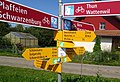
 Ruppen Landmark Abzweigung.jpg 1,579 × 1,160; 348 KB
-
 Rümlang - Letten IMG 6890.JPG 3,264 × 2,448; 5.13 MB
-
 Segnavia a Arbedo, via Orbello angolo viale Moesa.jpg 3,648 × 2,736; 4.5 MB
-
 Suisseavelo panneau.JPG 3,072 × 2,304; 2.19 MB
-
 Under der Burg-Brücke über die Simme, Zweisimmen BE 20220604-jag9889.jpg 4,197 × 3,358; 10.64 MB
-
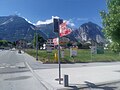
 Velo-Wegweiser im Tägerwiler Wald.jpg 3,600 × 2,400; 6.17 MB
-
 Velo-Wegweiser in Frauenfeld.jpg 2,402 × 3,600; 6.9 MB
-
 Wanderweg Schwarzenburg Rossgrabenbrücke-17.jpg 1,940 × 1,331; 363 KB
-
 Wegweiser in Schaffhausen 20150419-IMG 0185.JPG 1,722 × 2,560; 3.35 MB
-
 Wegweiser nach Kreuzlingen.jpg 4,000 × 3,000; 8.37 MB
Wegweiser_in_Schaffhausen.jpg)


.jpg)


_cycling_2022-05-27.jpg)

_2022-05-27.jpg)


_2011-08-28_19-08-20.jpg)
.jpg)
.jpg)
.jpg)
_Sonterswil_TG.jpg)


