Category:20th-century satirical maps
Jump to navigation
Jump to search
Subcategories
This category has the following 3 subcategories, out of 3 total.
Media in category "20th-century satirical maps"
The following 51 files are in this category, out of 51 total.
-
1904 Haru EiDo Serio-Comic Map of Asia and Europe during the Russo-Japanese War.jpg 6,000 × 4,268; 7.56 MB
-
1904 Kisaburō Ohara Satirical Octopus Map of Asia and Europe.jpg 6,000 × 4,488; 6.63 MB
-
1904 Nomura Samurai Shokai Russo-Japanese War Serio-Comic Map of Asi.jpg 6,447 × 4,695; 7.12 MB
-
Review of reviews and world's work (1890) (14786437503).jpg 2,256 × 3,020; 990 KB
-
Review of reviews and world's work (1890) (14761705076).jpg 2,274 × 1,434; 435 KB
-
Tableau et carte psycho philosophique de l'Europe en 1906.jpg 8,072 × 10,351; 10.7 MB
-
Humoristische Italienkarte - Karikatur - Propagandaplakat.jpg 1,940 × 2,917; 663 KB
-
A humoros war mar of the world. Made in Japan.jpg 1,800 × 1,340; 806 KB
-
European Revue (Kill That Eagle).jpg 9,646 × 6,855; 20.33 MB
-
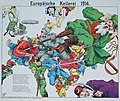
Europäische Keilerei 1914.jpg 4,133 × 3,479; 3.31 MB
-
Europäische Treibjagd.jpg 3,773 × 3,302; 2.75 MB
-
Humoristische Karte von Europa im Jahre 1914.tif 7,936 × 5,562; 126.31 MB
-
Pictorial map of World War I in Russian.jpg 7,308 × 5,505; 14.99 MB
-
The illustration of the Great European War. No. 16.jpg 6,577 × 4,809; 9.82 MB
-
1914 German satirical map of Europe.tif 5,757 × 4,274; 9.97 MB
-
1914 satirical map of Europe in French.jpg 4,092 × 2,694; 2.23 MB
-
Caricature map 1914--1915--1916--1917--??.jpg 5,223 × 3,909; 5.5 MB
-
Карта Поучитсльная Гражданъ Российскихъ 1917.jpg 11,635 × 7,686; 28.04 MB
-
1932 Japanese pictorial map of the world.tif 25,986 × 18,797; 1.36 GB
-
Caricature for Riga Peace 1921.png 1,903 × 1,311; 73 KB
-
Carriers of the New Black Plague.jpg 12,473 × 7,911; 31.04 MB
-
Carte symbolique de l'Europe Guerre libératrice de 1914-1915 - - B. Crétée, 1914. LCCN2016647864.tif 9,248 × 7,712; 204.11 MB
-
European Revue (Kill That Eagle) 1914.jpg 1,817 × 1,264; 341 KB
-
European Revue Kill That Eagle.jpg 5,000 × 3,446; 11.42 MB
-
Humoristische Karte von Europa im Jahre 1914.jpg 6,743 × 4,846; 6.55 MB
-
Il Calamaro o' ’Pesce Diavolo’ Prussiano.jpg 5,000 × 3,438; 10.14 MB
-
Il Calamaro o' ’Pesce Diavolo’ Prussiano.tif 13,377 × 9,198; 352.05 MB
-
John Bull and his friends - a serio-comic map of Europe LOC 2010587002.jpg 8,723 × 6,241; 6.37 MB
-
John Bull and his Friends 1900.jpg 8,439 × 5,943; 15.22 MB
-
L'europa nel 1915, ed. ronchi-varoli, 1915.jpg 2,576 × 1,895; 3.58 MB
-
Momentaufnahme von Europa und Halbasien 1914 - W. Kaspar fec. LCCN2014648402.jpg 8,811 × 6,557; 11.58 MB
-
Momentaufnahme von Europa und Halbasien 1914 - W. Kaspar fec. LCCN2014648402.tif 8,811 × 6,557; 165.29 MB
-
Muzeum Regionalne PTTK w Gorlicach 004.JPG 3,264 × 2,448; 3.85 MB
-
Muzeum Regionalne PTTK w Gorlicach 030.JPG 3,264 × 2,448; 3.5 MB
-
Prussian octopus.jpg 600 × 402; 106 KB
-
Satirical map of Europe, 1914.jpg 1,525 × 1,117; 332 KB
-
Satyrische Europa Karte, Weltkrieg 1914 Zeichnung u. Entwurf, E. Zimmermann.jpg 7,093 × 5,506; 13.04 MB
-
Sommerschau über Europa 1915.jpg 8,455 × 6,639; 20.99 MB
-
South America Under The Axis or The Heil With the Monroe Doctrine.jpg 12,490 × 8,062; 44.12 MB
-
Tableau et carte psycho philosophique de l'Europe en 1906 (cropped).jpg 7,444 × 4,965; 5.08 MB
-
The situation in the Far East by Tse Tsan-tai.jpg 1,245 × 1,794; 505 KB
-
William H. Walker United States of Guggenheimerica 1912 Cornell CUL PJM 1170 01.jpg 7,853 × 4,958; 6.67 MB
-
World around 1900.jpg 2,880 × 2,078; 1.11 MB
-
Übersichtsblatt der Operationskarte 1 zu 800 000 - Karikatur.jpg 1,557 × 1,960; 344 KB
-
时局图.jpg 3,915 × 5,532; 4.27 MB


