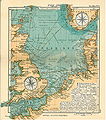
Category:20th-century maps of the North Sea
Jump to navigation
Jump to search
Media in category "20th-century maps of the North Sea"
The following 32 files are in this category, out of 32 total.
-
Nord Ostsee Hafen.jpg 4,563 × 3,956; 6.89 MB
-
North and Baltic Seas, 1911.png 960 × 625; 1.36 MB
-
Admiralty Chart No 1094 Outer Gabbard to Outer Dowsing, Published 1912.jpg 11,097 × 16,208; 55.23 MB
-
Admiralty Chart No 12 Norway to Iceland, Published 1915.jpg 18,420 × 8,753; 10.73 MB
-
The North sea. Close's fishermen's charts of the British isles... - btv1b53169956m.jpg 12,752 × 18,039; 34.06 MB
-
NavWarMap No. 3 - World War 2 in the North Sea Area.jpg 35,225 × 23,739; 285.85 MB
-
Admiralty Chart No 3104 Blyth to Hartlepool, Published 1963.jpg 11,299 × 16,413; 64.81 MB
-
Northern Europe, 1967.jpg 4,047 × 2,880; 2.4 MB
-
Admiralty Chart No 1200 Hartlepool to Flamborough Head, Published 1968.jpg 16,378 × 11,276; 35.11 MB
-
Admiralty Chart No 1191 Flamborough Head to the River Tyne, Published 1953.jpg 16,264 × 11,151; 43.93 MB
-
Admiralty Chart No 122 Mouths of River Maas, Published 1928.jpg 16,265 × 11,124; 40.44 MB
-
Admiralty Chart No 1405 Texel to Helgoland, Published 1961, Large Corrections 1970.jpg 19,232 × 11,167; 17.81 MB
-
Admiralty Chart No 1406 Dover and Calais to Orfordness and Scheveningen, Published 1906.jpg 16,332 × 11,290; 57.9 MB
-
Admiralty Chart No 1408 Harwich to Terschelling and Cromer to Rotterdam, Published 1958.jpg 16,347 × 11,272; 47.22 MB
-
Admiralty Chart No 2176 North Foreland to Duncansby Head, Published 1940.jpg 11,308 × 19,692; 67.02 MB
-
Admiralty Chart No 2181 Texel to Bergen, Published 1940.jpg 11,313 × 20,422; 79.32 MB
-
Admiralty Chart No 2182a North Sea southern sheet, Published 1920.jpg 16,405 × 11,294; 57.33 MB
-
Admiralty Chart No 2182b North Sea Sheet II, Corrections to 1905.jpg 13,940 × 8,331; 36.09 MB
-
Admiralty Chart No 2182d Faeroe Islands to Norway, Published 1918.jpg 22,012 × 11,263; 51.46 MB
-
Admiralty Chart No 3371 Dunkerque to Hook of Holland, Published 1949.jpg 15,956 × 12,472; 41.77 MB
-
Admiralty Chart No 3767 Norder Piep to Vortrapp Tief including Helgoland, Published 1954.jpg 16,260 × 11,103; 40.28 MB
-
Bruno Schulz - Karte der deutschen Bucht.jpg 4,532 × 4,823; 3.27 MB
-
Bruno Schulz - Karte der Nordsee.jpg 4,113 × 3,336; 1.64 MB
-
D445- N° 503. Côte allemande de la Mer du Nord. - Liv4-Ch03.png 1,441 × 1,650; 276 KB
-
Map elbe mouth 1910.jpg 1,500 × 927; 787 KB
-
Nordsee.jpg 4,004 × 4,549; 6.09 MB
-
Submarines, mines and torpedoes in the war (1914) (14576731388).jpg 2,984 × 3,452; 2.08 MB
-
The seafarers (1919) (14781900132).jpg 2,176 × 1,398; 428 KB


