
Category:20th-century maps of Rotterdam
- See also: 16th-century maps - 17th-century maps - 18th-century maps - 19th-century maps - 20th-century maps
Subcategories
This category has only the following subcategory.
2
Media in category "20th-century maps of Rotterdam"
The following 26 files are in this category, out of 26 total.
-

-

-
 Nord Ostsee Hafen.jpg 4,563 × 3,956; 6.89 MB
-

-
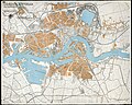 Plattegrond van Rotterdam in 1940 (2).jpg 9,894 × 7,900; 27.04 MB
-

-

-
 Admiralty Chart No 3142 The Maas Hook of Holland to Rotterdam and Dordrecht, Published 1957.jpg 16,197 × 11,090; 19.01 MB
-
 Gemeente Rotterdam en omgeving 1 - 25 000 - btv1b53200584r.jpg 9,574 × 6,555; 10.18 MB
-
 Hoekwater polderkaart - Oud-Mathenesse.PNG 467 × 371; 461 KB
-
 Kaart van Maashaven-Rijnhaven, Rotterdam Havenspoor in blauw - NL-RtSA 4201 1988-902.png 3,105 × 1,659; 10.89 MB
-

-
 Kaart van Rotterdam 1938 - Blad 11 Charlois en Bloemhof. - NL-RtSA 4201 1975-1179-11O.jpg 6,658 × 4,474; 10.94 MB
-
 Kaart van Rotterdam 1943 - Blad 11 Charlois en Bloemhof - NL-RtSA 4201 1975-1179-11Q.jpg 6,574 × 4,414; 11.71 MB
-

-

-
 Old map of Charlois and Bloemhof (1926).jpg 6,634 × 4,414; 10.42 MB
-
 Oud-Nederlandsche steden in haar ontstaan, groei en ontwikkeling (1909) (14742295016).jpg 2,098 × 3,428; 1.12 MB
-

-

-
 Plattegrond van Rotterdam 1900 - NL-RtSA 4201 I-127-3.jpg 10,110 × 6,634; 21.8 MB
-
 Plattegrond van Rotterdam in 1900 (overzichtskaart) door Gemeentewerken.jpg 8,091 × 7,900; 24.73 MB
-
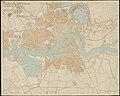 Plattegrond van Rotterdam in 1940.jpg 9,894 × 7,900; 21.2 MB
-
 Rotterdam 1905.jpg 4,481 × 3,661; 5.16 MB
-

-
 TA GEO 011 Geologisch dwarsprofiel Rotterdam-Brielle ±1900.jpg 18,622 × 4,025; 13.26 MB


.jpg)


.jpg)

.jpg)
_(14742295016).jpg)
_(14765300055).jpg)


_door_Gemeentewerken.jpg)


