Category:20th-century maps of Khartoum
Jump to navigation
Jump to search
Media in category "20th-century maps of Khartoum"
The following 10 files are in this category, out of 10 total.
-
1903 map Khartoum by Macmillan.png 330 × 542; 257 KB
-
1905 map Khartoum and Omdurman by Thomas Cook.png 689 × 457; 571 KB
-
Provisional map of Khartoum city.png 8,500 × 9,257; 67.75 MB
-
KhartoumMap FranzXaverGeyer Khartum1907.jpg 2,988 × 1,947; 5.29 MB
-
Khartum & Omdurman.png 4,812 × 3,450; 19.97 MB
-
Khartoum about the time of Gordon.png 2,584 × 4,242; 9.12 MB
-
1914 map Khartum and Omdurman by Baedeker.png 970 × 750; 1.47 MB
-
Egypt and the Sûdân; handbook for travellers (1914) (14784008755).jpg 1,456 × 2,384; 454 KB
-
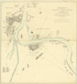
Plan of Khartoum showing Gordon's fortifications.png 6,584 × 4,085; 24.39 MB
-
Plan of Khartoum, 1910 (Town Planner's photograph)(GN01609).jpg 2,604 × 1,952; 1.95 MB


