Category:20th-century maps of Brest
Jump to navigation
Jump to search
Subcategories
This category has only the following subcategory.
Media in category "20th-century maps of Brest"
The following 4 files are in this category, out of 4 total.
-
 Cables sous-marins France, Algérie, Tunisie - btv1b531583161 (07 of 12).jpg 12,720 × 9,196; 14.34 MB
-
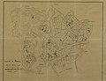 7FI 00192 Ville de Brest CAF.jpg 8,009 × 6,146; 7.36 MB
-
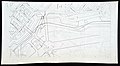 9FI 003 30 Projet de raccordement de la Place de la Liberté à la Place de l'Harteloire.jpg 4,202 × 2,322; 3.21 MB
-
 Defenses of Brest 74003542 001 001.jpg 8,480 × 6,591; 3.88 MB
.jpg)


