Category:2024 Indiana election maps
Jump to navigation
Jump to search
States of the United States: Alabama · Alaska · Arizona · Arkansas · California · Colorado · Connecticut · Delaware · Florida · Georgia · Hawaii · Idaho · Illinois · Indiana · Iowa · Kansas · Kentucky · Louisiana · Maine · Maryland · Massachusetts · Michigan · Minnesota · Mississippi · Missouri · Montana · Nebraska · Nevada · New Hampshire · New Jersey · New Mexico · New York · North Carolina · North Dakota · Ohio · Oklahoma · Oregon · Pennsylvania · Rhode Island · South Carolina · South Dakota · Tennessee · Texas · Utah · Vermont · Virginia · Washington · West Virginia · Wisconsin · Wyoming
Media in category "2024 Indiana election maps"
The following 18 files are in this category, out of 18 total.
-
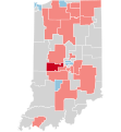
 2024 Indiana Attorney General election results map by county.svg 810 × 810; 35 KB
-

-
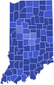
 2024 Indiana gubernatorial election results map by county.svg 810 × 810; 35 KB
-
 2024 Indiana Presidential Election by Congressional District.svg 810 × 810; 32 KB
-
 2024 Indiana Senate elections by district.svg 600 × 650; 827 KB
-

-

-

-

-

-

-
 IN01 2024 US House (Wiki).svg 800 × 767; 614 KB
-
 Indiana County Flips in 2024 U.S Presidential Election.svg 810 × 810; 34 KB
-
 Indiana County Swing in 2024 U.S Presidential Election.svg 810 × 810; 37 KB
-

-
 Indiana Presidential Election Results 2024.svg 810 × 810; 35 KB
-
-
 Indiana State House 2024 Results.svg 1,512 × 1,123; 753 KB


.svg)


