Category:2020s maps of the Americas
Jump to navigation
Jump to search
Subcategories
This category has the following 2 subcategories, out of 2 total.
N
S
Media in category "2020s maps of the Americas"
The following 7 files are in this category, out of 7 total.
-
American cordillera map.png 1,400 × 1,760; 121 KB
-
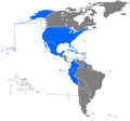
Copa América 2024 map.png 1,914 × 2,463; 85 KB
-
Cuba and the Organization of American States.svg 536 × 536; 435 KB
-
JetBlue.png 677 × 633; 17 KB
-
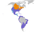
Podilymbus podiceps map.svg 1,248 × 1,155; 562 KB
-
Rubin Observatory Operations (rubin-Sites and Data Flows Map).jpg 3,000 × 1,821; 441 KB
-
Rubin Observatory Operations (rubin-Sites and Data Flows Map).tiff 3,000 × 1,821; 1.53 MB


