Category:2020 in Welwick
Jump to navigation
Jump to search
Media in category "2020 in Welwick"
The following 33 files are in this category, out of 33 total.
-
 Bend in Skeffling Road (B1445), Weeton (geograph 6376387).jpg 5,184 × 3,888; 6.03 MB
-

-
 Crop field off Welwick Road (geograph 6379076).jpg 800 × 600; 92 KB
-
 Drain beside Northfield Lane (geograph 6376307).jpg 800 × 600; 109 KB
-
 Drain beside Welwick Road (B1445) (geograph 6378436).jpg 800 × 600; 99 KB
-
 Elizabeth II postbox and telephone box on Main Street, Welwick (geograph 6376416).jpg 4,408 × 3,355; 3.68 MB
-
 Elizabeth II postbox on Main Street, Welwick (geograph 6376414).jpg 2,056 × 4,033; 1.43 MB
-

-
 Entering Weeton (geograph 6376376).jpg 800 × 600; 84 KB
-
 Entering Weeton (geograph 6378151).jpg 800 × 591; 71 KB
-
 Entering Welwick (geograph 6378158).jpg 800 × 568; 112 KB
-
 Field entrance off the B1445 (geograph 6378153).jpg 800 × 600; 109 KB
-
 Field margin off the B1445 (geograph 6378435).jpg 800 × 600; 118 KB
-
 Gunpowder plot sculpture (geograph 6378434).jpg 800 × 636; 180 KB
-
 House on Main Street, Welwick (geograph 6378428).jpg 800 × 600; 101 KB
-
 House on Main Street, Welwick (geograph 6378430).jpg 640 × 480; 63 KB
-
 House on Skeffling Road, Weeton (geograph 6376427).jpg 5,184 × 3,888; 5.83 MB
-
 K6 telephone box on Main Street, Welwick (geograph 6378163).jpg 480 × 640; 84 KB
-
 Main Street (B1445), Welwick (geograph 6376419).jpg 640 × 403; 51 KB
-
 Main Street (B1445), Welwick (geograph 6376421).jpg 4,341 × 3,190; 3.76 MB
-
 Power lines over crop field (geograph 6376373).jpg 800 × 566; 54 KB
-
 Red House Farm, Weeton (geograph 6376374).jpg 800 × 557; 70 KB
-
 Sign for the Coach & Horses, Welwick (geograph 6378166).jpg 800 × 775; 132 KB
-
 Skeffling Road (B1445), Weeton (geograph 6376429).jpg 640 × 395; 72 KB
-
 Skeffling Road (geograph 6378155).jpg 800 × 600; 133 KB
-
 St Mary's Church, Welwick (geograph 6378167).jpg 800 × 600; 118 KB
-
 St Mary's Church, Welwick (geograph 6378168).jpg 800 × 608; 121 KB
-
 The Coach & Horses, Welwick (geograph 6378165).jpg 800 × 556; 74 KB
-
 Wakefield Lane towards Holmpton (geograph 6376303).jpg 800 × 600; 68 KB
-
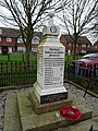
 War Memorial, Welwick (geograph 6378159).jpg 800 × 600; 198 KB
-
 War Memorial, Welwick (geograph 6378161).jpg 600 × 800; 187 KB
-
 Weeton North Lane (geograph 6376370).jpg 800 × 600; 82 KB
-
 Welwick Road (B1445) (geograph 6379077).jpg 800 × 600; 104 KB
,_Weeton_(geograph_6376387).jpg)
.jpg)
.jpg)
.jpg)
_(geograph_6378436).jpg)
.jpg)
.jpg)
.jpg)
.jpg)
.jpg)
.jpg)
.jpg)
.jpg)
.jpg)
.jpg)
.jpg)
.jpg)
.jpg)
,_Welwick_(geograph_6376419).jpg)
,_Welwick_(geograph_6376421).jpg)
.jpg)
.jpg)
.jpg)
,_Weeton_(geograph_6376429).jpg)
.jpg)
.jpg)
.jpg)
.jpg)
.jpg)
.jpg)
.jpg)
.jpg)
_(geograph_6379077).jpg)