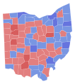
Category:2020 Ohio election maps
Jump to navigation
Jump to search
States of the United States: Arizona · California · Colorado · Connecticut · Delaware · Florida · Idaho · Indiana · Iowa · Kentucky · Michigan · Missouri · Montana · Nevada · New Hampshire · New Mexico · New York · North Carolina · Ohio · Oklahoma · Pennsylvania · Utah · Virginia · Washington · West Virginia
Subcategories
This category has the following 2 subcategories, out of 2 total.
Media in category "2020 Ohio election maps"
The following 7 files are in this category, out of 7 total.
-
2020 Ohio SC Seat 4 election.svg 810 × 810; 336 KB
-
2020 Ohio Supreme Court Election by Congressional District.svg 810 × 810; 145 KB
-
2020 Ohio Supreme Court Election Seat 5.svg 230 × 260; 44 KB
-
20ohscj.svg 531 × 602; 30.71 MB
-
Ohio Associate Justice 2020 Brunner French.svg 810 × 810; 39 KB
-
Ohio House 2020 Election.svg 1,243 × 1,021; 3.06 MB
-
Ohio Senate 2020 Election.svg 819 × 886; 1.84 MB


