
Category:2019 maps of Hungary
Media in category "2019 maps of Hungary"
The following 3 files are in this category, out of 3 total.
-
 Hungary-geographic map-NL.svg 1,855 × 1,200; 13.61 MB
-
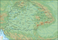 Physical map of the Kingdom of Hungary before 1919-es.svg 3,561 × 2,489; 25.79 MB
-
 Population density in Hungary.png 870 × 540; 133 KB


