Category:2017 maps of Pennsylvania
Jump to navigation
Jump to search
Subcategories
This category has the following 8 subcategories, out of 8 total.
P
Media in category "2017 maps of Pennsylvania"
The following 7 files are in this category, out of 7 total.
-
2017 Pennsylvania Supreme Court election.svg 744 × 443; 165 KB
-
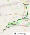
Lebanon Valley Rail Trail.svg 503 × 600; 204 KB
-
Society Hill Bus Map.png 1,256 × 1,050; 689 KB
-
Society Hill Pedestrian Greenway Map.png 1,256 × 1,050; 890 KB
-
Society Hill Standard Map.png 1,256 × 1,050; 1.07 MB
-
Street map of Philadelphia and surrounding area.png 1,307 × 1,024; 2.12 MB
-
Street map of Philadelphia and Walt Whitman Bridge.png 729 × 433; 308 KB


