Category:2017 Germany Bundestagswahl maps
Jump to navigation
Jump to search
Media in category "2017 Germany Bundestagswahl maps"
The following 28 files are in this category, out of 28 total.
-
 2017 German federal election - Results by state.svg 630 × 818; 145 KB
-
 2017 German federal election.svg 2,535 × 1,863; 1.92 MB
-
 Btw17afd.svg 560 × 750; 766 KB
-
 Btw17cdu.svg 560 × 750; 766 KB
-
 Btw17gruene.svg 560 × 750; 765 KB
-
 Btw17linke.svg 560 × 750; 766 KB
-
 Btw17npd.svg 560 × 750; 765 KB
-
 Btw17spd.svg 560 × 750; 765 KB
-
 Bundestagswahl 2017 - Mehrheiten der Erststimmen in Essen.svg 350 × 420; 421 KB
-
 Bundestagswahl 2017 Erststimmenergebnisse.svg 1,530 × 1,812; 1.84 MB
-
 Bundestagswahl2017 Beteiligung.svg 560 × 750; 766 KB
-
 Bundestagswahlkreise 2017.svg 1,220 × 1,450; 1.47 MB
-
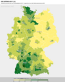
 Bundestagswahlkreise2021 Zweitstimmen2017(%) DieLinke.png 1,514 × 1,906; 685 KB
-
 Btw17fdp.svg 560 × 750; 765 KB
-

-
 German Federal Election - Party list vote results by state - 2017.png 1,030 × 1,300; 64 KB
-
 German federal election 2017 - Additional Member Seats by State.svg 650 × 807; 301 KB
-
 German Federal Election 2017 - Results by Constituency & Regional Seats.svg 1,469 × 1,708; 1.21 MB
-
 Karte btw afd17z endg.svg 560 × 750; 766 KB
-
 Karte btw cdu17z endg.svg 560 × 750; 766 KB
-
 Karte btw fdp17z endg.svg 560 × 750; 765 KB
-
 Karte btw gruene17z endg.svg 560 × 750; 765 KB
-
 Karte btw linke17z endg.svg 560 × 750; 766 KB
-
 Karte btw spd17z endg.svg 560 × 750; 765 KB
-

-

-
-


_DieLinke.png)


