Category:2016 maps of Mexico
Jump to navigation
Jump to search
Countries of North America: Canada · Jamaica · Mexico · United States of America‡
Other territories: Puerto Rico
‡: partly located in North America
Other territories: Puerto Rico
‡: partly located in North America
Media in category "2016 maps of Mexico"
The following 14 files are in this category, out of 14 total.
-
01E 2016 5day.gif 895 × 716; 20 KB
-
ECDM 20160606 World SevereWeather.pdf 1,625 × 1,125; 578 KB
-
ECDM 20160607 World SevereWeather.pdf 1,625 × 1,125; 572 KB
-
ECDM 20160804 TC EARL.pdf 1,625 × 1,125; 760 KB
-
ECDM 20160805 TC EARL.pdf 1,625 × 1,125; 686 KB
-
ECDM 20160809 Mexico TC JAVIER.pdf 1,625 × 1,125; 603 KB
-
ECDM 20160829 ECHO CentralAmericaMap.pdf 1,625 × 1,125; 591 KB
-
ECDM 20160906 TC NEWTON.pdf 1,625 × 1,125; 677 KB
-
ECDM 20160908 World Severe Weather.pdf 1,625 × 1,125; 1.02 MB
-
ECDM 20160920 World events.pdf 1,625 × 1,125; 678 KB
-
ECDM 20160921 World events.pdf 1,625 × 1,125; 669 KB
-
IDH MEXICO 2016.png 1,069 × 536; 90 KB
-
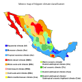
Mexico Köppen.svg 765 × 765; 2.04 MB
-
Mexico map of Köppen climate classification.svg 1,900 × 1,900; 328 KB


