Category:2016 maps of Massachusetts
Jump to navigation
Jump to search
States of the United States: Arizona · California · Indiana · Iowa · Massachusetts · New York · Ohio · Pennsylvania · South Carolina · Utah · Virginia – Washington, D.C.
Puerto Rico
Puerto Rico
| ← 2010 2016 2018 2019 → |
Media in category "2016 maps of Massachusetts"
The following 3 files are in this category, out of 3 total.
-
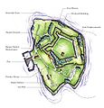
NPS boston-harbor-islands-map-georges-island.jpg 891 × 930; 184 KB


