Category:2015 UK local elections
Jump to navigation
Jump to search
elections | |||||
| Upload media | |||||
| Instance of |
| ||||
|---|---|---|---|---|---|
| Location |
| ||||
| Point in time |
| ||||
| Follows | |||||
| Followed by | |||||
| |||||
Media in category "2015 UK local elections"
The following 200 files are in this category, out of 205 total.
(previous page) (next page)-
2015 City of York Council Election Results Map.png 3,120 × 1,588; 449 KB
-
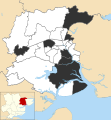
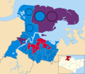
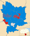
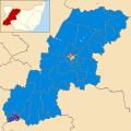
2015 Epping Forest Council election results.svg 830 × 800; 92 KB
-
Allerdale UK local election 2015 map.svg 1,015 × 1,345; 889 KB
-
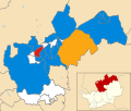
Amber Valley wards 2015.svg 1,170 × 1,305; 500 KB
-
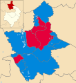
Arun UK ward map 2015.svg 635 × 380; 199 KB
-
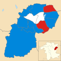
Ashfield District Council election 2015.svg 799 × 1,192; 216 KB
-
Ashford UK local election 2015 map.svg 1,199 × 1,266; 648 KB
-
Aylesbury Vale UK local election 2015 map.svg 1,187 × 1,266; 926 KB
-
Babergh District Council election 2015 map.svg 1,425 × 873; 769 KB
-
BANES wards 2015.svg 1,425 × 982; 710 KB
-
Barnsley wards 2015.png 1,425 × 981; 216 KB
-
Barrow-in-Furness UK local election 2015 map.svg 833 × 1,345; 368 KB
-
Basildon UK local election 2015 map.svg 1,108 × 1,266; 361 KB
-
Basingstoke and Deane UK local election 2015 map.svg 1,223 × 1,226; 493 KB
-
Bassetlaw District Council election, 2015.svg 1,087 × 1,179; 307 KB
-
Birmingham wards 2015.png 1,045 × 1,266; 296 KB
-
Blackpool local election map 2015.png 800 × 968; 132 KB
-
Bolsover UK local election 2015 map.svg 792 × 1,306; 420 KB
-
Boston UK ward map 2015.svg 1,425 × 1,225; 445 KB
-
Bournemouth UK local election 2015 map.svg 1,425 × 904; 264 KB
-
Bradford UK local election 2015 map.svg 1,685 × 1,681; 837 KB
-
Braintree UK ward map 2015 (results).svg 990 × 1,266; 785 KB
-
Breckland UK results map 2015.svg 1,078 × 1,266; 696 KB
-
Brighton and Hove City Council election 2015 map.svg 1,425 × 900; 591 KB
-
Bristol 2015 election.png 2,000 × 2,225; 521 KB
-
Bristol wards 2015.svg 1,138 × 1,266; 709 KB
-
Broadland UK ward map 2015.svg 1,425 × 968; 731 KB
-
Bromsgrove UK ward map 2015.svg 691 × 586; 336 KB
-
Broxtowe UK ward map 2015.svg 880 × 1,306; 356 KB
-
Calderdale UK ward map 2015 Election.svg 1,781 × 1,548; 719 KB
-
Cambridge UK local election 2015 map.svg 1,319 × 1,266; 115 KB
-
Cannock Chase District Council election 2015 map.svg 1,055 × 1,305; 210 KB
-
Canterbury UK local election 2015 map.svg 1,076 × 1,266; 505 KB
-
Carlisle UK local election 2015 map.svg 1,252 × 1,346; 667 KB
-
CBC results map 2015.png 1,887 × 2,148; 501 KB
-
Central Bedfordshire UK ward map 2015.svg 614 × 703; 353 KB
-
Chelmsford UK ward map 2015 (results).svg 1,035 × 1,266; 603 KB
-
Cheshire East UK ward map 2015.svg 768 × 721; 686 KB
-
Chiltern UK ward map 2015.svg 1,108 × 1,266; 392 KB
-
Chorley 2011.jpg 705 × 600; 63 KB
-
Christchurch UK local election 2015 map.svg 1,385 × 1,226; 234 KB
-
City of Lincoln Council Election Results 2015.svg 1,385 × 1,306; 160 KB
-
City of York Council election 2015 map.svg 1,516 × 1,483; 468 KB
-
Colchester Borough Council election 2015 map.svg 1,173 × 1,266; 723 KB
-
Copeland UK local election 2015 map.svg 1,044 × 1,346; 659 KB
-
Corby UK local election 2015 map.svg 1,425 × 1,244; 279 KB
-
Cotswold District Council election 2015 map.svg 970 × 1,180; 464 KB
-
Coventry UK local election 2015 map.svg 1,340 × 1,266; 260 KB
-
Craven UK local election 2015 map.svg 1,425 × 1,336; 606 KB
-
Crawley UK local election 2015 map.svg 1,188 × 1,266; 433 KB
-
CWAC-2015-election-results-striped-flat.svg 730 × 577; 566 KB
-
Dacorum UK ward map 2015.svg 1,425 × 1,233; 371 KB
-
Darlington UK ward map 2015.svg 618 × 590; 191 KB
-
Dave Hodgson 2015.jpg 1,432 × 1,432; 586 KB
-
DDDC Wards 2015.svg 763 × 1,306; 1.07 MB
-
Derby City Council election 2015 map.svg 1,400 × 1,305; 254 KB
-
Doncaster ward results 2015.png 901 × 800; 174 KB
-
Dover UK local election 2015 map.svg 1,066 × 1,266; 425 KB
-
Dudley wards 2015.png 2,000 × 2,239; 501 KB
-
East Dorset UK local election 2015 map.svg 1,231 × 1,226; 532 KB
-
East Hampshire UK local election 2015 map.png 813 × 1,080; 134 KB
-
East Hampshire UK local election 2015 map.svg 924 × 1,227; 572 KB
-
East Hertfordshire UK ward map 2015.svg 1,283 × 1,266; 537 KB
-
East Lindsey UK ward map 2015.svg 1,075 × 1,306; 877 KB
-
Eastbourne UK local election 2015 map.svg 1,187 × 1,226; 150 KB
-
Eastleigh wards 2015.svg 838 × 1,227; 365 KB
-
Eden UK ward map 2015.svg 903 × 836; 712 KB
-
English local elections 2015 map.svg 1,108 × 1,345; 501 KB
-
Erewash UK local election 2015 map.svg 1,372 × 1,305; 389 KB
-
Exeter City Council political composition in 2015.svg 360 × 185; 2 KB
-
Exeter City Council Wards, October 2015.svg 934 × 1,187; 275 KB
-
Exeter UK local election 2015 map.svg 934 × 1,187; 272 KB
-
Fenland UK ward map 2015.svg 535 × 716; 181 KB
-
Forest Heath UK ward map 2015.svg 1,131 × 1,266; 343 KB
-
Forest of Dean wards 2015.svg 829 × 1,266; 751 KB
-
Fylde UK local election 2015 map.svg 1,425 × 1,176; 370 KB
-
Fylde UK local election 2019 map.svg 1,425 × 1,176; 370 KB
-
Gedling UK ward map 2015.svg 1,118 × 1,306; 321 KB
-
Gravesham UK local election 2015 map.svg 1,055 × 1,266; 350 KB
-
Guildfordbc2015e.png 2,000 × 1,887; 442 KB
-
Hambleton UK ward map 2015.svg 553 × 675; 490 KB
-
Harlow UK local election 2011 map.svg 1,425 × 1,140; 224 KB
-
Harrogate wards 2015.svg 1,425 × 1,184; 755 KB
-
Hart Local Election Result 2015.svg 964 × 1,227; 354 KB
-
Hartlepool UK local election 2015 map.svg 1,425 × 1,111; 235 KB
-
High Peak UK local election 2015 map.svg 371 × 564; 289 KB
-
Hinckley and Bosworth UK ward map 2015.svg 721 × 685; 301 KB
-
Huntingdonshire UK local election 2015 map.svg 1,055 × 1,266; 574 KB
-
Hyndburn UK local election 2015 map.svg 512 × 507; 304 KB
-
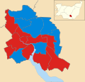
Ipswich UK local election 2015 map.svg 1,319 × 1,266; 218 KB
-
Kettering UK local election 2015 map.svg 1,206 × 1,266; 372 KB
-
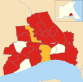
Kingston upon Hull UK 2015 Local Election map.svg 1,319 × 1,305; 179 KB
-
Kirklees wards 2015.png 1,358 × 1,345; 282 KB
-
Leeds UK local election 2015 map.svg 1,425 × 1,086; 624 KB
-
Leeds wards 2015.png 823 × 652; 20 KB
-
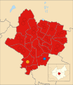
Leicester UK ward map 2015.svg 512 × 592; 306 KB
-
Lichfield UK ward map 2015.svg 699 × 681; 324 KB
-
Liverpool wards 2015.png 1,024 × 1,305; 223 KB
-
Maldon UK ward map 2015 (results).svg 1,253 × 1,266; 907 KB
-
Manchester UK local election 2015 map.svg 720 × 1,306; 363 KB
-
Mansfield UK ward map 2015.svg 1,157 × 1,306; 304 KB
-
Medway UK ward map 2015.svg 1,425 × 1,233; 556 KB
-
Melton UK local election 2015.svg 995 × 1,266; 456 KB
-
Mendip 2015 election result map.png 762 × 600; 80 KB
-
Mendip UK local election 2015 map.svg 1,425 × 1,122; 757 KB
-
Mid Suffolk wards 2015.svg 1,390 × 1,266; 690 KB
-
Mid Sussex UK ward map 2015.svg 817 × 1,227; 552 KB
-
Middlesbrough UK ward map 2015.svg 718 × 745; 194 KB
-
Milton Keynes Council election, 2015.svg 1,055 × 1,266; 350 KB
-
New Forest UK local election 2015 map.svg 1,425 × 1,055; 936 KB
-
Newark and Sherwood UK ward map 2015.svg 1,244 × 1,306; 619 KB
-
Newcastle upon Tyne UK local election 2015 map.svg 1,425 × 1,305; 272 KB
-
Newcastle-under-Lyme UK local election 2015 map.svg 982 × 1,305; 410 KB
-
North Devon UK local election 2015 map.svg 1,375 × 1,187; 1.06 MB
-
North Dorset UK local election 2015 map.svg 1,040 × 1,226; 582 KB
-
North East Lincolnshire Council election, 2015.svg 1,259 × 1,306; 289 KB
-
North Hertfordshire UK ward map 2015.svg 1,425 × 1,207; 395 KB
-
North Lincolnshire 2015.png 3,508 × 2,480; 192 KB
-
North Somerset UK local election 2015 map.svg 1,425 × 964; 750 KB
-
North Warwickshire UK ward map 2015.svg 1,157 × 1,266; 452 KB
-
North West Leicestershire UK ward map 2015.svg 701 × 706; 391 KB
-
Northampton UK local election 2015 map.svg 1,385 × 1,266; 256 KB
-
Norwich wards 2015.png 1,187 × 1,266; 191 KB
-
Nottingham UK ward map (2015 results).svg 1,003 × 1,306; 259 KB
-
Plymouth City Council composition 2015.svg 360 × 185; 3 KB
-
Plymouth City Council election 2015 map.svg 1,100 × 1,187; 614 KB
-
Poole Borough Council election 2015 map.svg 1,218 × 1,226; 393 KB
-
Portsmouth 2015 ward map.svg 1,055 × 1,226; 283 KB
-
Purbeck UK local election 2015 map.svg 1,425 × 1,226; 573 KB
-
Redcar and Cleveland UK local election 2015 map.svg 1,425 × 1,014; 433 KB
-
Redditch wards 2015.svg 1,267 × 1,266; 212 KB
-
Richmondshire UK local election 2015 map.svg 1,425 × 1,148; 671 KB
-
Rochdale UK local election 2015 map.svg 1,304 × 1,305; 388 KB
-
Rother UK local election 2015 map.svg 1,425 × 1,105; 573 KB
-
Rugby UK local election 2015 map.svg 924 × 1,266; 465 KB
-
Rushcliffe UK ward map 2015.svg 1,385 × 1,305; 544 KB
-
Rushmoor UK local election 2015 map.svg 792 × 1,227; 226 KB
-
Ryedale UK ward map 2015.svg 1,425 × 1,345; 780 KB
-
Sandwell UK local election 2015 map.svg 1,131 × 1,266; 293 KB
-
Scarborough UK ward map 2015.svg 1,425 × 1,240; 610 KB
-
Sedgemoor UK local election 2015 map.svg 1,351 × 1,225; 584 KB
-
Selby UK local election 2015 map.svg 1,131 × 1,345; 691 KB
-
Sevenoaks UK ward map 2015.svg 478 × 715; 315 KB
-
SGlos local election map 2015.png 1,228 × 1,266; 349 KB
-
Sheffield local election map 2015.gif 512 × 317; 8 KB
-
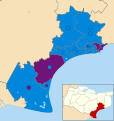
Shepway UK ward map 2015.svg 1,199 × 1,266; 416 KB
-
SODC 2015 PieCharts.png 750 × 355; 34 KB
-
Solihull wards 2015.png 1,187 × 1,266; 227 KB
-
South Bucks UK ward map 2015.svg 950 × 1,266; 378 KB
-
South Cambridgeshire UK composition 2015 map.svg 1,425 × 1,256; 663 KB
-
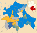
South Cambridgeshire UK local election 2015 map.svg 1,425 × 1,256; 662 KB
-
South Hams District Council wards, May 2015.svg 1,425 × 1,084; 1.08 MB
-
South Kesteven UK local election 2015 map.svg 1,114 × 1,305; 650 KB
-
South Lakeland UK local election 2015 map.svg 1,425 × 1,174; 1.06 MB
-
South Norfolk UK local election 2015 map.svg 1,425 × 1,096; 1,010 KB
-
South Oxfordshire UK ward map 2015 results.png 2,000 × 2,711; 521 KB
-
South Ribble 2015 Borough Council Election Ward Map.svg 1,425 × 1,038; 378 KB
-
South Somerset UK local election 2015 map.svg 1,425 × 994; 947 KB
-
South Tyneside UK ward map 2015.svg 1,367 × 1,346; 246 KB
-
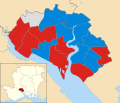
Southampton UK local election 2015 map.svg 1,425 × 1,226; 269 KB
-
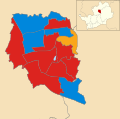
St Albans wards 2015.svg 990 × 1,266; 282 KB
-
St Edmundsbury wards 2015.svg 1,270 × 1,266; 674 KB
-
Stafford UK ward map 2015.svg 583 × 529; 454 KB
-
Staffordshire Moorlands UK local election 2015 map.svg 1,223 × 1,305; 893 KB
-
Stevenage UK local election 2015 map.svg 1,286 × 1,266; 129 KB
-
Stockport UK local election 2015 map.svg 1,336 × 1,305; 394 KB
-
Stoke-on-Trent UK ward map 2015.svg 990 × 1,306; 467 KB
-
Stratford-on-Avon UK ward map 2015.svg 2,357 × 2,159; 603 KB
-
Suffolk Coastal UK ward map 2015.svg 946 × 1,266; 695 KB
-
Sunderland UK local election 2015 map.svg 1,071 × 1,345; 335 KB
-
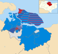
Swale UK ward map 2015.svg 1,357 × 1,266; 654 KB
-
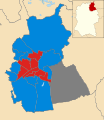
Swindon UK local election 2015 map.svg 1,102 × 1,266; 382 KB
-
Taunton Deane UK local election 2015 map.svg 1,425 × 1,047; 616 KB
-
Tendring UK 2015 Council Election.svg 1,403 × 1,266; 735 KB
-
Test Valley UK Local Election 2015.svg 828 × 1,221; 575 KB
-
Thanet UK local election 2015 map.svg 1,425 × 929; 330 KB
-
Three Rivers wards 2015.svg 931 × 1,266; 245 KB
-
Torbay Council election 2015 map.svg 950 × 1,187; 479 KB
-
Torridge UK local election 2015 map.svg 1,034 × 1,187; 1.01 MB
-
Tunbridge Wells UK ward map 2015.svg 1,425 × 1,053; 567 KB
-
Wakefield UK ward map 2015.svg 1,425 × 988; 418 KB
-
Walsall UK local election 2015 map.svg 1,187 × 1,266; 224 KB
-
Warwick UK ward map 2015.svg 1,152 × 882; 424 KB
-
Watford wards 2015.svg 990 × 1,266; 109 KB
-
Waveney UK ward map 2015.svg 1,370 × 1,266; 495 KB
-
Wealden UK local election 2015 map.svg 1,055 × 1,226; 998 KB
-
Wellingborough UK local election 2015 map.svg 1,041 × 1,266; 369 KB
-
West Berkshire UK local election 2015 map.svg 1,425 × 1,124; 542 KB
-
West Dorset UK local election 2015 map.svg 1,262 × 1,226; 754 KB
-
West Lindsey District Council election, 2015.svg 1,291 × 1,306; 639 KB
-
West Lindsey UK ward map 2015.svg 1,291 × 1,306; 643 KB
-
West Oxfordshire UK local election 2015 map.svg 1,187 × 1,266; 670 KB
-
West Somerset UK local election 2015 map.svg 1,425 × 799; 653 KB
-
Weymouth and Portland UK local election 2015 map.svg 880 × 1,226; 220 KB
-
Wigan UK local election 2015 map.svg 1,425 × 1,245; 503 KB
-
Winchester 2015 election map.svg 990 × 1,227; 653 KB
-
Wirral Council Election Results Map 2015.svg 1,407 × 1,305; 238 KB
-
Wirral wards 2015.png 1,407 × 1,305; 232 KB
-
Wokingham UK local election 2015 map.svg 860 × 1,266; 312 KB
-
Wolverhampton UK local election 2015 map.svg 1,295 × 1,266; 191 KB


