Category:2014 floods in the United Kingdom
Jump to navigation
Jump to search
Subcategories
This category has only the following subcategory.
E
Media in category "2014 floods in the United Kingdom"
The following 8 files are in this category, out of 8 total.
-

-
 Flood at St Huberts.jpg 3,744 × 5,616; 10.24 MB
-
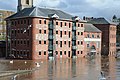 Flooded converted warehouses - geograph.org.uk - 3851865.jpg 1,024 × 680; 262 KB
-
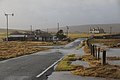 Flooded road at Averley, Baltasound - geograph.org.uk - 3823469.jpg 1,024 × 681; 161 KB
-
 Flooding at the dune slack area, Stevenston Beach LNR.jpg 2,592 × 1,552; 1.62 MB
-
 Floods on Norwick Meadows - geograph.org.uk - 4237969.jpg 1,024 × 681; 238 KB
-
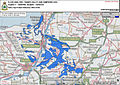 Sentinel Mapping of Flood Hit Areas MOD 45157032.jpg 842 × 595; 480 KB
-
 View across the flooded Severn - geograph.org.uk - 3852275.jpg 1,024 × 680; 182 KB


