Category:2014 Ebola outbreak maps
Jump to navigation
Jump to search
Media in category "2014 Ebola outbreak maps"
The following 76 files are in this category, out of 76 total.
-
2014 Ebola outbreak-countries in Africa with active transmission.png 585 × 600; 50 KB
-
2014 ebola virus epidemic in West Africa (eo 20140923).png 5,200 × 2,400; 909 KB
-
2014 ebola virus epidemic in West Africa (eo 20141001).png 5,200 × 2,400; 906 KB
-
2014 ebola virus epidemic in West Africa (eo 20141012).png 5,200 × 2,400; 906 KB
-
2014 ebola virus epidemic in West Africa (eo 20141023).png 5,333 × 2,833; 975 KB
-
2014 ebola virus epidemic in West Africa (eo 20141104).png 5,333 × 2,833; 977 KB
-
2014 ebola virus epidemic in West Africa (eo 20141123).png 5,333 × 2,833; 993 KB
-
2014 ebola virus epidemic in West Africa (eo 20141130).png 5,333 × 2,833; 983 KB
-
2014 ebola virus epidemic in West Africa (eo).png 5,200 × 2,400; 904 KB
-
2014 ebola virus epidemic in West Africa CS.svg 1,600 × 850; 371 KB
-
2014 ebola virus epidemic in West Africa he.svg 1,600 × 850; 373 KB
-
2014 ebola virus epidemic in West Africa simplified 2.svg 1,600 × 850; 365 KB
-
2014 ebola virus epidemic in West Africa simplified cy.svg 1,600 × 850; 362 KB
-
2014 ebola virus epidemic in West Africa simplified-ur.svg 512 × 272; 255 KB
-
2014 ebola virus epidemic in West Africa simplified.svg 1,600 × 850; 301 KB
-
2014 ebola virus epidemic in West Africa zh-CN.png 1,561 × 721; 65 KB
-
2014 Ebola virus epidemic in West Africa zh-CN.svg 1,561 × 721; 279 KB
-
2014 ebola virus epidemic in West Africa.-es.svg 1,600 × 850; 348 KB
-
2014 Ebola virus epidemic in West Africa.png 1,560 × 720; 144 KB
-
2014 ebola virus epidemic in West Africa.svg 1,600 × 850; 384 KB
-
2014 West Africa Ebola virus outbreak situation map zh-CN.jpg 1,200 × 1,414; 632 KB
-
2014 West Africa Ebola virus outbreak situation map.jpg 1,039 × 882; 160 KB
-
69517-Ebolaren bilakaera 2014ko martxotik abuztura.svg 1,102 × 180; 31.22 MB
-
A map of West African outbreak.tif 9,449 × 8,513; 230.16 MB
-
Avancée d'Ebola dans le monde.png 1,425 × 625; 38 KB
-
Countries effected in the 2014 outbreaks of Ebola.png 1,434 × 624; 44 KB
-
Current ebola map 30-09-2014.svg 854 × 433; 1.21 MB
-
DRC Ebola Map.png 805 × 729; 225 KB
-
Ebola 1976-2014.svg 1,000 × 1,000; 181 KB
-
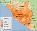
Ebola 2014 outbreak map of Guinea, Liberia, and Sierra Leone.png 975 × 756; 1,016 KB
-
Ebola Map from Guinea, Liberia and Sierra Leone in summer 2014 (animated).gif 960 × 1,127; 1.31 MB
-
Ebola Map Guinea Liberia Sierra Leone 2014-08-25 animated.gif 976 × 999; 144 KB
-
Ebola Map Guinea Liberia Sierra Leone 2014-10-19 animated.gif 976 × 999; 150 KB
-
Ebola Outbreak Map (ongoing).png 2,454 × 1,502; 841 KB
-
Ebola Outbreak Map.png 960 × 720; 1.02 MB
-
Ebola quarantine United States.png 959 × 593; 100 KB
-
Ebola Winkel Tripel Projection.svg 1,636 × 1,001; 5.34 MB
-
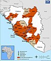
Ebola-CDC-Case-Map.svg 976 × 999; 1.13 MB
-
EbolaOutbreakAugust2014-ActiveTransmissions.svg 863 × 443; 1.59 MB
-
EBOV Outbreak in West Africa with USA.png 2,087 × 1,005; 97 KB
-
ECDM 20140527 Africa EbolaCholera.pdf 1,625 × 1,125; 357 KB
-
ECDM 20140618 Africa Ebola.pdf 1,625 × 1,125; 546 KB
-
ECDM 20140626 Africa Ebola.pdf 1,625 × 1,125; 540 KB
-
ECDM 20140703 WestAfrica Ebola.pdf 1,625 × 1,125; 548 KB
-
ECDM 20140811 WestAfrica Ebola.pdf 1,625 × 1,125; 679 KB
-
ECDM 20140829 WestAfrica Ebola.pdf 1,625 × 1,125; 699 KB
-
ECDM 20140910 WestAfrica Ebola.pdf 1,625 × 1,125; 753 KB
-
ECDM 20141027 WestAfrica Ebola.pdf 1,625 × 1,125; 557 KB
-
ECDM 20141104 WestAfrica Ebola v01.pdf 1,625 × 1,125; 561 KB
-
ECDM 20141107 EVD Netherlands vessel transport of assistance.pdf 1,754 × 1,239; 392 KB
-
ECDM 20141114 WestAfrica Ebola.pdf 1,625 × 1,125; 570 KB
-
ECDM 20141119 WestAfrica EVDOutbreak.pdf 1,625 × 1,125; 850 KB
-
ECDM 20141126 WestAfrica EVDOutbreak.pdf 1,625 × 1,125; 523 KB
-
ECDM 20141201 WestAfrica EVDOutbreak.pdf 1,625 × 1,125; 445 KB
-
ECDM 20141215 EVD Netherlands Vessel 2nd rotation JRC UPDATE.pdf 1,754 × 1,239; 327 KB
-
ECDM 20150120 WestAfrica EVDOutbreak.pdf 1,625 × 1,125; 819 KB
-
ECDM 20150224 WestAfrica EVDOutbreak.pdf 1,625 × 1,125; 804 KB
-
ECDM 20150309 WestAfrica EVDOutbreak.pdf 1,625 × 1,125; 758 KB
-
ECDM 20150319 WestAfrica EVDOutbreak.pdf 1,625 × 1,125; 816 KB
-
ECDM 20160331 WestAfrica EVDOutbreak.pdf 1,625 × 1,125, 2 pages; 1.44 MB
-
Epidemia de ébola de 2014-2015 en África Occidental.png 800 × 425; 57 KB
-
Epidemia de ébola na África Ocidental de 2014.png 1,560 × 720; 188 KB
-
Finnish map of ebola outbreak.svg 1,636 × 1,001; 5.29 MB
-
Guinea Liberia Sierra Leone Ebola Map August 4 2014.jpg 960 × 1,128; 312 KB
-
Guinea Liberia Sierra Leone Ebola Map August 8 2014.jpg 960 × 1,128; 309 KB
-
Guinea Sierra Leone Ebola Map April 14 2014.jpg 960 × 1,128; 268 KB
-
Mali- Ebola districts.png 449 × 443; 30 KB
-
Map of Ebola Outbreak - 1 October 2014.svg 1,636 × 1,001; 5.37 MB
-
Map of Ebola Outbreak.PNG 2,999 × 1,504; 877 KB
-
Mapamundi epidemia de ébola de 2014 - ES.png 4,000 × 1,973; 1.34 MB
-
Mapamundi epidemia de ébola de 2014 - Esp.jpg 4,000 × 1,973; 1,020 KB
-
Mapamundi epidemia de ébola de 2014 -- Esp -- 2.svg 3,024 × 1,491; 1.66 MB
-
Nigeria Map Ebola 2014.png 777 × 599; 145 KB
-
USA-Ebola-outbreak-2014.svg 959 × 593; 51 KB
-
USA-Ebola-quarantine-regs.svg 959 × 593; 48 KB


