Category:2012 maps of Canada
Jump to navigation
Jump to search
Countries of the Americas: Argentina · The Bahamas · Canada · Chile · Cuba · Honduras · Mexico · Paraguay · Saint Vincent and the Grenadines · United States of America
Provinces and territories of Canada: British Columbia · Nova Scotia · Ontario · Quebec · Saskatchewan ·
Subcategories
This category has the following 5 subcategories, out of 5 total.
Media in category "2012 maps of Canada"
The following 7 files are in this category, out of 7 total.
-
Alta2012.png 3,229 × 3,871; 824 KB
-
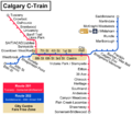
C-train routes.png 2,000 × 1,764; 459 KB
-
Calgary C-Train map.svg 1,584 × 1,397; 67 KB
-
Canada Alberta relief location map.jpg 2,184 × 2,692; 2.93 MB
-
Canada Yukon location map-albers proj.svg 512 × 581; 444 KB
-
Canada Yukon location map-albers proj2.svg 512 × 581; 444 KB
-
CFL stadiums map.jpg 923 × 574; 27 KB


