Category:2011 in Dover, Kent
Jump to navigation
Jump to search
Media in category "2011 in Dover, Kent"
The following 9 files are in this category, out of 9 total.
-
 70's Office Block - geograph.org.uk - 2315993.jpg 427 × 640; 107 KB
-
 Cliffs above Samphire Hoe - geograph.org.uk - 2290813.jpg 3,072 × 2,304; 2.23 MB
-

-
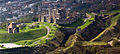 Dover Castle aerial view.jpg 3,072 × 1,376; 1.77 MB
-
 Dover, Russell Street - geograph.org.uk - 2846512.jpg 3,648 × 2,736; 4.14 MB
-
 Dover, South Eastern Main Railway Line - geograph.org.uk - 2600381.jpg 3,648 × 2,736; 1.75 MB
-
 Dover, Western Heights Beach - geograph.org.uk - 2599115.jpg 3,648 × 2,736; 2.25 MB
-
 Footpath on Western Heights - geograph.org.uk - 2317450.jpg 3,072 × 2,304; 1.86 MB
-
 Wolverton - Dwelling - geograph.org.uk - 2990136.jpg 1,200 × 808; 1.05 MB


