Category:2010s maps of Brazil
Jump to navigation
Jump to search
Countries of the Americas: Argentina · The Bahamas · Bolivia · Brazil · Canada · Chile · Colombia · Costa Rica · Cuba · Guatemala · Guyana · Haiti · Honduras · Jamaica · Mexico · Nicaragua · Panama · Paraguay · Peru · Saint Vincent and the Grenadines · Suriname · United States of America · Uruguay · Venezuela
Other areas: Greenland · Puerto Rico
Other areas: Greenland · Puerto Rico
Subcategories
This category has the following 3 subcategories, out of 3 total.
- 2013 maps of Brazil (7 F)
Media in category "2010s maps of Brazil"
The following 3 files are in this category, out of 3 total.
-
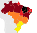
Map of homicide rate in Brazil 2018.png 1,387 × 1,352; 1.85 MB
-
Estados brasileiros por anos de escolaridade (2019).png 804 × 764; 77 KB
-
Pobreza.png 1,000 × 881; 125 KB


