Category:2010 maps of Toronto
Jump to navigation
Jump to search
Most populous urban areas of the world: Boston [US] · New York City [US] · Philadelphia [US] · Toronto [CA] · Washington, D.C. [US]
Media in category "2010 maps of Toronto"
The following 6 files are in this category, out of 6 total.
-
Cityoftorontosmall.png 525 × 390; 234 KB
-
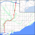
DVP map.svg 1,420 × 1,420; 545 KB
-
Maple Leaf boundaries.PNG 659 × 524; 23 KB
-
Southern Ontario - Toronto.jpg 3,094 × 2,271; 3.48 MB
-
Transit City support.png 1,203 × 628; 58 KB
-
York University Heights map.PNG 613 × 720; 19 KB


