Category:2010 maps of Iran
Jump to navigation
Jump to search
Media in category "2010 maps of Iran"
The following 6 files are in this category, out of 6 total.
-
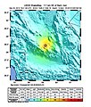
December 2010 Kerman earthquake shakemap USGS.jpg 612 × 716; 121 KB
-
Earthquake south iran.png 409 × 449; 121 KB
-
Iran. LOC 2010586700.jpg 2,490 × 3,263; 744 KB
-
Iran. LOC 2010586700.tif 2,490 × 3,263; 23.25 MB
-
M 6.7 - southeastern Iran.jpg 612 × 718; 125 KB
-
Sismo en Irán, 20 de diciembre, 2010.png 464 × 478; 92 KB


