Category:2010 United States Census of Puerto Rico
Jump to navigation
Jump to search
States of the United States: Alabama · Alaska · Arizona · Arkansas · California · Colorado · Connecticut · Delaware · Florida · Georgia · Hawaii · Idaho · Illinois · Indiana · Iowa · Kansas · Kentucky · Louisiana · Maine · Maryland · Massachusetts · Michigan · Minnesota · Mississippi · Missouri · Montana · Nebraska · Nevada · New Hampshire · New Jersey · New Mexico · New York · North Carolina · North Dakota · Ohio · Oklahoma · Oregon · Pennsylvania · Rhode Island · South Carolina · South Dakota · Tennessee · Texas · Utah · Vermont · Virginia · Washington · West Virginia · Wisconsin · Wyoming – Washington, D.C.
Guam · Puerto Rico
Guam · Puerto Rico
Media in category "2010 United States Census of Puerto Rico"
The following 43 files are in this category, out of 43 total.
-
2010 Census Road Tour - San Juan (4384825127).jpg 3,084 × 1,554; 2.19 MB
-
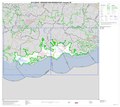
2010 Census Urbanized Area Reference Map for Arecibo, Puerto Rico - DPLA - 33158b0d5fb818e02083265ab77ae2e9.pdf 5,404 × 4,800, 3 pages; 2.62 MB
-
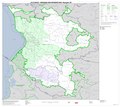
2010 Census Urbanized Area Reference Map for Guayama, Puerto Rico - DPLA - e27c5288ae6e0a0de2a66470af06558b.pdf 5,404 × 4,800, 3 pages; 1.68 MB
-
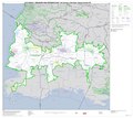
2010 Census Urbanized Area Reference Map for San Juan, Puerto Rico - DPLA - 6b08f8e1e759bfae282d5119556aa624.pdf 5,404 × 4,800, 7 pages; 11.28 MB
-
Appendix D. Puerto Rico Questionnaire on US 2010 Census 01.jpg 3,400 × 4,400; 751 KB
-
Appendix D. Puerto Rico Questionnaire on US 2010 Census 02.jpg 3,400 × 4,400; 709 KB
-
Appendix D. Puerto Rico Questionnaire on US 2010 Census 03.jpg 3,400 × 4,400; 710 KB
-
Appendix D. Puerto Rico Questionnaire on US 2010 Census 04.jpg 3,400 × 4,400; 502 KB
-
Appendix D. Puerto Rico Questionnaire on US 2010 Census 05.jpg 3,400 × 4,400; 461 KB
-
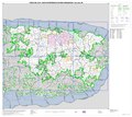
Maps in the Puerto Rico 2010 Census of Population and Housing Page 119.jpg 1,700 × 2,200; 338 KB
-
Maps in the Puerto Rico 2010 Census of Population and Housing Page 120.jpg 1,700 × 2,200; 354 KB
-
Maps in the Puerto Rico 2010 Census of Population and Housing Page 121.jpg 1,700 × 2,200; 338 KB
-
Maps in the Puerto Rico 2010 Census of Population and Housing Page 122.jpg 1,700 × 2,200; 354 KB
-
Maps in the Puerto Rico 2010 Census of Population and Housing Page 123.jpg 1,700 × 2,200; 355 KB
-
Maps in the Puerto Rico 2010 Census of Population and Housing Page 124.jpg 2,200 × 1,700; 593 KB
-
Maps in the Puerto Rico 2010 Census of Population and Housing Page 125.jpg 2,200 × 1,700; 386 KB
-
Maps in the Puerto Rico 2010 Census of Population and Housing Page 126.jpg 2,200 × 1,700; 239 KB
-
Maps in the Puerto Rico 2010 Census of Population and Housing Page 127.jpg 2,200 × 1,700; 288 KB
-
Maps in the Puerto Rico 2010 Census of Population and Housing Page 128.jpg 2,200 × 1,700; 501 KB
-
Maps in the Puerto Rico 2010 Census of Population and Housing Page 129.jpg 2,200 × 1,700; 585 KB
-
Maps in the Puerto Rico 2010 Census of Population and Housing Page 130.jpg 2,200 × 1,700; 424 KB
-
Maps in the Puerto Rico 2010 Census of Population and Housing Page 131.jpg 1,700 × 2,200; 313 KB
-
Maps in the Puerto Rico 2010 Census of Population and Housing Page 132.jpg 1,700 × 2,200; 339 KB
-
Maps in the Puerto Rico 2010 Census of Population and Housing Page 133.jpg 1,700 × 2,200; 308 KB
-
Maps in the Puerto Rico 2010 Census of Population and Housing Page 134.jpg 2,200 × 1,700; 709 KB
-
Maps in the Puerto Rico 2010 Census of Population and Housing Page 135.jpg 2,200 × 1,700; 271 KB
-
Maps in the Puerto Rico 2010 Census of Population and Housing Page 136.jpg 2,192 × 1,700; 210 KB
-
Maps in the Puerto Rico 2010 Census of Population and Housing Page 137.jpg 2,192 × 1,700; 231 KB
-
Maps in the Puerto Rico 2010 Census of Population and Housing Page 138.jpg 2,200 × 1,700; 347 KB
-
Maps in the Puerto Rico 2010 Census of Population and Housing Page 139 (cropped).jpg 1,760 × 1,360; 428 KB
-
Maps in the Puerto Rico 2010 Census of Population and Housing Page 139.jpg 2,200 × 1,700; 495 KB
